TopoQuest Logo
Do you find TopoQuest useful?
Help keep TopoQuest running and adding new maps/features by donating!
Bitcoin:  19c7KJd3qBynnjoSw5npx9KScwjBe4ifkT
Litecoin:  LXs6TkuXGGXo1vDsWCkWVdjQX94eUKd6ui
Home View Maps Find Maps Find Places Resources & Links


Polar, Wisconsin Topographic Map

USGS Map Title: Polar, WI
USGS Map MRC: 45088B8
DRG (GeoTIFF) Download: o45088b8.tif


Neighboring USGS Topographic Map Quads:


  Pearson, WI  
45089C1
 

  Pickerel, WI  
45088C8
 

  Lily, WI  
45088C7
 

  Bryant, WI  
45089B1
 

  Polar, WI  
45088B8
 

  White Lake, WI  
45088B7
 

  Mattoon, WI  
45089A1
 

  Zoar, WI  
45088A8
 

  Perote Lake, WI  
45088A7


Map MRC Location:

N46°
W89°
N46°
W88°
H8 H7 H6 H5 H4 H3 H2 H1
G8 G7 G6 G5 G4 G3 G2 G1
F8 F7 F6 F5 F4 F3 F2 F1
E8 E7 E6 E5 E4 E3 E2 E1
D8 D7 D6 D5 D4 D3 D2 D1
C8 C7 C6 C5 C4 C3 C2 C1
B8 B7 B6 B5 B4 B3 B2 B1
A8 A7 A6 A5 A4 A3 A2 A1
N45°
W89°
N45°
W88°

Polar, WI USGS 1:24K Topographic Map Preview:
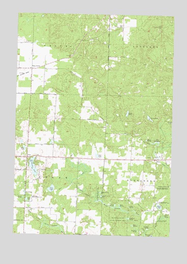
Polar, WI USGS Topographic Map
Click on map above to begin viewing in our Map Viewer.

This topographic map contains these locations and features:
Feature Name Type Latitude Longitude GNIS ID View Map
Clubhouse SpringpondLakeN45.1530°W88.8754°1579022View Map
Clubhouse Springpond State Fishery AreaParkN45.1516°W88.8762°1579023View Map
Dodge LakeLakeN45.1942°W88.9110°1564023View Map
Drew CreekStreamN45.1272°W88.8948°1564105View Map
EltonPopulated PlaceN45.1683°W88.8865°1564595View Map
Elton SpringpondLakeN45.1779°W88.8887°1564597View Map
Garski FlowageChannelN45.1294°W88.9698°1565432View Map
Goto LakeLakeN45.1510°W88.9704°1565444View Map
Hatton SpringsLakeN45.1792°W88.8954°1566135View Map
Hogelee Spring Number OneSpringN45.1491°W88.9307°1566524View Map
Hogelee Spring Number TwoSpringN45.1472°W88.9301°1566525View Map
Hoglot SpringsLakeN45.1412°W88.9081°1566527View Map
Joyce LakeLakeN45.1699°W88.9345°1567300View Map
Karbergers SpringsLakeN45.1346°W88.9087°1567346View Map
Kent Lookout TowerTowerN45.2439°W88.8846°1581245View Map
Kent School (historical)SchoolN45.2439°W88.9262°1840777View Map
Krause SpringsLakeN45.1457°W88.9930°1567641View Map
Leonard Nixon SpringsLakeN45.1359°W88.8799°1567982View Map
McGee CreekStreamN45.1264°W88.8951°1569217View Map
McGee LakeLakeN45.1419°W88.8842°1569218View Map
Moonshine SpringsSpringN45.1277°W88.9009°1569703View Map
Mueller LakeLakeN45.1631°W88.9852°1570009View Map
Nixon SpringsLakeN45.1423°W88.9160°1570314View Map
Norway LakeLakeN45.1916°W88.8933°1570543View Map
Pine SpringsLakeN45.1308°W88.9055°1571522View Map
PolarPopulated PlaceN45.1686°W88.9901°1571734View Map
Punchout SpringsSpringN45.1289°W88.8932°1571976View Map
Rabe LakeLakeN45.1446°W88.9901°1572011View Map
Rabe Lake State Fishery AreaParkN45.1441°W88.9959°1572012View Map
Sherry CemeteryCemeteryN45.1863°W88.9268°1574038View Map
Sherry JunctionPopulated PlaceN45.2191°W88.9879°1577822View Map
Shuman School (historical)SchoolN45.1319°W88.9918°1840813View Map
Starks SpringsSpringN45.1422°W88.9193°1574820View Map
Sylan LakeLakeN45.1736°W88.9925°1575201View Map
Town of PolarCivilN45.1611°W88.9906°1583949View Map
Town of PriceCivilN45.2479°W88.9887°1583984View Map
Wilderness ChurchChurchN45.2308°W88.9412°1576745View Map
Woods FlowageLakeN45.1416°W88.9251°1577020View Map
Woods Flowage State Fishery AreaParkN45.1325°W88.9168°1580830View Map

Note: Coordinates in the location and feature list above are referenced to NAD83 datum.


Copyright (C) 2008-2024 Ryan Niemi / Sunset Dynamics ... All Rights Reserved