TopoQuest Logo
Do you find TopoQuest useful?
Help keep TopoQuest running and adding new maps/features by donating!
Bitcoin:  19c7KJd3qBynnjoSw5npx9KScwjBe4ifkT
Litecoin:  LXs6TkuXGGXo1vDsWCkWVdjQX94eUKd6ui
Home View Maps Find Maps Find Places Resources & Links


Point Conception, California Topographic Map

USGS Map Title: Point Conception, CA
USGS Map MRC: 34120D4
DRG (GeoTIFF) Download: o34120d4.tif


Neighboring USGS Topographic Map Quads:


  Tranquillon Mountain, CA  
34120E5
 

  Lompoc Hills, CA  
34120E4
 

  Santa Rosa Hills, CA  
34120E3


  Point Conception, CA  
34120D4
 

  Sacate, CA  
34120D3


Map MRC Location:

N35°
W121°
N35°
W120°
H8 H7 H6 H5 H4 H3 H2 H1
G8 G7 G6 G5 G4 G3 G2 G1
F8 F7 F6 F5 F4 F3 F2 F1
E8 E7 E6 E5 E4 E3 E2 E1
D8 D7 D6 D5 D4 D3 D2 D1
C8 C7 C6 C5 C4 C3 C2 C1
B8 B7 B6 B5 B4 B3 B2 B1
A8 A7 A6 A5 A4 A3 A2 A1
N34°
W121°
N34°
W120°

Point Conception, CA USGS 1:24K Topographic Map Preview:
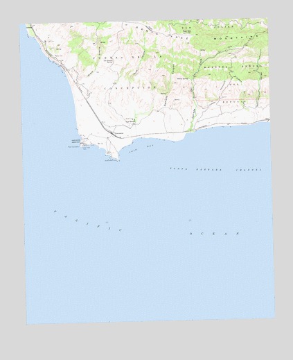
Point Conception, CA USGS Topographic Map
Click on map above to begin viewing in our Map Viewer.

This topographic map contains these locations and features:
Feature Name Type Latitude Longitude GNIS ID View Map
Barranca HondaValleyN34.4564°W120.3827°255346View Map
Black CanyonValleyN34.4758°W120.4735°239390View Map
Caņada Del CementerioValleyN34.4603°W120.4129°240158View Map
Caņada Del CojoValleyN34.4530°W120.4160°240160View Map
Caņada del GatoValleyN34.4569°W120.3829°255409View Map
Cojo AnchorageHarborN34.4505°W120.4432°253340View Map
Cojo BayBayN34.4469°W120.4407°240752View Map
Cojo RanchLocaleN34.4569°W120.4443°240753View Map
ConcepcionPopulated PlaceN34.4536°W120.4549°252874View Map
Damsite CanyonValleyN34.4500°W120.4265°241240View Map
GatoPopulated PlaceN34.4575°W120.3777°1660667View Map
Government PointCapeN34.4428°W120.4529°271378View Map
Indian Head RockBarN34.4480°W120.4704°243819View Map
JalamaPopulated PlaceN34.4980°W120.4946°1660807View Map
Kunuqug (historical)Populated PlaceN34.4500°W120.4718°1871777View Map
La OllaValleyN34.4825°W120.4088°244440View Map
Las Animas SpringSpringN34.4835°W120.4544°244599View Map
Palo Alto HillSummitN34.4944°W120.4171°247163View Map
Point ConceptionCapeN34.4486°W120.4716°254158View Map
Point Conception LighthouseLocaleN34.4489°W120.4707°1702891View Map
Shisholop (historical)Populated PlaceN34.4583°W120.4441°1871808View Map
Willow SpringSpringN34.4757°W120.4167°251629View Map
Wood CanyonValleyN34.4511°W120.4432°251766View Map

Note: Coordinates in the location and feature list above are referenced to NAD83 datum.


Copyright (C) 2008-2024 Ryan Niemi / Sunset Dynamics ... All Rights Reserved