TopoQuest Logo
Do you find TopoQuest useful?
Help keep TopoQuest running and adding new maps/features by donating!
Bitcoin:  19c7KJd3qBynnjoSw5npx9KScwjBe4ifkT
Litecoin:  LXs6TkuXGGXo1vDsWCkWVdjQX94eUKd6ui
Home View Maps Find Maps Find Places Resources & Links


Platte Lake, Minnesota Topographic Map

USGS Map Title: Platte Lake, MN
USGS Map MRC: 46093B8
DRG (GeoTIFF) Download: o46093b8.tif


Neighboring USGS Topographic Map Quads:


  South Long Lake, MN  
46094C1
 

  Grave Lake, MN  
46093C8
 

  Garrison, MN  
46093C7
 

  Shephard, MN  
46094B1
 

  Platte Lake, MN  
46093B8
 

  Vineland, MN  
46093B7
 

  Lastrup, MN  
46094A1
 

  Hillman, MN  
46093A8
 

  Hillman SE, MN  
46093A7


Map MRC Location:

N47°
W94°
N47°
W93°
H8 H7 H6 H5 H4 H3 H2 H1
G8 G7 G6 G5 G4 G3 G2 G1
F8 F7 F6 F5 F4 F3 F2 F1
E8 E7 E6 E5 E4 E3 E2 E1
D8 D7 D6 D5 D4 D3 D2 D1
C8 C7 C6 C5 C4 C3 C2 C1
B8 B7 B6 B5 B4 B3 B2 B1
A8 A7 A6 A5 A4 A3 A2 A1
N46°
W94°
N46°
W93°

Platte Lake, MN USGS 1:24K Topographic Map Preview:
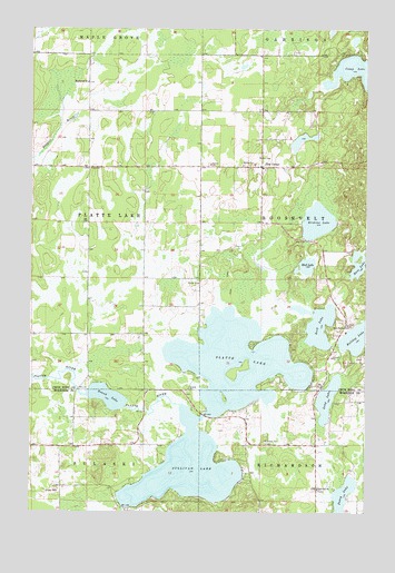
Platte Lake, MN USGS Topographic Map
Click on map above to begin viewing in our Map Viewer.

This topographic map contains these locations and features:
Feature Name Type Latitude Longitude GNIS ID View Map
Bass LakeLakeN46.1885°W93.8779°639705View Map
Bulldog LakeLakeN46.1704°W93.8784°640630View Map
Emmanuel ChurchChurchN46.2361°W93.9792°643362View Map
Erskine LakeLakeN46.2003°W93.8932°643406View Map
Holy Family CemeteryCemeteryN46.1739°W93.8814°2071510View Map
Holy Family ChurchChurchN46.1730°W93.8816°645121View Map
Lakeview CemeteryCemeteryN46.1308°W93.8925°2068635View Map
Lakeview ChurchChurchN46.1311°W93.8928°646438View Map
Long LakeLakeN46.1544°W93.8892°647075View Map
Mud LakeLakeN46.1890°W93.8970°648285View Map
Peavy LakeLakeN46.1276°W93.8835°649219View Map
Pine CenterPopulated PlaceN46.2144°W93.9144°649444View Map
Platte LakeLakeN46.1640°W93.9233°649543View Map
Rock LakeLakeN46.1735°W93.8927°650196View Map
Round LakeLakeN46.1549°W93.9717°650337View Map
Schwitz Post Office (historical)Post OfficeN46.2083°W93.9250°2071659View Map
Sullivan LakeLakeN46.1361°W93.9414°652786View Map
Township of Platte LakeCivilN46.1998°W93.9998°665318View Map

Note: Coordinates in the location and feature list above are referenced to NAD83 datum.


Copyright (C) 2008-2024 Ryan Niemi / Sunset Dynamics ... All Rights Reserved