TopoQuest Logo
Do you find TopoQuest useful?
Help keep TopoQuest running and adding new maps/features by donating!
Bitcoin:  19c7KJd3qBynnjoSw5npx9KScwjBe4ifkT
Litecoin:  LXs6TkuXGGXo1vDsWCkWVdjQX94eUKd6ui
Home View Maps Find Maps Find Places Resources & Links


Pie Town, New Mexico Topographic Map

USGS Map Title: Pie Town, NM
USGS Map MRC: 34108C2
DRG (GeoTIFF) Download: o34108c2.tif


Neighboring USGS Topographic Map Quads:


  Adams Diggings, NM  
34108D3
 

  Blue Hills, NM  
34108D2
 

  Tres Lagunas, NM  
34108D1
 

  Omega, NM  
34108C3
 

  Pie Town, NM  
34108C2
 

  Red Flats, NM  
34108C1
 

  Mangas, NM  
34108B3
 

  Alegres Mountain, NM  
34108B2
 

  Cox Peak, NM  
34108B1


Map MRC Location:

N35°
W109°
N35°
W108°
H8 H7 H6 H5 H4 H3 H2 H1
G8 G7 G6 G5 G4 G3 G2 G1
F8 F7 F6 F5 F4 F3 F2 F1
E8 E7 E6 E5 E4 E3 E2 E1
D8 D7 D6 D5 D4 D3 D2 D1
C8 C7 C6 C5 C4 C3 C2 C1
B8 B7 B6 B5 B4 B3 B2 B1
A8 A7 A6 A5 A4 A3 A2 A1
N34°
W109°
N34°
W108°

Pie Town, NM USGS 1:24K Topographic Map Preview:
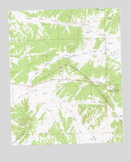
Pie Town, NM USGS Topographic Map
Click on map above to begin viewing in our Map Viewer.

This topographic map contains these locations and features:
Feature Name Type Latitude Longitude GNIS ID View Map
Bols WellWellN34.3248°W108.2073°886576View Map
Bull Pasture WellWellN34.3345°W108.1540°886887View Map
Chamiso WellWellN34.3337°W108.1667°887425View Map
Chavez DrawValleyN34.3020°W108.2153°887467View Map
Electric WellWellN34.3639°W108.1967°888833View Map
First Baptist ChurchChurchN34.2984°W108.1348°921259View Map
HaynesLocaleN34.3520°W108.2456°929578View Map
Lake WellWellN34.3306°W108.1803°890898View Map
Long LakeLakeN34.2546°W108.1571°891303View Map
Long Lake WellWellN34.2534°W108.1592°891305View Map
McKeeLocaleN34.2970°W108.1615°929588View Map
Nalda Ranch AirportAirportN34.3577°W108.1666°936996View Map
North WellWellN34.3201°W108.2170°892703View Map
Odyssey SchoolSchoolN34.2984°W108.1348°934234View Map
Pancake DrawValleyN34.2551°W108.2451°893058View Map
Payne DrawValleyN34.3362°W108.1378°909521View Map
Pie TownPopulated PlaceN34.2984°W108.1348°897442View Map
Pie Town CemeteryCemeteryN34.3027°W108.1341°931329View Map
Pie Town Census Designated PlaceCensusN34.3400°W108.1708°2584176View Map
Pie Town Emergency Medical ServicesBuildingN34.2988°W108.1332°2657575View Map
Pie Town Post OfficePost OfficeN34.2984°W108.1348°937793View Map
Pie Town Volunteer Fire DepartmentBuildingN34.2988°W108.1333°2657776View Map
RigsbyLocaleN34.3720°W108.2026°929639View Map
Santianez LakeReservoirN34.3308°W108.1758°894585View Map
Seeps WellWellN34.2812°W108.2051°894705View Map
Tingle FlatsFlatN34.3320°W108.1351°895688View Map
Toms Rock PuebloLocaleN34.2984°W108.1348°935935View Map
Top of the WorldRidgeN34.3234°W108.1862°895758View Map
Tres LagunasLakeN34.3414°W108.1417°895819View Map
Tres Lagunas DrawValleyN34.2981°W108.2323°911808View Map
Upper WellWellN34.2976°W108.2103°896045View Map
Wade WellWellN34.2895°W108.1912°896180View Map
Wyche DrawValleyN34.2862°W108.1884°896787View Map

Note: Coordinates in the location and feature list above are referenced to NAD83 datum.


Copyright (C) 2008-2024 Ryan Niemi / Sunset Dynamics ... All Rights Reserved