TopoQuest Logo
Do you find TopoQuest useful?
Help keep TopoQuest running and adding new maps/features by donating!
Bitcoin:  19c7KJd3qBynnjoSw5npx9KScwjBe4ifkT
Litecoin:  LXs6TkuXGGXo1vDsWCkWVdjQX94eUKd6ui
Home View Maps Find Maps Find Places Resources & Links


Picture Rocks, Pennsylvania Topographic Map

USGS Map Title: Picture Rocks, PA
USGS Map MRC: 41076C6
DRG (GeoTIFF) Download: o41076c6.tif


Neighboring USGS Topographic Map Quads:


  Barbours, PA  
41076D7
 

  Hillsgrove, PA  
41076D6
 

  Eagles Mere, PA  
41076D5
 

  Huntersville, PA  
41076C7
 

  Picture Rocks, PA  
41076C6
 

  Sonestown, PA  
41076C5
 

  Muncy, PA  
41076B7
 

  Hughesville, PA  
41076B6
 

  Lairdsville, PA  
41076B5


Map MRC Location:

N42°
W77°
N42°
W76°
H8 H7 H6 H5 H4 H3 H2 H1
G8 G7 G6 G5 G4 G3 G2 G1
F8 F7 F6 F5 F4 F3 F2 F1
E8 E7 E6 E5 E4 E3 E2 E1
D8 D7 D6 D5 D4 D3 D2 D1
C8 C7 C6 C5 C4 C3 C2 C1
B8 B7 B6 B5 B4 B3 B2 B1
A8 A7 A6 A5 A4 A3 A2 A1
N41°
W77°
N41°
W76°

Picture Rocks, PA USGS 1:24K Topographic Map Preview:
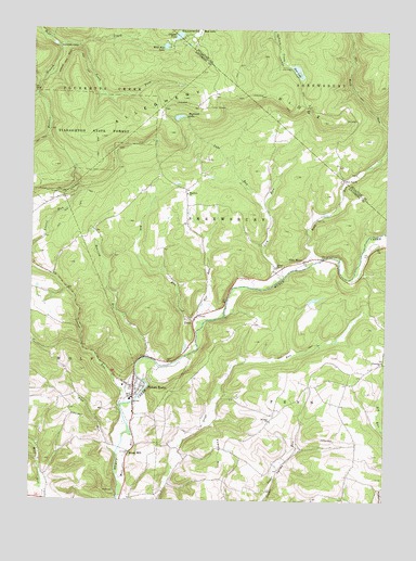
Picture Rocks, PA USGS Topographic Map
Click on map above to begin viewing in our Map Viewer.

This topographic map contains these locations and features:
Feature Name Type Latitude Longitude GNIS ID View Map
Bethel ChurchChurchN41.3117°W76.6627°1192127View Map
Big RunStreamN41.2967°W76.6886°1192137View Map
Borough of Picture RocksCivilN41.2804°W76.7079°1215425View Map
Bryan MillPopulated PlaceN41.2626°W76.7141°1205030View Map
Camp GeneseeLocaleN41.3542°W76.6875°1192233View Map
Crystal LakeLakeN41.3734°W76.6987°1192318View Map
Deer LakeLakeN41.3642°W76.6564°1192339View Map
Dunwoody CampLocaleN41.3706°W76.7402°1192387View Map
Ebenezer ChurchChurchN41.2873°W76.6255°1192417View Map
Fox RunStreamN41.2976°W76.6902°1199872View Map
Frantz HillSummitN41.2590°W76.6830°1192489View Map
Frantz SchoolSchoolN41.2637°W76.6802°1197410View Map
Glen MawrPopulated PlaceN41.3137°W76.6533°1205048View Map
Grandad RunStreamN41.3570°W76.7486°1192535View Map
Hessler BranchStreamN41.3704°W76.7411°1192608View Map
Highland LakeLakeN41.3518°W76.6983°1192613View Map
Lake RunStreamN41.3273°W76.6658°1192731View Map
Laurel RunStreamN41.2759°W76.7144°1179021View Map
Lick RunStreamN41.3081°W76.6627°1192777View Map
Mapleton ChurchChurchN41.3315°W76.6944°1192889View Map
Maurglen Post Office (historical)Post OfficeN41.3137°W76.6533°1197411View Map
Mill RaceStreamN41.2506°W76.7180°1181172View Map
Mount Zion ChurchChurchN41.2712°W76.6647°1192972View Map
Mud LakeLakeN41.3740°W76.6905°1199915View Map
Picture RocksCliffN41.2798°W76.7080°1201373View Map
Picture RocksPopulated PlaceN41.2798°W76.7130°1193116View Map
Picture Rocks Post OfficePost OfficeN41.2800°W76.7136°2772910View Map
Picture Rocks Volunteer Fire DepartmentBuildingN41.2809°W76.7126°2652928View Map
Pine RunStreamN41.2623°W76.7191°1193131View Map
Roaring RunStreamN41.2879°W76.7086°1193198View Map
Rock RunStreamN41.3145°W76.6466°1199949View Map
Rock Run ChurchChurchN41.3356°W76.6394°1193207View Map
South Fork Bear CreekStreamN41.3709°W76.7397°1193406View Map
Springhill TrailTrailN41.3529°W76.7366°1206299View Map
Ticklish RockPillarN41.3506°W76.6480°1201371View Map
TivoliPopulated PlaceN41.2981°W76.6913°1205091View Map
Township of PennCivilN41.2779°W76.6408°1216767View Map
Township of ShrewsburyCivilN41.3280°W76.6872°1216772View Map
Township of WolfCivilN41.2636°W76.7314°1216777View Map
Villa GrovePopulated PlaceN41.2584°W76.7155°1202035View Map
Villa Grove SchoolSchoolN41.2565°W76.7158°1197409View Map
Wild Rice LakeLakeN41.3706°W76.7032°1193666View Map

Note: Coordinates in the location and feature list above are referenced to NAD83 datum.


Copyright (C) 2008-2024 Ryan Niemi / Sunset Dynamics ... All Rights Reserved