TopoQuest Logo
Do you find TopoQuest useful?
Help keep TopoQuest running and adding new maps/features by donating!
Bitcoin:  19c7KJd3qBynnjoSw5npx9KScwjBe4ifkT
Litecoin:  LXs6TkuXGGXo1vDsWCkWVdjQX94eUKd6ui
Home View Maps Find Maps Find Places Resources & Links


Picacho, California Topographic Map

USGS Map Title: Picacho, CA
USGS Map MRC: 33114A5
DRG (GeoTIFF) Download: o33114a5.tif


Neighboring USGS Topographic Map Quads:


  Picacho NW, CA  
33114B6
 

  Hidden Valley, AZ  
33114B5
 

  Red Hill, AZ  
33114B4
 

  Picacho SW, CA  
33114A6
 

  Picacho, CA  
33114A5
 

  Red Hill SW, AZ  
33114A4
 

  Picacho Peak, CA  
32114H6
 

  Little Picacho Peak, CA  
32114H5
 

  Imperial Reservoir, AZ  
32114H4


Map MRC Location:

N34°
W115°
N34°
W114°
H8 H7 H6 H5 H4 H3 H2 H1
G8 G7 G6 G5 G4 G3 G2 G1
F8 F7 F6 F5 F4 F3 F2 F1
E8 E7 E6 E5 E4 E3 E2 E1
D8 D7 D6 D5 D4 D3 D2 D1
C8 C7 C6 C5 C4 C3 C2 C1
B8 B7 B6 B5 B4 B3 B2 B1
A8 A7 A6 A5 A4 A3 A2 A1
N33°
W115°
N33°
W114°

Picacho, CA USGS 1:24K Topographic Map Preview:
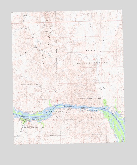
Picacho, CA USGS Topographic Map
Click on map above to begin viewing in our Map Viewer.

This topographic map contains these locations and features:
Feature Name Type Latitude Longitude GNIS ID View Map
Arrastra WashStreamN33.0356°W114.5830°802View Map
Black Rock MineMineN33.0884°W114.5930°1602View Map
Cane Break CanyonValleyN33.0334°W114.5425°24023View Map
Devils CanyonValleyN33.0295°W114.5341°241455View Map
Dives MineMineN33.1164°W114.5863°3967View Map
Eureka MineMineN33.0392°W114.5644°4509View Map
Golden Dream MineMineN33.0323°W114.5608°242818View Map
Imperial Refuge WildernessReserveN33.0447°W114.6121°2035162View Map
Island LakeLakeN33.0300°W114.5872°6281View Map
Little Picacho WashStreamN33.0250°W114.6097°244937View Map
Marcus WashStreamN33.0214°W114.5963°245495View Map
Papago MineMineN33.0914°W114.5997°9183View Map
PicachoPopulated PlaceN33.0231°W114.6111°1661216View Map
Picacho Mill RuinsLocaleN33.0228°W114.6011°247435View Map
Picacho Mills Historic TrailTrailN33.0214°W114.6052°1868174View Map
Princess MineMineN33.1061°W114.5847°9783View Map
Red Cloud MineMineN33.1003°W114.5997°10036View Map
Red Rock GateBendN33.0334°W114.5675°24027View Map
Red Rock LakeLakeN33.0235°W114.5928°1868177View Map
Rojo GrandeSummitN33.0167°W114.6061°252169View Map
Sleepers BendBendN33.0167°W114.5341°24026View Map
Sortan WashStreamN33.0281°W114.5822°249670View Map
Three Point BendBendN33.0500°W114.5841°24028View Map
West Fork Yuma WashStreamN33.0814°W114.5302°13502View Map
Whitley BridgeArchN33.0028°W114.5819°2726161View Map
Yuma WashStreamN33.0350°W114.5219°14122View Map

Note: Coordinates in the location and feature list above are referenced to NAD83 datum.


Copyright (C) 2008-2024 Ryan Niemi / Sunset Dynamics ... All Rights Reserved