TopoQuest Logo
Do you find TopoQuest useful?
Help keep TopoQuest running and adding new maps/features by donating!
Bitcoin:  19c7KJd3qBynnjoSw5npx9KScwjBe4ifkT
Litecoin:  LXs6TkuXGGXo1vDsWCkWVdjQX94eUKd6ui
Home View Maps Find Maps Find Places Resources & Links


Pechanga, California Topographic Map

USGS Map Title: Pechanga, CA
USGS Map MRC: 33117D1
DRG (GeoTIFF) Download: o33117d1.tif


Neighboring USGS Topographic Map Quads:


  Murrieta, CA  
33117E2
 

  Bachelor Mountain, CA  
33117E1
 

  Sage, CA  
33116E8
 

  Temecula, CA  
33117D2
 

  Pechanga, CA  
33117D1
 

  Vail Lake, CA  
33116D8
 

  Bonsall, CA  
33117C2
 

  Pala, CA  
33117C1
 

  Boucher Hill, CA  
33116C8


Map MRC Location:

N34°
W118°
N34°
W117°
H8 H7 H6 H5 H4 H3 H2 H1
G8 G7 G6 G5 G4 G3 G2 G1
F8 F7 F6 F5 F4 F3 F2 F1
E8 E7 E6 E5 E4 E3 E2 E1
D8 D7 D6 D5 D4 D3 D2 D1
C8 C7 C6 C5 C4 C3 C2 C1
B8 B7 B6 B5 B4 B3 B2 B1
A8 A7 A6 A5 A4 A3 A2 A1
N33°
W118°
N33°
W117°

Pechanga, CA USGS 1:24K Topographic Map Preview:
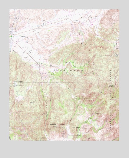
Pechanga, CA USGS Topographic Map
Click on map above to begin viewing in our Map Viewer.

This topographic map contains these locations and features:
Feature Name Type Latitude Longitude GNIS ID View Map
Castro CanyonValleyN33.3789°W117.0473°270345View Map
Chief MountainSummitN33.3873°W117.0500°270414View Map
Colina VistaPopulated PlaceN33.4625°W117.1161°1849530View Map
Country Manor EstatesPopulated PlaceN33.4814°W117.1117°1849532View Map
Emerson Wildlife PreserveParkN33.4667°W117.0403°1849535View Map
Galway Downs Equestrian Training CenterLocaleN33.4895°W117.0314°1849537View Map
Heriot MountainSummitN33.3767°W117.0364°271556View Map
Joan F Sparkman Elementary SchoolSchoolN33.4845°W117.1028°1849540View Map
John Magee ParkParkN33.4753°W117.1170°1849541View Map
Little Chief MountainSummitN33.3798°W117.0489°272080View Map
Little TemeculaCivilN33.4661°W117.1003°272131View Map
Louis Wolf TombstoneCemeteryN33.4644°W117.1200°2773312View Map
Magee TrailTrailN33.4064°W117.0131°272309View Map
McGee QuarryMineN33.3753°W117.0206°2680228View Map
Mount OlympusSummitN33.4109°W117.1025°272795View Map
Oak Haven EstatesPopulated PlaceN33.4398°W117.0950°1849545View Map
Oak MountainSummitN33.4864°W117.0111°272749View Map
Pala Chief MineMineN33.3873°W117.0514°272839View Map
Paloma del Sol ParkParkN33.4836°W117.1023°1849548View Map
Pauba ValleyValleyN33.4739°W117.1175°272893View Map
Pechanga Fire Department Station 177BuildingN33.4467°W117.0820°2664973View Map
Pechanga Fire Department Station 2BuildingN33.4535°W117.1038°2665271View Map
Pechanga Hot SpringsSpringN33.4392°W117.0403°1849550View Map
Pechanga ReservationCivilN33.4465°W117.0608°272911View Map
Pechanga Tribal ParkParkN33.4481°W117.0859°1849551View Map
Rainbow Canyon VillagePopulated PlaceN33.4570°W117.1150°1849552View Map
Rainbow Conservation CampLocaleN33.4278°W117.1181°1654778View Map
Red Hawk Elementary SchoolSchoolN33.4761°W117.0973°1849555View Map
Red Hawk Golf ClubLocaleN33.4745°W117.0931°1849556View Map
Riverside County Fire Department Station 84 ParkviewBuildingN33.4972°W117.1218°2664536View Map
Riverside County Fire Department Station 92 - Wolf CreekBuildingN33.4613°W117.1052°2664985View Map
San Gabriel ChurchChurchN33.4459°W117.0773°273479View Map
Stewart MineMineN33.3811°W117.0623°273901View Map
Temecula RanchosPopulated PlaceN33.4709°W117.0873°1849566View Map
Tourmaline King MineMineN33.3914°W117.0734°274170View Map
Tourmaline Queen MineMineN33.3900°W117.0689°274171View Map
Tourmaline Queen MountainSummitN33.3898°W117.0714°274172View Map
White Cloud MineMineN33.3881°W117.0723°274466View Map
Wolf ValleyValleyN33.4739°W117.1175°274562View Map
Yampa RanchLocaleN33.4639°W117.0042°274584View Map

Note: Coordinates in the location and feature list above are referenced to NAD83 datum.


Copyright (C) 2008-2024 Ryan Niemi / Sunset Dynamics ... All Rights Reserved