TopoQuest Logo
Do you find TopoQuest useful?
Help keep TopoQuest running and adding new maps/features by donating!
Bitcoin:  19c7KJd3qBynnjoSw5npx9KScwjBe4ifkT
Litecoin:  LXs6TkuXGGXo1vDsWCkWVdjQX94eUKd6ui
Home View Maps Find Maps Find Places Resources & Links


Benton, California Topographic Map

USGS Map Title: Benton, CA
USGS Map MRC: 37118G4
DRG (GeoTIFF) Download: o37118g4.tif


Neighboring USGS Topographic Map Quads:


  River Spring, CA  
37118H5
 

  Truman Meadows, NV  
37118H4
 

  Mount Montgomery, NV  
37118H3
 

  Benton Hot Springs, CA  
37118G5
 

  Benton, CA  
37118G4
 

  Boundary Peak, NV  
37118G3
 

  Banner Ridge, CA  
37118F5
 

  Hammil Valley, CA  
37118F4
 

  White Mountain Peak, CA  
37118F3


Map MRC Location:

N38°
W119°
N38°
W118°
H8 H7 H6 H5 H4 H3 H2 H1
G8 G7 G6 G5 G4 G3 G2 G1
F8 F7 F6 F5 F4 F3 F2 F1
E8 E7 E6 E5 E4 E3 E2 E1
D8 D7 D6 D5 D4 D3 D2 D1
C8 C7 C6 C5 C4 C3 C2 C1
B8 B7 B6 B5 B4 B3 B2 B1
A8 A7 A6 A5 A4 A3 A2 A1
N37°
W119°
N37°
W118°

Benton, CA USGS 1:24K Topographic Map Preview:
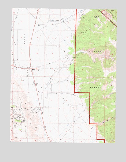
Benton, CA USGS Topographic Map
Click on map above to begin viewing in our Map Viewer.

This topographic map contains these locations and features:
Feature Name Type Latitude Longitude GNIS ID View Map
Anderson PeakSummitN37.7727°W118.4868°1657929View Map
Barasco GulchValleyN37.7877°W118.4751°256503View Map
BentonPopulated PlaceN37.8191°W118.4765°256836View Map
Benton Census Designated PlaceCensusN37.8189°W118.4844°2582943View Map
Benton ValleyBasinN37.8472°W118.4940°219059View Map
Black Warrior MineMineN37.8527°W118.4187°257165View Map
Blind Spring HillRidgeN37.7577°W118.4890°257204View Map
Buscones PeakSummitN37.7772°W118.4915°1658181View Map
Comanche MineMineN37.7774°W118.4729°258616View Map
Cornucopia GulchValleyN37.7722°W118.4840°1667695View Map
Cornucopia MineMineN37.7747°W118.4865°258723View Map
Diana PeakSummitN37.7680°W118.4882°1658417View Map
Edne Beaman Elementary SchoolSchoolN37.8165°W118.4770°1812832View Map
Kerrick GulchValleyN37.7722°W118.4935°262152View Map
Last Chance GulchValleyN37.7819°W118.4690°262333View Map
Lynford GulchValleyN37.7847°W118.4732°263083View Map
Modoc PeakSummitN37.7813°W118.4962°1659152View Map
Montgomery CityPopulated PlaceN37.8285°W118.4310°263768View Map
Montgomery CreekStreamN37.7958°W118.4743°228976View Map
Morris CreekStreamN37.8633°W118.4537°860648View Map
Pearce PeakSummitN37.7797°W118.4890°1659358View Map
Pedro RanchLocaleN37.8644°W118.4565°264618View Map
Queen DicksLocaleN37.7638°W118.4010°265106View Map
Truman CanyonValleyN37.8488°W118.4979°268441View Map
White Mountain Fire Protection DistrictBuildingN37.8159°W118.4756°2624285View Map

Note: Coordinates in the location and feature list above are referenced to NAD83 datum.


Copyright (C) 2008-2024 Ryan Niemi / Sunset Dynamics ... All Rights Reserved