TopoQuest Logo
Do you find TopoQuest useful?
Help keep TopoQuest running and adding new maps/features by donating!
Bitcoin:  19c7KJd3qBynnjoSw5npx9KScwjBe4ifkT
Litecoin:  LXs6TkuXGGXo1vDsWCkWVdjQX94eUKd6ui
Home View Maps Find Maps Find Places Resources & Links


Orinoco, Montana Topographic Map

USGS Map Title: Orinoco, MT
USGS Map MRC: 46106C5
DRG (GeoTIFF) Download: o46106c5.tif


Neighboring USGS Topographic Map Quads:


  Black Coulee, MT  
46106D6
 

  Schultz Coulee, MT  
46106D5
 

  Box Canyon Coulee, MT  
46106D4
 

  Forsyth, MT  
46106C6
 

  Orinoco, MT  
46106C5
 

  Rosebud, MT  
46106C4
 

  Smith Creek, MT  
46106B6
 

  Smith Creek NE, MT  
46106B5
 

  Rosebud Buttes, MT  
46106B4


Map MRC Location:

N47°
W107°
N47°
W106°
H8 H7 H6 H5 H4 H3 H2 H1
G8 G7 G6 G5 G4 G3 G2 G1
F8 F7 F6 F5 F4 F3 F2 F1
E8 E7 E6 E5 E4 E3 E2 E1
D8 D7 D6 D5 D4 D3 D2 D1
C8 C7 C6 C5 C4 C3 C2 C1
B8 B7 B6 B5 B4 B3 B2 B1
A8 A7 A6 A5 A4 A3 A2 A1
N46°
W107°
N46°
W106°

Orinoco, MT USGS 1:24K Topographic Map Preview:
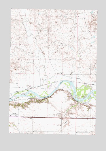
Orinoco, MT USGS Topographic Map
Click on map above to begin viewing in our Map Viewer.

This topographic map contains these locations and features:
Feature Name Type Latitude Longitude GNIS ID View Map
06N41E08D___01 WellWellN46.2847°W106.6186°815068View Map
06N41E10BB__01 WellWellN46.2939°W106.5900°815155View Map
06N41E10C___01 WellWellN46.2847°W106.5873°815067View Map
06N41E16C___01 WellWellN46.2703°W106.6081°814970View Map
07N41E35C___01 WellWellN46.3147°W106.5684°815374View Map
Camp Alarm (historical)LocaleN46.2939°W106.5900°1716712View Map
Dewey (historical)LocaleN46.2939°W106.5548°1716703View Map
Dry CreekStreamN46.3322°W106.5903°770794View Map
FlynnLocaleN46.2939°W106.5420°1716697View Map
FlynnPopulated PlaceN46.2939°W106.5420°771484View Map
Hayden School (historical)SchoolN46.3472°W106.5781°1716588View Map
Horse CreekStreamN46.3019°W106.5348°772546View Map
Lantry (historical)LocaleN46.2819°W106.6234°1716784View Map
Little Porcupine (historical)LocaleN46.2958°W106.5617°1716779View Map
Little Porcupine CreekStreamN46.2969°W106.5586°773475View Map
Montgomery Number 1 DamDamN46.3717°W106.5106°797068View Map
OrinocoPopulated PlaceN46.2961°W106.5920°774981View Map
Orinoco School (historical)SchoolN46.2953°W106.6117°1716580View Map
Tillitt FieldAirportN46.2693°W106.6224°806413View Map
Wildcat CouleeValleyN46.2825°W106.5259°778492View Map

Note: Coordinates in the location and feature list above are referenced to NAD83 datum.


Copyright (C) 2008-2024 Ryan Niemi / Sunset Dynamics ... All Rights Reserved