TopoQuest Logo
Do you find TopoQuest useful?
Help keep TopoQuest running and adding new maps/features by donating!
Bitcoin:  19c7KJd3qBynnjoSw5npx9KScwjBe4ifkT
Litecoin:  LXs6TkuXGGXo1vDsWCkWVdjQX94eUKd6ui
Home View Maps Find Maps Find Places Resources & Links


Omaha NE, Arkansas Topographic Map

USGS Map Title: Omaha NE, AR
USGS Map MRC: 36093D1
DRG (GeoTIFF) Download: o36093d1.tif


Neighboring USGS Topographic Map Quads:


  Hollister, MO  
36093E2
 

  Mincy, MO  
36093E1
 

  Protem SW, MO  
36092E8
 

  Omaha, AR  
36093D2
 

  Omaha NE, AR  
36093D1
 

  Diamond City, AR  
36092D8
 

  Batavia, AR  
36093C2
 

  Bergman, AR  
36093C1
 

  Zinc, AR  
36092C8


Map MRC Location:

N37°
W94°
N37°
W93°
H8 H7 H6 H5 H4 H3 H2 H1
G8 G7 G6 G5 G4 G3 G2 G1
F8 F7 F6 F5 F4 F3 F2 F1
E8 E7 E6 E5 E4 E3 E2 E1
D8 D7 D6 D5 D4 D3 D2 D1
C8 C7 C6 C5 C4 C3 C2 C1
B8 B7 B6 B5 B4 B3 B2 B1
A8 A7 A6 A5 A4 A3 A2 A1
N36°
W94°
N36°
W93°

Omaha NE, AR USGS 1:24K Topographic Map Preview:
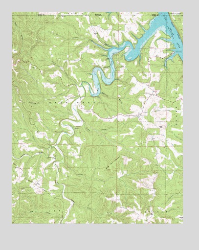
Omaha NE, AR USGS Topographic Map
Click on map above to begin viewing in our Map Viewer.

This topographic map contains these locations and features:
Feature Name Type Latitude Longitude GNIS ID View Map
Barren ForkStreamN36.4215°W93.0927°46120View Map
Bear CreekStreamN36.4956°W93.0160°46214View Map
Bee HollowValleyN36.3795°W93.0877°46304View Map
BellvillePopulated PlaceN36.4673°W93.0591°57356View Map
BoonePopulated PlaceN36.4737°W93.0210°57410View Map
Brushy CreekStreamN36.4773°W93.0552°47065View Map
Cedar CreekStreamN36.4190°W93.0985°47599View Map
Chaney ChurchChurchN36.4790°W93.0255°47689View Map
Charley CreekStreamN36.4573°W93.0743°47708View Map
Clinton HollowValleyN36.4326°W93.0721°47857View Map
Cottonwood CemeteryCemeteryN36.4142°W93.0938°48071View Map
Crumpler SubdivisionPopulated PlaceN36.4737°W93.0488°69275View Map
Lead HillSummitN36.4320°W93.0143°51025View Map
LowryPopulated PlaceN36.4717°W93.0543°58095View Map
Malden CreekStreamN36.4112°W93.0882°51626View Map
Pine HollowValleyN36.3873°W93.0799°53448View Map
Pleasant Ridge Church of ChristChurchN36.4384°W93.0324°78059View Map
SelfPopulated PlaceN36.3981°W93.1082°57183View Map
Sidney CreekStreamN36.4573°W93.0785°54839View Map
Sugarcamp BranchStreamN36.4520°W93.0624°55310View Map
Township of Bear Creek (historical)CivilN36.4417°W93.0835°69255View Map
Tucker HollowValleyN36.4753°W93.0066°55686View Map
Tucker Hollow Recreation AreaParkN36.4762°W93.0071°78591View Map
White Oak MountainSummitN36.4103°W93.0513°58870View Map

Note: Coordinates in the location and feature list above are referenced to NAD83 datum.


Copyright (C) 2008-2024 Ryan Niemi / Sunset Dynamics ... All Rights Reserved