TopoQuest Logo
Do you find TopoQuest useful?
Help keep TopoQuest running and adding new maps/features by donating!
Bitcoin:  19c7KJd3qBynnjoSw5npx9KScwjBe4ifkT
Litecoin:  LXs6TkuXGGXo1vDsWCkWVdjQX94eUKd6ui
Home View Maps Find Maps Find Places Resources & Links


Okolona North, Arkansas Topographic Map

USGS Map Title: Okolona North, AR
USGS Map MRC: 34093A3
DRG (GeoTIFF) Download: o34093a3.tif


Neighboring USGS Topographic Map Quads:


  Chalybeate Mountain West, AR  
34093B4
 

  Chalybeate Mountain East, AR  
34093B3
 

  De Gray, AR  
34093B2
 

  Antoine, AR  
34093A4
 

  Okolona North, AR  
34093A3
 

  Hollywood, AR  
34093A2
 

  Piney Grove, AR  
33093H4
 

  Okolona South, AR  
33093H3
 

  Gurdon, AR  
33093H2


Map MRC Location:

N35°
W94°
N35°
W93°
H8 H7 H6 H5 H4 H3 H2 H1
G8 G7 G6 G5 G4 G3 G2 G1
F8 F7 F6 F5 F4 F3 F2 F1
E8 E7 E6 E5 E4 E3 E2 E1
D8 D7 D6 D5 D4 D3 D2 D1
C8 C7 C6 C5 C4 C3 C2 C1
B8 B7 B6 B5 B4 B3 B2 B1
A8 A7 A6 A5 A4 A3 A2 A1
N34°
W94°
N34°
W93°

Okolona North, AR USGS 1:24K Topographic Map Preview:
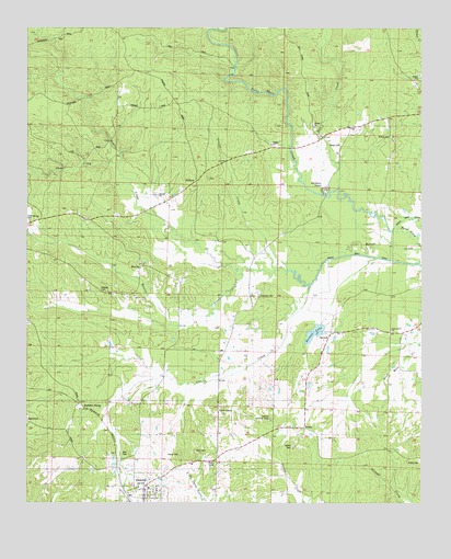
Okolona North, AR USGS Topographic Map
Click on map above to begin viewing in our Map Viewer.

This topographic map contains these locations and features:
Feature Name Type Latitude Longitude GNIS ID View Map
Bell CreekStreamN34.0834°W93.2763°46351View Map
BethelPopulated PlaceN34.0195°W93.2877°57364View Map
Bethel CemeteryCemeteryN34.0148°W93.2910°46429View Map
Bethel Church (historical)ChurchN34.0145°W93.2910°64979View Map
BoswellPopulated PlaceN34.0443°W93.2793°57413View Map
Boswell LakeReservoirN34.0449°W93.2841°80197View Map
Boswell Lake DamDamN34.0434°W93.2835°80196View Map
Clear Spring CemeteryCemeteryN34.0743°W93.3741°64980View Map
Davidson CampLocaleN34.0823°W93.2810°48368View Map
DobyvillePopulated PlaceN34.0120°W93.2541°57664View Map
Ebenezer CemeteryCemeteryN34.0545°W93.3021°48799View Map
Gentry CreekStreamN34.0576°W93.2855°49369View Map
HalfwayPopulated PlaceN34.0848°W93.3218°57041View Map
HaretownPopulated PlaceN34.0209°W93.3743°57882View Map
Holly Grove ChurchChurchN34.0457°W93.2599°50226View Map
Holly Grove School (historical)SchoolN34.0451°W93.2599°64977View Map
Kathleen SidingLocaleN34.0262°W93.3585°50770View Map
Love CreekStreamN34.0398°W93.2971°51483View Map
Love CreekPopulated PlaceN34.0254°W93.3149°57098View Map
McAlly CemeteryCemeteryN34.0968°W93.2599°51774View Map
Okolona Baptist ChurchChurchN34.0040°W93.3363°64982View Map
Okolona Fire StationBuildingN34.0011°W93.3376°2116899View Map
Okolona Lookout TowerTowerN34.0220°W93.2985°82535View Map
Peeples CemeteryCemeteryN34.0565°W93.3518°53261View Map
Pettus CemeteryCemeteryN34.0129°W93.3266°53311View Map
Ross CemeteryCemeteryN34.0137°W93.3221°54219View Map
Shaw CreekStreamN34.0884°W93.3468°54745View Map
SmyrnaPopulated PlaceN34.0623°W93.3388°58648View Map
Smyrna United Methodist ChurchChurchN34.0629°W93.3393°64981View Map
Town of OkolonaCivilN34.0005°W93.3376°2407041View Map
Township of Terre Noire (historical)CivilN34.0848°W93.3002°66432View Map
Trailer CreekStreamN34.0615°W93.2930°55634View Map
Wier CemeteryCemeteryN34.0129°W93.3424°56344View Map
Wimbley CemeteryCemeteryN34.0809°W93.3021°64978View Map

Note: Coordinates in the location and feature list above are referenced to NAD83 datum.


Copyright (C) 2008-2024 Ryan Niemi / Sunset Dynamics ... All Rights Reserved