TopoQuest Logo
Do you find TopoQuest useful?
Help keep TopoQuest running and adding new maps/features by donating!
Bitcoin:  19c7KJd3qBynnjoSw5npx9KScwjBe4ifkT
Litecoin:  LXs6TkuXGGXo1vDsWCkWVdjQX94eUKd6ui
Home View Maps Find Maps Find Places Resources & Links


Oak Hill, Missouri Topographic Map

USGS Map Title: Oak Hill, MO
USGS Map MRC: 38091B4
DRG (GeoTIFF) Download: o38091b4.tif


Neighboring USGS Topographic Map Quads:


  Owensville West, MO  
38091C5
 

  Owensville East, MO  
38091C4
 

  Strain, MO  
38091C3
 

  Redbird, MO  
38091B5
 

  Oak Hill, MO  
38091B4
 

  Argo, MO  
38091B3
 

  Rosati, MO  
38091A5
 

  Cuba, MO  
38091A4
 

  Leasburg, MO  
38091A3


Map MRC Location:

N39°
W92°
N39°
W91°
H8 H7 H6 H5 H4 H3 H2 H1
G8 G7 G6 G5 G4 G3 G2 G1
F8 F7 F6 F5 F4 F3 F2 F1
E8 E7 E6 E5 E4 E3 E2 E1
D8 D7 D6 D5 D4 D3 D2 D1
C8 C7 C6 C5 C4 C3 C2 C1
B8 B7 B6 B5 B4 B3 B2 B1
A8 A7 A6 A5 A4 A3 A2 A1
N38°
W92°
N38°
W91°

Oak Hill, MO USGS 1:24K Topographic Map Preview:
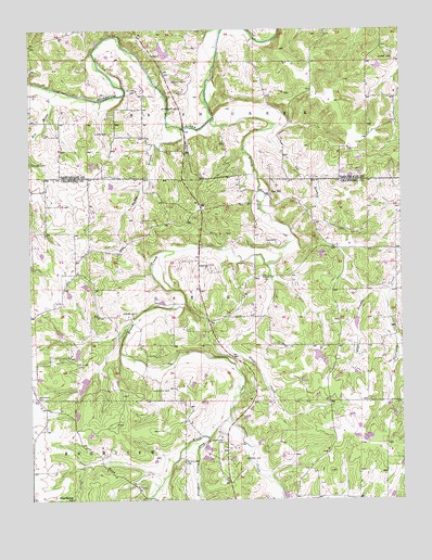
Oak Hill, MO USGS Topographic Map
Click on map above to begin viewing in our Map Viewer.

This topographic map contains these locations and features:
Feature Name Type Latitude Longitude GNIS ID View Map
Alexander LakeReservoirN38.1367°W91.4318°765109View Map
Alexander Lake DamDamN38.1367°W91.4318°765108View Map
Anderson CemeteryCemeteryN38.1517°W91.4988°713281View Map
Aunt Pop CemeteryCemeteryN38.1839°W91.4224°713485View Map
Bailey SchoolSchoolN38.1506°W91.3999°713548View Map
Barnes CemeteryCemeteryN38.1359°W91.4282°713669View Map
Big River CreekStreamN38.2342°W91.4907°714203View Map
Bird SanctuaryLocaleN38.2323°W91.4529°744414View Map
Blue Spring SchoolSchoolN38.1253°W91.4865°714433View Map
Brush CreekStreamN38.2264°W91.4377°714841View Map
Carr CemeteryCemeteryN38.1931°W91.4182°715421View Map
Collier CemeteryCemeteryN38.2145°W91.4999°716123View Map
Eickhoff LakeReservoirN38.1550°W91.4102°765111View Map
Eickhoff Lake DamDamN38.1550°W91.4102°765110View Map
Forester LakeReservoirN38.2087°W91.4727°765119View Map
Forester Lake DamDamN38.2084°W91.4718°765118View Map
Frerichs Lake Section 22ReservoirN38.1558°W91.4824°764857View Map
Frerichs Lake Section 4ReservoirN38.1484°W91.4685°764433View Map
Frerichs Lake Section 4 DamDamN38.1484°W91.4685°764432View Map
Frerichs Section 22 Lake DamDamN38.1567°W91.4802°764856View Map
Frericks Section 34 Lake DamDamN38.2467°W91.4768°765410View Map
Gal BranchStreamN38.2231°W91.4221°718311View Map
Gibson CemeteryCemeteryN38.1748°W91.4651°718429View Map
Griffith CemeteryCemeteryN38.1542°W91.4593°718877View Map
Hamby BranchStreamN38.2237°W91.4496°719022View Map
Hamby School (historical)SchoolN38.2194°W91.4585°719024View Map
Hamilton CemeteryCemeteryN38.1414°W91.4365°719030View Map
Hickory LakeReservoirN38.2443°W91.4550°764514View Map
Hickory Lake DamDamN38.2434°W91.4535°764513View Map
High Point SchoolSchoolN38.1739°W91.4777°719546View Map
Holmstrom South LakeReservoirN38.1250°W91.3918°764028View Map
Holmstrom South Lake DamDamN38.1250°W91.3918°764027View Map
Kohrman Lake DamDamN38.2147°W91.4792°765122View Map
Kozlowski LakeReservoirN38.1719°W91.3904°765409View Map
Kozlowski Lake DamDamN38.1734°W91.3902°765408View Map
Krekder LakeReservoirN38.1467°W91.4285°764853View Map
Krekder Lake DamDamN38.1467°W91.4285°764852View Map
Loeb CemeteryCemeteryN38.2225°W91.4785°721402View Map
McIntire CemeteryCemeteryN38.1611°W91.4849°722129View Map
McWilliams CemeteryCemeteryN38.1350°W91.4488°722174View Map
Miller CemeteryCemeteryN38.2337°W91.4646°722375View Map
Morris CemeteryCemeteryN38.2362°W91.4485°722641View Map
Neill LakeReservoirN38.1584°W91.3918°765113View Map
Neill Lake DamDamN38.1584°W91.3918°765112View Map
Oak HillPopulated PlaceN38.2059°W91.4207°736330View Map
Oak Hill CemeteryCemeteryN38.2020°W91.4076°1796356View Map
Oak Hill SchoolSchoolN38.2014°W91.4068°723625View Map
Persimmon Pond School (historical)SchoolN38.2420°W91.4060°729607View Map
Pinnell CemeteryCemeteryN38.1870°W91.4443°724417View Map
Pleasant Valley CreekStreamN38.1417°W91.4404°724625View Map
Prairie CreekStreamN38.1470°W91.4338°736337View Map
Ruwwe CemeteryCemeteryN38.2429°W91.3797°725695View Map
Schannon CemeteryCemeteryN38.2289°W91.4496°726094View Map
Skinner-Sorth-Koch-Kreider LakeReservoirN38.1641°W91.4845°764114View Map
Skinner-Sorth-Koch-Kreider Lake DamDamN38.1650°W91.4835°764113View Map
Souder CreekStreamN38.1873°W91.4213°726695View Map
Stubblefield LakeReservoirN38.1632°W91.4035°764116View Map
Stubblefield Lake DamDamN38.1634°W91.4035°764115View Map
Taylor Iron MineMineN38.1531°W91.4857°736435View Map
Taylor SchoolSchoolN38.1737°W91.4418°727498View Map
Threemile SchoolSchoolN38.1731°W91.3763°727635View Map
Township of Oak HillCivilN38.1689°W91.4116°766546View Map
Vieman (historical)BuildingN38.2107°W91.4803°737092View Map
Walker North LakeReservoirN38.1400°W91.4418°764122View Map
Walker North Lake DamDamN38.1400°W91.4418°764121View Map
Walker South LakeReservoirN38.1367°W91.4435°764124View Map
Walker South Lake DamDamN38.1367°W91.4435°764123View Map
West Branch Threemile CreekStreamN38.1809°W91.3788°728537View Map
Worthington Lake DamDamN38.2400°W91.3818°764851View Map

Note: Coordinates in the location and feature list above are referenced to NAD83 datum.


Copyright (C) 2008-2024 Ryan Niemi / Sunset Dynamics ... All Rights Reserved