TopoQuest Logo
Do you find TopoQuest useful?
Help keep TopoQuest running and adding new maps/features by donating!
Bitcoin:  19c7KJd3qBynnjoSw5npx9KScwjBe4ifkT
Litecoin:  LXs6TkuXGGXo1vDsWCkWVdjQX94eUKd6ui
Home View Maps Find Maps Find Places Resources & Links


North Manchester North, Indiana Topographic Map

USGS Map Title: North Manchester North, IN
USGS Map MRC: 41085A7
DRG (GeoTIFF) Download: o41085a7.tif


Neighboring USGS Topographic Map Quads:


  Burket, IN  
41085B8
 

  Warsaw, IN  
41085B7
 

  Pierceton, IN  
41085B6
 

  Silver Lake, IN  
41085A8
 

  North Manchester North, IN  
41085A7
 

  South Whitley West, IN  
41085A6
 

  Roann, IN  
40085H8
 

  North Manchester South, IN  
40085H7
 

  Servia, IN  
40085H6


Map MRC Location:

N42°
W86°
N42°
W85°
H8 H7 H6 H5 H4 H3 H2 H1
G8 G7 G6 G5 G4 G3 G2 G1
F8 F7 F6 F5 F4 F3 F2 F1
E8 E7 E6 E5 E4 E3 E2 E1
D8 D7 D6 D5 D4 D3 D2 D1
C8 C7 C6 C5 C4 C3 C2 C1
B8 B7 B6 B5 B4 B3 B2 B1
A8 A7 A6 A5 A4 A3 A2 A1
N41°
W86°
N41°
W85°

North Manchester North, IN USGS 1:24K Topographic Map Preview:
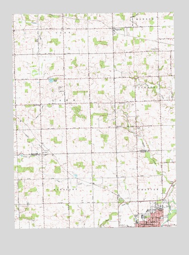
North Manchester North, IN USGS Topographic Map
Click on map above to begin viewing in our Map Viewer.

This topographic map contains these locations and features:
Feature Name Type Latitude Longitude GNIS ID View Map
Beigh LakeLakeN41.0864°W85.8453°430750View Map
Christian Fellowship ChurchChurchN41.0003°W85.7583°2649557View Map
Clemmers-Fishers CemeteryCemeteryN41.1028°W85.7644°432640View Map
Eel River ChurchChurchN41.0725°W85.7886°434040View Map
First Brethren ChurchChurchN41.0033°W85.7653°2649558View Map
Gospel Hill CemeteryCemeteryN41.0818°W85.8394°435237View Map
Grove ChapelChurchN41.1100°W85.8550°435527View Map
Manchester CollegeSchoolN41.0112°W85.7619°449690View Map
Manchester High SchoolSchoolN41.0094°W85.7729°447531View Map
Manchester Junior High SchoolSchoolN41.0100°W85.7728°447532View Map
North ManchesterPopulated PlaceN41.0006°W85.7686°440278View Map
North Manchester Congregational Christian ChurchChurchN41.0022°W85.7689°2649559View Map
North Manchester United Methodist ChurchChurchN41.0006°W85.7661°2649555View Map
Oaklawn CemeteryCemeteryN41.0066°W85.7812°440476View Map
Old German ChurchChurchN41.0587°W85.7958°440565View Map
PackertonPopulated PlaceN41.1164°W85.7975°440823View Map
Peabody Memorial HomeLocaleN41.0062°W85.7769°440955View Map
Saint Robert's Catholic ChurchChurchN41.0003°W85.7533°2649556View Map
Swank CemeteryCemeteryN41.0245°W85.7530°444467View Map
Swank CreekStreamN41.0150°W85.7528°444468View Map
Thomas Marshall Elementary SchoolSchoolN41.0053°W85.7625°438658View Map
Town of North ManchesterCivilN41.0044°W85.7750°2396822View Map
Township of LakeCivilN41.0724°W85.8521°453536View Map
Warvel ParkParkN41.0064°W85.7725°445490View Map
WBKE-FM (North Manchester)TowerN41.0112°W85.7625°449020View Map
West Eel River ChurchChurchN41.0720°W85.8536°445736View Map

Note: Coordinates in the location and feature list above are referenced to NAD83 datum.


Copyright (C) 2008-2024 Ryan Niemi / Sunset Dynamics ... All Rights Reserved