TopoQuest Logo
Do you find TopoQuest useful?
Help keep TopoQuest running and adding new maps/features by donating!
Bitcoin:  19c7KJd3qBynnjoSw5npx9KScwjBe4ifkT
Litecoin:  LXs6TkuXGGXo1vDsWCkWVdjQX94eUKd6ui
Home View Maps Find Maps Find Places Resources & Links


Belmont, New Hampshire Topographic Map

USGS Map Title: Belmont, NH
USGS Map MRC: 43071D4
DRG (GeoTIFF) Download: o43071d4.tif


Neighboring USGS Topographic Map Quads:


  Winnisquam Lake, NH  
43071E5
 

  Laconia, NH  
43071E4
 

  West Alton, NH  
43071E3
 

  Northfield, NH  
43071D5
 

  Belmont, NH  
43071D4
 

  Gilmanton Ironworks, NH  
43071D3
 

  Penacook, NH  
43071C5
 

  Loudon, NH  
43071C4
 

  Pittsfield, NH  
43071C3


Map MRC Location:

N44°
W72°
N44°
W71°
H8 H7 H6 H5 H4 H3 H2 H1
G8 G7 G6 G5 G4 G3 G2 G1
F8 F7 F6 F5 F4 F3 F2 F1
E8 E7 E6 E5 E4 E3 E2 E1
D8 D7 D6 D5 D4 D3 D2 D1
C8 C7 C6 C5 C4 C3 C2 C1
B8 B7 B6 B5 B4 B3 B2 B1
A8 A7 A6 A5 A4 A3 A2 A1
N43°
W72°
N43°
W71°

Belmont, NH USGS 1:24K Topographic Map Preview:
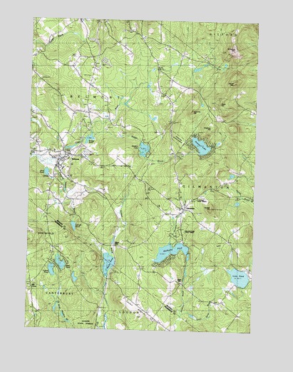
Belmont, NH USGS Topographic Map
Click on map above to begin viewing in our Map Viewer.

This topographic map contains these locations and features:
Feature Name Type Latitude Longitude GNIS ID View Map
Allens MillsPopulated PlaceN43.4084°W71.4515°865219View Map
Badger BrookStreamN43.4526°W71.4654°865312View Map
Badger PondLakeN43.4520°W71.4666°865316View Map
Badger Pond DamDamN43.4517°W71.4665°1774907View Map
Bean DamDamN43.4667°W71.4428°1775072View Map
BelmontPopulated PlaceN43.4454°W71.4779°865537View Map
Belmont Baptist ChurchChurchN43.4479°W71.4809°1914992View Map
Belmont Census Designated PlaceCensusN43.4430°W71.4780°2629713View Map
Belmont Elementary SchoolSchoolN43.4424°W71.4702°1914993View Map
Belmont Fire DepartmentBuildingN43.4445°W71.4777°1914994View Map
Belmont High SchoolSchoolN43.4509°W71.4802°1914995View Map
Belmont Middle SchoolSchoolN43.4397°W71.4809°1914996View Map
Belmont Police DepartmentBuildingN43.4424°W71.4811°2752943View Map
Belmont Post OfficePost OfficeN43.4324°W71.4711°1914997View Map
Belmont Town HallBuildingN43.4459°W71.4773°1914999View Map
Bradford HillSummitN43.4570°W71.3998°865754View Map
C H Page State ForestForestN43.4284°W71.4070°1915005View Map
Center Congregational ChurchChurchN43.4240°W71.4109°1915012View Map
Clough PondLakeN43.4167°W71.4741°866220View Map
Faith Christian AcademySchoolN43.4854°W71.4978°2500244View Map
GilmantonPopulated PlaceN43.4242°W71.4145°867072View Map
Gilmanton Fire Department Station 2BuildingN43.4222°W71.4151°2605043View Map
Gilmanton Post OfficePost OfficeN43.4224°W71.4170°1915049View Map
Gilmanton Public LibraryBuildingN43.4242°W71.4145°1915050View Map
Gilmanton Public Safety ComplexBuildingN43.4236°W71.4242°2752863View Map
Grant HillSummitN43.4665°W71.3953°867178View Map
Ham CemeteryCemeteryN43.3756°W71.4937°867331View Map
Heavenly Sonshine PreschoolSchoolN43.4479°W71.4812°2500272View Map
Hills CornerPopulated PlaceN43.3926°W71.4970°867495View Map
Jones MillsPopulated PlaceN43.3945°W71.4142°1915078View Map
Kimball BrookStreamN43.4040°W71.4520°867868View Map
Lakes Christian CenterChurchN43.4406°W71.4817°1915092View Map
Lamprey HillSummitN43.4634°W71.4106°867938View Map
Loon PondLakeN43.3972°W71.3819°868165View Map
Loon Pond BrookStreamN43.3792°W71.4137°868167View Map
Loudon RidgeRidgeN43.3815°W71.4359°868182View Map
Loudon Ridge SchoolSchoolN43.3756°W71.4276°868183View Map
Lyford PondReservoirN43.3987°W71.4858°868216View Map
Lyford Pond DikeDamN43.3981°W71.4862°1775351View Map
Meadow Pond State ForestForestN43.4162°W71.4131°868349View Map
New PondLakeN43.4015°W71.4810°868714View Map
Peaked HillSummitN43.4242°W71.3984°869038View Map
Pout PondLakeN43.4381°W71.4898°869330View Map
Pumping Station BranchStreamN43.4415°W71.4917°869393View Map
Rocky PondLakeN43.4017°W71.4546°869578View Map
Saint Joseph ChurchChurchN43.4442°W71.4773°1915150View Map
Sargent LakeReservoirN43.4480°W71.4363°869793View Map
Sargent Lake DamDamN43.4470°W71.4365°1774909View Map
Sawyer LakeReservoirN43.4498°W71.4047°869800View Map
Sawyer Lake DamDamN43.4498°W71.4045°1774780View Map
Shaker State ForestForestN43.3770°W71.4653°869868View Map
Shellcamp PondReservoirN43.4071°W71.4202°869896View Map
Shellcamp Pond DamDamN43.4073°W71.4192°1775551View Map
Smith OrchardLocaleN43.4911°W71.4492°2611148View Map
The Acord CampgroundLocaleN43.4398°W71.4629°1915173View Map
Tioga River DamDamN43.4484°W71.4795°1775695View Map
Tioga River ReservoirReservoirN43.4483°W71.4769°1775696View Map
Tioga River ReservoirReservoirN43.4667°W71.4428°1775073View Map
Town of BelmontCivilN43.4686°W71.4757°873542View Map
Whiteface MountainSummitN43.4879°W71.3876°870854View Map

Note: Coordinates in the location and feature list above are referenced to NAD83 datum.


Copyright (C) 2008-2024 Ryan Niemi / Sunset Dynamics ... All Rights Reserved