TopoQuest Logo
Do you find TopoQuest useful?
Help keep TopoQuest running and adding new maps/features by donating!
Bitcoin:  19c7KJd3qBynnjoSw5npx9KScwjBe4ifkT
Litecoin:  LXs6TkuXGGXo1vDsWCkWVdjQX94eUKd6ui
Home View Maps Find Maps Find Places Resources & Links


Nelson, Georgia Topographic Map

USGS Map Title: Nelson, GA
USGS Map MRC: 34084D3
DRG (GeoTIFF) Download: o34084d3.tif


Neighboring USGS Topographic Map Quads:


  Dyke, GA  
34084E4
 

  Amicalola, GA  
34084E3
 

  Nimblewill, GA  
34084E2
 

  Jasper, GA  
34084D4
 

  Nelson, GA  
34084D3
 

  Juno, GA  
34084D2
 

  Ball Ground West, GA  
34084C4
 

  Ball Ground East, GA  
34084C3
 

  Matt, GA  
34084C2


Map MRC Location:

N35°
W85°
N35°
W84°
H8 H7 H6 H5 H4 H3 H2 H1
G8 G7 G6 G5 G4 G3 G2 G1
F8 F7 F6 F5 F4 F3 F2 F1
E8 E7 E6 E5 E4 E3 E2 E1
D8 D7 D6 D5 D4 D3 D2 D1
C8 C7 C6 C5 C4 C3 C2 C1
B8 B7 B6 B5 B4 B3 B2 B1
A8 A7 A6 A5 A4 A3 A2 A1
N34°
W85°
N34°
W84°

Nelson, GA USGS 1:24K Topographic Map Preview:
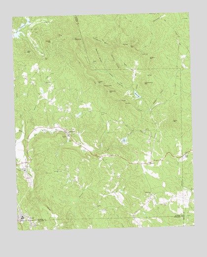
Nelson, GA USGS Topographic Map
Click on map above to begin viewing in our Map Viewer.

This topographic map contains these locations and features:
Feature Name Type Latitude Longitude GNIS ID View Map
Abs GapGapN34.4640°W84.2802°310377View Map
Anderson LakeReservoirN34.4551°W84.3549°336956View Map
Arbor Hill ChurchChurchN34.4093°W84.3444°310601View Map
Bent Tree DamDamN34.4884°W84.3733°336957View Map
Bent Tree Fire DepartmentBuildingN34.4913°W84.3561°2603860View Map
Bethel RidgeRidgeN34.4756°W84.3138°311211View Map
Bethesda ChurchChurchN34.3773°W84.3630°311221View Map
Big Canoe Fire Department Station 1BuildingN34.4358°W84.2787°2604610View Map
Big Canoe Fire Department Station 2BuildingN34.4824°W84.3020°2604676View Map
Big Canoe Fire Department Station 3BuildingN34.4579°W84.2896°2604605View Map
Big Canoe Fire Department Station 4BuildingN34.4582°W84.3120°2604899View Map
Big Canoe Fire Department Station 5BuildingN34.4635°W84.2762°2604611View Map
Big Canoe HeliportAirportN34.4548°W84.2891°351805View Map
Blackwell CreekStreamN34.4426°W84.2808°311509View Map
City of NelsonCivilN34.3791°W84.3708°2404354View Map
Coffey CoveValleyN34.4963°W84.3613°312799View Map
Corinth ChurchChurchN34.4315°W84.2824°312992View Map
Cox CreekStreamN34.4323°W84.3696°313075View Map
Cox LakeReservoirN34.4262°W84.2981°313076View Map
Cox MountainSummitN34.4476°W84.2963°331469View Map
DanielsPopulated PlaceN34.4168°W84.3641°1705460View Map
Darnell CreekStreamN34.4318°W84.3605°313315View Map
Dawson County Fire Department Station 6BuildingN34.4605°W84.2562°2603721View Map
Disharoon CoveValleyN34.4565°W84.2942°313478View Map
Disharoon CreekStreamN34.4426°W84.2808°313479View Map
Disharoon GapGapN34.4581°W84.3108°313480View Map
Disharoon LakeReservoirN34.4551°W84.2933°339744View Map
Disharoon Lake DamDamN34.4551°W84.2933°339743View Map
Disharoon MountainSummitN34.4554°W84.3069°313481View Map
Dubose LakeReservoirN34.4592°W84.3461°336934View Map
Dubose Lake DamDamN34.4584°W84.3466°336933View Map
East Branch Long Swamp CreekStreamN34.4287°W84.3685°313770View Map
Federal School (historical)SchoolN34.4012°W84.3310°1672989View Map
Fourmile ChurchChurchN34.3879°W84.3185°355892View Map
Fourmile CreekStreamN34.3790°W84.3469°314318View Map
Georgia Marble Company LakeReservoirN34.4418°W84.3299°336989View Map
Harrison LakeReservoirN34.4118°W84.3266°336930View Map
Harrison Lake DamDamN34.4118°W84.3266°336929View Map
Hendrix MountainSummitN34.4848°W84.3471°356260View Map
High GapGapN34.4818°W84.2963°315385View Map
HolcombPopulated PlaceN34.4129°W84.2805°332005View Map
Kents LakeReservoirN34.4161°W84.2560°316391View Map
Lake PetitReservoirN34.4666°W84.2885°336954View Map
Lake Petit DamDamN34.4634°W84.2899°336953View Map
Lake TamarackReservoirN34.4905°W84.3680°323904View Map
Little McElory MountainSummitN34.4590°W84.2824°332237View Map
Long Swamp ChurchChurchN34.4601°W84.3519°317391View Map
Long Swamp Creek Watershed Dam Number EightDamN34.4418°W84.3299°336988View Map
Long Swamp Watershed Dam Number 14DamN34.4251°W84.2983°339296View Map
Long Swamp Watershed Dam Number 18DamN34.3968°W84.3016°336990View Map
Long Swamp Watershed Dam Number NineDamN34.4551°W84.3549°336955View Map
Low GapGapN34.4498°W84.2991°317454View Map
Marble Hill Methodist ChurchChurchN34.4306°W84.3366°1673006View Map
Marble Hill Post OfficePost OfficeN34.4351°W84.3441°1673007View Map
Marble Hill School (historical)SchoolN34.4384°W84.3396°1673008View Map
MarblehillPopulated PlaceN34.4306°W84.3369°332315View Map
McElory MountainSummitN34.4734°W84.2783°332348View Map
Mole MountainSummitN34.4790°W84.3652°318383View Map
Mount OglethorpeSummitN34.4862°W84.3302°319923View Map
NelsonPopulated PlaceN34.3820°W84.3710°319244View Map
Nelson Methodist ChurchChurchN34.3837°W84.3727°1673009View Map
Nelson Police DepartmentBuildingN34.3821°W84.3726°2734140View Map
Nelson Volunteer Fire DepartmentBuildingN34.3807°W84.3706°2603811View Map
Nelson-Tate-Marble Hill DivisionCivilN34.4533°W84.3478°1936429View Map
New Lebanon ChurchChurchN34.4665°W84.3596°1673010View Map
Odum LakeReservoirN34.3968°W84.3016°336991View Map
Pettit CoveValleyN34.4667°W84.2907°320419View Map
Pettit CreekStreamN34.4551°W84.2885°320421View Map
Pettit RidgeRidgeN34.4718°W84.3024°320423View Map
Pickens County Fire and Rescue Department Station 9BuildingN34.3980°W84.2797°2604103View Map
Pleasant Union ChurchChurchN34.4998°W84.2730°320931View Map
Potts MountainSummitN34.4368°W84.2630°332748View Map
Sanderlin MountainSummitN34.4845°W84.3149°332969View Map
Sconti GapGapN34.4765°W84.2833°322639View Map
Sconti LakeReservoirN34.4527°W84.2881°322640View Map
Sconti Lake DamDamN34.4509°W84.2849°339745View Map
South Pickens Division (historical)CensusN34.4518°W84.3416°1936550View Map
Tate Division (historical)CensusN34.4301°W84.3391°1936577View Map
Tate Lookout TowerTowerN34.4084°W84.3544°344357View Map
Toland MountainSummitN34.4606°W84.3149°333242View Map
Weaver School (historical)SchoolN34.4340°W84.2960°1673030View Map
Wet MountainSummitN34.4812°W84.2913°333401View Map
Yellow Creek ChurchChurchN34.3943°W84.2805°325616View Map

Note: Coordinates in the location and feature list above are referenced to NAD83 datum.


Copyright (C) 2008-2024 Ryan Niemi / Sunset Dynamics ... All Rights Reserved