TopoQuest Logo
Do you find TopoQuest useful?
Help keep TopoQuest running and adding new maps/features by donating!
Bitcoin:  19c7KJd3qBynnjoSw5npx9KScwjBe4ifkT
Litecoin:  LXs6TkuXGGXo1vDsWCkWVdjQX94eUKd6ui
Home View Maps Find Maps Find Places Resources & Links


Neeley, Idaho Topographic Map

USGS Map Title: Neeley, ID
USGS Map MRC: 42112F8
DRG (GeoTIFF) Download: o42112f8.tif


Neighboring USGS Topographic Map Quads:


  Pillar Butte SE, ID  
42113G1
 

  American Falls SW, ID  
42112G8
 

  American Falls, ID  
42112G7
 

  Register Rock, ID  
42113F1
 

  Neeley, ID  
42112F8
 

  Indian Springs, ID  
42112F7
 

  Badger Peak, ID  
42113E1
 

  Rockland West, ID  
42112E8
 

  Rockland East, ID  
42112E7


Map MRC Location:

N43°
W113°
N43°
W112°
H8 H7 H6 H5 H4 H3 H2 H1
G8 G7 G6 G5 G4 G3 G2 G1
F8 F7 F6 F5 F4 F3 F2 F1
E8 E7 E6 E5 E4 E3 E2 E1
D8 D7 D6 D5 D4 D3 D2 D1
C8 C7 C6 C5 C4 C3 C2 C1
B8 B7 B6 B5 B4 B3 B2 B1
A8 A7 A6 A5 A4 A3 A2 A1
N42°
W113°
N42°
W112°

Neeley, ID USGS 1:24K Topographic Map Preview:
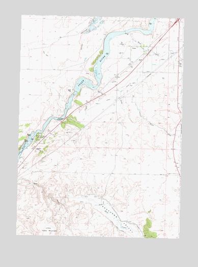
Neeley, ID USGS Topographic Map
Click on map above to begin viewing in our Map Viewer.

This topographic map contains these locations and features:
Feature Name Type Latitude Longitude GNIS ID View Map
Beaver IslandIslandN42.6819°W112.9894°371422View Map
Cold CreekStreamN42.7246°W112.8794°372077View Map
Eagle RockSummitN42.7077°W112.9600°372532View Map
Goat IslandIslandN42.6777°W112.9917°372859View Map
Hunt Party Historical SiteLocaleN42.6913°W112.9653°373181View Map
Lamb-Weston DamDamN42.7416°W112.9475°398784View Map
Little CreekStreamN42.7207°W112.9369°373622View Map
Little Table MountainSummitN42.6271°W112.9742°384970View Map
Lower West DitchCanalN42.6255°W112.9114°386254View Map
Main West CanalCanalN42.7194°W112.9033°373808View Map
Marys Mine Access AreaLocaleN42.7463°W112.9233°401606View Map
Massacre RocksSummitN42.6738°W112.9864°396858View Map
Massacre Rocks Rest AreaLocaleN42.7024°W112.9475°401605View Map
Massacre Rocks State ParkParkN42.6810°W112.9831°373856View Map
NeeleyPopulated PlaceN42.7335°W112.9150°374109View Map
Neeley CemeteryCemeteryN42.7251°W112.9102°374110View Map
Rockland ValleyValleyN42.6485°W112.9614°389534View Map
U S DitchCanalN42.6302°W112.9047°375657View Map
US DitchCanalN42.6288°W112.9044°392591View Map
W 4.2 LateralCanalN42.7412°W112.8862°2439079View Map
Warm CreekStreamN42.7416°W112.9158°375732View Map
West CanalCanalN42.7287°W112.8864°2439074View Map

Note: Coordinates in the location and feature list above are referenced to NAD83 datum.


Copyright (C) 2008-2024 Ryan Niemi / Sunset Dynamics ... All Rights Reserved