TopoQuest Logo
Do you find TopoQuest useful?
Help keep TopoQuest running and adding new maps/features by donating!
Bitcoin:  19c7KJd3qBynnjoSw5npx9KScwjBe4ifkT
Litecoin:  LXs6TkuXGGXo1vDsWCkWVdjQX94eUKd6ui
Home View Maps Find Maps Find Places Resources & Links


Mount Washington, Oregon Topographic Map

USGS Map Title: Mount Washington, OR
USGS Map MRC: 44121C7
DRG (GeoTIFF) Download: o44121c7.tif


Neighboring USGS Topographic Map Quads:


  Santiam Junction, OR  
44121D8
 

  Three Fingered Jack, OR  
44121D7
 

  Black Butte, OR  
44121D6
 

  Clear Lake, OR  
44121C8
 

  Mount Washington, OR  
44121C7
 

  Black Crater, OR  
44121C6
 

  Linton Lake, OR  
44121B8
 

  North Sister, OR  
44121B7
 

  Trout Creek Butte, OR  
44121B6


Map MRC Location:

N45°
W122°
N45°
W121°
H8 H7 H6 H5 H4 H3 H2 H1
G8 G7 G6 G5 G4 G3 G2 G1
F8 F7 F6 F5 F4 F3 F2 F1
E8 E7 E6 E5 E4 E3 E2 E1
D8 D7 D6 D5 D4 D3 D2 D1
C8 C7 C6 C5 C4 C3 C2 C1
B8 B7 B6 B5 B4 B3 B2 B1
A8 A7 A6 A5 A4 A3 A2 A1
N44°
W122°
N44°
W121°

Mount Washington, OR USGS 1:24K Topographic Map Preview:
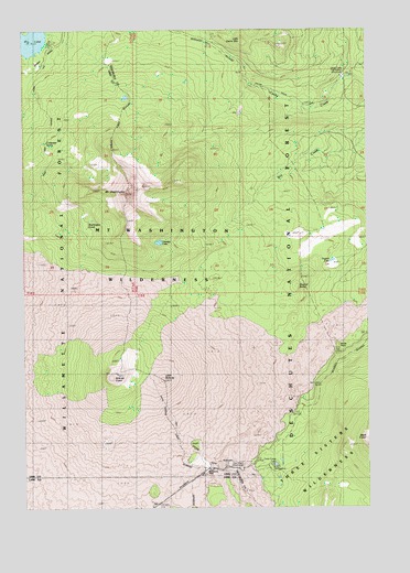
Mount Washington, OR USGS Topographic Map
Click on map above to begin viewing in our Map Viewer.

This topographic map contains these locations and features:
Feature Name Type Latitude Longitude GNIS ID View Map
Belknap CraterCraterN44.2843°W121.8428°1137894View Map
Big LakeLakeN44.3738°W121.8726°1138037View Map
Black CraterCraterN44.2679°W121.7504°1138195View Map
Cache Creek Toll StationLocaleN44.3629°W121.7589°1158155View Map
Coldwater SpringSpringN44.3451°W121.8678°1139973View Map
Dee Wright ObservatoryLocaleN44.2604°W121.8017°1140783View Map
Dugout ButteSummitN44.3075°W121.7765°1141384View Map
Dugout LakeLakeN44.3144°W121.7639°1141387View Map
George LakeLakeN44.3193°W121.8269°1142615View Map
Lava Camp LakeLakeN44.2611°W121.7852°1144868View Map
Lava Camp Lake Recreation SiteLocaleN44.2612°W121.7856°1159326View Map
Little BelknapSummitN44.2832°W121.8254°1145097View Map
Little Belknap TrailTrailN44.2829°W121.8270°1155873View Map
Little Cache MountainSummitN44.3722°W121.7961°1145119View Map
McKenzie PassGapN44.2598°W121.8098°1145999View Map
Mount WashingtonSummitN44.3323°W121.8384°1151927View Map
Seventh Day Adventist Organization CampLocaleN44.3721°W121.8651°1161644View Map
Shadow LakeLakeN44.3611°W121.8171°1154093View Map
Washington PondsLakeN44.3232°W121.8534°1151925View Map
Windy PointRidgeN44.2918°W121.7614°1152517View Map

Note: Coordinates in the location and feature list above are referenced to NAD83 datum.


Copyright (C) 2008-2024 Ryan Niemi / Sunset Dynamics ... All Rights Reserved