TopoQuest Logo
Do you find TopoQuest useful?
Help keep TopoQuest running and adding new maps/features by donating!
Bitcoin:  19c7KJd3qBynnjoSw5npx9KScwjBe4ifkT
Litecoin:  LXs6TkuXGGXo1vDsWCkWVdjQX94eUKd6ui
Home View Maps Find Maps Find Places Resources & Links


Mount Silliman, California Topographic Map

USGS Map Title: Mount Silliman, CA
USGS Map MRC: 36118F6
DRG (GeoTIFF) Download: o36118f6.tif


Neighboring USGS Topographic Map Quads:


  Wren Peak, CA  
36118G7
 

  Cedar Grove, CA  
36118G6
 

  The Sphinx, CA  
36118G5
 

  Muir Grove, CA  
36118F7
 

  Mount Silliman, CA  
36118F6
 

  Sphinx Lakes, CA  
36118F5
 

  Giant Forest, CA  
36118E7
 

  Lodgepole, CA  
36118E6
 

  Triple Divide Peak, CA  
36118E5


Map MRC Location:

N37°
W119°
N37°
W118°
H8 H7 H6 H5 H4 H3 H2 H1
G8 G7 G6 G5 G4 G3 G2 G1
F8 F7 F6 F5 F4 F3 F2 F1
E8 E7 E6 E5 E4 E3 E2 E1
D8 D7 D6 D5 D4 D3 D2 D1
C8 C7 C6 C5 C4 C3 C2 C1
B8 B7 B6 B5 B4 B3 B2 B1
A8 A7 A6 A5 A4 A3 A2 A1
N36°
W119°
N36°
W118°

Mount Silliman, CA USGS 1:24K Topographic Map Preview:
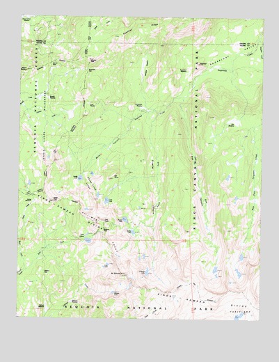
Mount Silliman, CA USGS Topographic Map
Click on map above to begin viewing in our Map Viewer.

This topographic map contains these locations and features:
Feature Name Type Latitude Longitude GNIS ID View Map
Ball DomeSummitN36.6830°W118.7042°256481View Map
Belle CanyonValleyN36.7076°W118.6930°1667519View Map
Beville LakeLakeN36.6608°W118.6916°256862View Map
Box CanyonValleyN36.7169°W118.6663°274624View Map
Cahoon GapGapN36.6438°W118.7373°257813View Map
Comanche MeadowFlatN36.7124°W118.6859°258615View Map
Crescent LakeLakeN36.6444°W118.6841°258912View Map
Crowley CanyonValleyN36.7103°W118.6790°274623View Map
East Fork Clover CreekStreamN36.6449°W118.7476°259726View Map
East Fork Sugarloaf CreekStreamN36.7174°W118.6651°259754View Map
Ellis MeadowFlatN36.7088°W118.6398°259875View Map
Ferguson CreekStreamN36.7413°W118.6268°266705View Map
J.O. PassGapN36.6758°W118.7440°261953View Map
Kanawyer GapGapN36.7276°W118.7165°274627View Map
Kettle PeakSummitN36.6734°W118.7335°262155View Map
Little LakeLakeN36.6472°W118.7043°252154View Map
Little LakesLakeN36.6475°W118.7043°262653View Map
Lost LakeLakeN36.6738°W118.7055°262944View Map
Marvin PassGapN36.7302°W118.7351°263242View Map
Mitchell PeakSummitN36.7323°W118.7150°263711View Map
Mount MaddoxSummitN36.7279°W118.7472°1659033View Map
Mount SillimanSummitN36.6432°W118.6968°266175View Map
Pattee MeadowFlatN36.6727°W118.7429°1667530View Map
Pond MeadowFlatN36.7133°W118.7176°264921View Map
Profile ViewCapeN36.6983°W118.7451°265045View Map
Ranger LakeLakeN36.6661°W118.6958°265185View Map
Rowell MeadowFlatN36.7161°W118.7418°265633View Map
Sentinel RidgeRidgeN36.7323°W118.7150°265996View Map
Seville LakeLakeN36.6830°W118.7192°266017View Map
Sheep Camp LakesLakeN36.6799°W118.7129°274622View Map
Silliman CrestRidgeN36.6433°W118.6969°252297View Map
Silliman LakeLakeN36.6360°W118.7015°266172View Map
Silliman MeadowFlatN36.6291°W118.7357°266173View Map
Silliman PassGapN36.6622°W118.7068°266174View Map
South Fork Sugarloaf CreekStreamN36.7105°W118.6784°267510View Map
SugarloafSummitN36.7305°W118.6588°267861View Map
Sugarloaf MeadowFlatN36.7280°W118.6634°267873View Map
Sugarloaf ValleyBasinN36.7358°W118.6357°267878View Map
Twin LakesLakeN36.6572°W118.7147°252233View Map
Twin PeaksSummitN36.6645°W118.7104°1660054View Map
West Fork Clover CreekStreamN36.6449°W118.7476°268894View Map
Williams MeadowFlatN36.7286°W118.6873°269121View Map

Note: Coordinates in the location and feature list above are referenced to NAD83 datum.


Copyright (C) 2008-2024 Ryan Niemi / Sunset Dynamics ... All Rights Reserved