TopoQuest Logo
Do you find TopoQuest useful?
Help keep TopoQuest running and adding new maps/features by donating!
Bitcoin:  19c7KJd3qBynnjoSw5npx9KScwjBe4ifkT
Litecoin:  LXs6TkuXGGXo1vDsWCkWVdjQX94eUKd6ui
Home View Maps Find Maps Find Places Resources & Links


Mount Nutt, Arizona Topographic Map

USGS Map Title: Mount Nutt, AZ
USGS Map MRC: 35114A3
DRG (GeoTIFF) Download: o35114a3.tif


Neighboring USGS Topographic Map Quads:


  Union Pass, AZ  
35114B4
 

  Secret Pass, AZ  
35114B3
 

  Kingman NW, AZ  
35114B2
 

  Oatman, AZ  
35114A4
 

  Mount Nutt, AZ  
35114A3
 

  Kingman SW, AZ  
35114A2
 

  Boundary Cone, AZ  
34114H4
 

  Warm Springs, AZ  
34114H3
 

  Yucca NW, AZ  
34114H2


Map MRC Location:

N36°
W115°
N36°
W114°
H8 H7 H6 H5 H4 H3 H2 H1
G8 G7 G6 G5 G4 G3 G2 G1
F8 F7 F6 F5 F4 F3 F2 F1
E8 E7 E6 E5 E4 E3 E2 E1
D8 D7 D6 D5 D4 D3 D2 D1
C8 C7 C6 C5 C4 C3 C2 C1
B8 B7 B6 B5 B4 B3 B2 B1
A8 A7 A6 A5 A4 A3 A2 A1
N35°
W115°
N35°
W114°

Mount Nutt, AZ USGS 1:24K Topographic Map Preview:
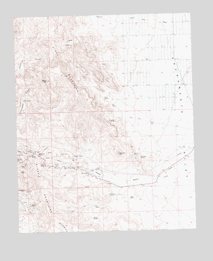
Mount Nutt, AZ USGS Topographic Map
Click on map above to begin viewing in our Map Viewer.

This topographic map contains these locations and features:
Feature Name Type Latitude Longitude GNIS ID View Map
Baker SpringSpringN35.0192°W114.2942°967View Map
Black Eagle MineMineN35.0158°W114.3669°1511View Map
Cave SpringSpringN35.0772°W114.3134°2594View Map
Cool SpringSpringN35.0151°W114.3213°3194View Map
Cottonwood WellWellN35.0367°W114.3338°3411View Map
Dripping SpringSpringN35.0639°W114.3072°4112View Map
Eds CampLocaleN35.0339°W114.3266°4356View Map
Elephants ToothPillarN35.0247°W114.3713°4403View Map
Fig SpringSpringN35.0728°W114.3077°4592View Map
Flag SpringSpringN35.0767°W114.3702°4655View Map
Gold Trail MineMineN35.0444°W114.2933°5122View Map
Gold Trail SpringSpringN35.0426°W114.2891°5123View Map
Goldroad MineMineN35.0392°W114.3700°5142View Map
Goldroad WellWellN35.0214°W114.3069°5144View Map
Hidden ValleyValleyN35.0433°W114.3283°5781View Map
Indian SpringSpringN35.0453°W114.3402°6235View Map
KMOH-TV (Kingman)TowerN35.0325°W114.3663°45276View Map
KRCY-FM (Kingman)TowerN35.0328°W114.3666°45193View Map
Little MeadowsFlatN35.0347°W114.3216°7143View Map
Mount NuttSummitN35.0878°W114.3536°8823View Map
Mount Nutt WildernessReserveN35.1045°W114.3532°2015986View Map
Onetto SpringSpringN35.0450°W114.3644°8994View Map
Shaffer SpringSpringN35.0389°W114.3565°11141View Map
Sitgreaves PassGapN35.0458°W114.3605°11373View Map
Thimble MountainSummitN35.0447°W114.3041°12387View Map
Tri-State ViewpointLocaleN35.0467°W114.3650°12706View Map
Twin SpringsSpringN35.0360°W114.3174°12961View Map
Walker SpringsSpringN35.0077°W114.3231°13293View Map

Note: Coordinates in the location and feature list above are referenced to NAD83 datum.


Copyright (C) 2008-2024 Ryan Niemi / Sunset Dynamics ... All Rights Reserved