TopoQuest Logo
Do you find TopoQuest useful?
Help keep TopoQuest running and adding new maps/features by donating!
Bitcoin:  19c7KJd3qBynnjoSw5npx9KScwjBe4ifkT
Litecoin:  LXs6TkuXGGXo1vDsWCkWVdjQX94eUKd6ui
Home View Maps Find Maps Find Places Resources & Links


Mount Jackson, Colorado Topographic Map

USGS Map Title: Mount Jackson, CO
USGS Map MRC: 39106D5
DRG (GeoTIFF) Download: o39106d5.tif


Neighboring USGS Topographic Map Quads:


  Fulford, CO  
39106E6
 

  Grouse Mountain, CO  
39106E5
 

  Minturn, CO  
39106E4
 

  Crooked Creek Pass, CO  
39106D6
 

  Mount Jackson, CO  
39106D5
 

  Mount of the Holy Cross, CO  
39106D4
 

  Meredith, CO  
39106C6
 

  Nast, CO  
39106C5
 

  Homestake Reservoir, CO  
39106C4


Map MRC Location:

N40°
W107°
N40°
W106°
H8 H7 H6 H5 H4 H3 H2 H1
G8 G7 G6 G5 G4 G3 G2 G1
F8 F7 F6 F5 F4 F3 F2 F1
E8 E7 E6 E5 E4 E3 E2 E1
D8 D7 D6 D5 D4 D3 D2 D1
C8 C7 C6 C5 C4 C3 C2 C1
B8 B7 B6 B5 B4 B3 B2 B1
A8 A7 A6 A5 A4 A3 A2 A1
N39°
W107°
N39°
W106°

Mount Jackson, CO USGS 1:24K Topographic Map Preview:
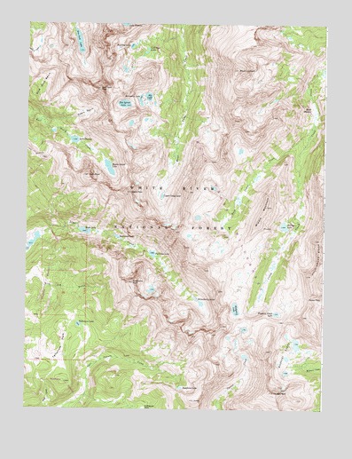
Mount Jackson, CO USGS Topographic Map
Click on map above to begin viewing in our Map Viewer.

This topographic map contains these locations and features:
Feature Name Type Latitude Longitude GNIS ID View Map
Avalanche PeakSummitN39.4161°W106.5803°179499View Map
Big LakeLakeN39.4764°W106.5744°179488View Map
Big Pine LakeLakeN39.4928°W106.5816°179481View Map
Big Spruce LakeLakeN39.4740°W106.5845°179490View Map
Blodgett LakeLakeN39.4076°W106.5370°179509View Map
Eagle LakeLakeN39.4327°W106.6005°179494View Map
Eagle PeakSummitN39.4455°W106.5814°179496View Map
Fairview LakeLakeN39.4254°W106.5721°179498View Map
Fancy PassGapN39.4105°W106.5064°179512View Map
Fools PeakSummitN39.4508°W106.5998°179493View Map
Gold Dust BasinBasinN39.4786°W106.6200°179485View Map
Gold Dust LakesLakeN39.4905°W106.5756°179482View Map
Gold Dust PeakSummitN39.4789°W106.5948°179487View Map
Halfmoon LakeLakeN39.4309°W106.5870°179495View Map
Harvey LakeLakeN39.4345°W106.5169°179502View Map
Holy Cross WildernessReserveN39.4428°W106.5106°197658View Map
Horseshoe LakeLakeN39.4830°W106.5778°179489View Map
Josephine LakeLakeN39.3820°W106.5598°179508View Map
Lake CharlesLakeN39.4622°W106.6055°179491View Map
Middle MountainSummitN39.4436°W106.5245°179501View Map
Missouri LakesLakeN39.3922°W106.5150°179513View Map
Missouri PassGapN39.4035°W106.5169°2711283View Map
Mount JacksonSummitN39.4853°W106.5367°179483View Map
Mystic Island LakeLakeN39.4533°W106.5906°179492View Map
Negro BasinBasinN39.4711°W106.6011°179486View Map
New York LakeLakeN39.4942°W106.6038°179480View Map
Reeds MeadowSwampN39.4725°W106.5048°179484View Map
Savage PeakSummitN39.3808°W106.5203°179514View Map
South MountainSummitN39.4192°W106.6011°190609View Map
Strawberry LakesLakeN39.4105°W106.5531°179507View Map
Tellurium LakeLakeN39.4023°W106.6029°179503View Map
Tellurium ParkFlatN39.3953°W106.6095°179504View Map
Treasure Vault LakeLakeN39.4063°W106.5198°179511View Map
Upper Camp LakeLakeN39.4442°W106.5682°179497View Map
West Cross CreekStreamN39.4680°W106.5134°179500View Map

Note: Coordinates in the location and feature list above are referenced to NAD83 datum.


Copyright (C) 2008-2024 Ryan Niemi / Sunset Dynamics ... All Rights Reserved