TopoQuest Logo
Do you find TopoQuest useful?
Help keep TopoQuest running and adding new maps/features by donating!
Bitcoin:  19c7KJd3qBynnjoSw5npx9KScwjBe4ifkT
Litecoin:  LXs6TkuXGGXo1vDsWCkWVdjQX94eUKd6ui
Home View Maps Find Maps Find Places Resources & Links


Mount Hamilton, Nevada Topographic Map

USGS Map Title: Mount Hamilton, NV
USGS Map MRC: 39115B5
DRG (GeoTIFF) Download: o39115b5.tif


Neighboring USGS Topographic Map Quads:


  Pancake Summit SW, NV  
39115C6
 

  Seligman Canyon, NV  
39115C5
 

  Hamilton, NV  
39115C4
 

  Green Springs NW, NV  
39115B6
 

  Mount Hamilton, NV  
39115B5
 

  Treasure Hill, NV  
39115B4
 

  Green Springs SW, NV  
39115A6
 

  Green Springs, NV  
39115A5
 

  Indian Garden Mountain, NV  
39115A4


Map MRC Location:

N40°
W116°
N40°
W115°
H8 H7 H6 H5 H4 H3 H2 H1
G8 G7 G6 G5 G4 G3 G2 G1
F8 F7 F6 F5 F4 F3 F2 F1
E8 E7 E6 E5 E4 E3 E2 E1
D8 D7 D6 D5 D4 D3 D2 D1
C8 C7 C6 C5 C4 C3 C2 C1
B8 B7 B6 B5 B4 B3 B2 B1
A8 A7 A6 A5 A4 A3 A2 A1
N39°
W116°
N39°
W115°

Mount Hamilton, NV USGS 1:24K Topographic Map Preview:
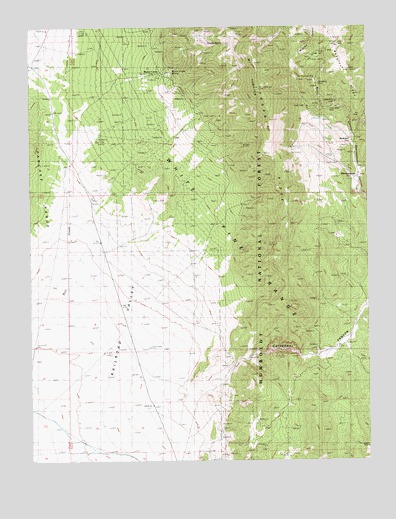
Mount Hamilton, NV USGS Topographic Map
Click on map above to begin viewing in our Map Viewer.

This topographic map contains these locations and features:
Feature Name Type Latitude Longitude GNIS ID View Map
Babylon (historical)Populated PlaceN39.2441°W115.5139°847724View Map
Carbonate (historical)LocaleN39.2222°W115.5092°862808View Map
Caroline MineMineN39.2097°W115.5525°854338View Map
Cathedral CanyonValleyN39.1438°W115.5703°859175View Map
Cathedral WellWellN39.1577°W115.5823°862768View Map
Eberhardt Mill (historical)LocaleN39.2027°W115.5045°853190View Map
Enterprise MineMineN39.2360°W115.5603°854334View Map
Grand Prize MineMineN39.2288°W115.5131°859866View Map
Great Valley MineMineN39.2263°W115.5156°859895View Map
Homestake MineMineN39.2355°W115.5178°860017View Map
Hoppe SpringSpringN39.2449°W115.5553°860027View Map
Metropolitan Mill (historical)LocaleN39.2027°W115.5045°853191View Map
Monte Cristo (historical)LocaleN39.2372°W115.5789°860629View Map
Monte Cristo Mill (historical)LocaleN39.2372°W115.5789°854337View Map
Monte Cristo SpringSpringN39.2369°W115.5739°860630View Map
Mount HamiltonSummitN39.2322°W115.5417°859931View Map
Ne Plus Ultra MineMineN39.2355°W115.5206°860809View Map
Oasis Mill (historical)LocaleN39.2027°W115.5045°853189View Map
Ora MineMineN39.2235°W115.5045°860844View Map
Pogonip RidgeRidgeN39.2110°W115.5342°860987View Map
Rocco CanyonValleyN39.2185°W115.5064°861143View Map
Rocco Homestake MineMineN39.2349°W115.5175°854335View Map
ShermantownPopulated PlaceN39.2027°W115.5045°861362View Map
Shermantown Post Office (historical)Post OfficeN39.2027°W115.5045°864508View Map
Swansea (historical)Populated PlaceN39.2249°W115.5023°862875View Map
Swansea Mill (historical)LocaleN39.2377°W115.5025°854336View Map
Vernon Mill (historical)LocaleN39.2230°W115.5036°853188View Map
White Pine Mining DistrictCivilN39.2194°W115.5131°854089View Map

Note: Coordinates in the location and feature list above are referenced to NAD83 datum.


Copyright (C) 2008-2024 Ryan Niemi / Sunset Dynamics ... All Rights Reserved