TopoQuest Logo
Do you find TopoQuest useful?
Help keep TopoQuest running and adding new maps/features by donating!
Bitcoin:  19c7KJd3qBynnjoSw5npx9KScwjBe4ifkT
Litecoin:  LXs6TkuXGGXo1vDsWCkWVdjQX94eUKd6ui
Home View Maps Find Maps Find Places Resources & Links


Mount Emily, Oregon Topographic Map

USGS Map Title: Mount Emily, OR
USGS Map MRC: 42124A2
DRG (GeoTIFF) Download: o42124a2.tif


Neighboring USGS Topographic Map Quads:


  Carpenterville, OR  
42124B3
 

  Bosley Butte, OR  
42124B2
 

  Quail Prairie Mountain, OR  
42124B1
 

  Brookings, OR  
42124A3
 

  Mount Emily, OR  
42124A2
 

  Fourth of July Creek, OR  
42124A1


  Smith River, CA  
41124H2
 

  High Divide, CA  
41124H1


Map MRC Location:

N43°
W125°
N43°
W124°
H8 H7 H6 H5 H4 H3 H2 H1
G8 G7 G6 G5 G4 G3 G2 G1
F8 F7 F6 F5 F4 F3 F2 F1
E8 E7 E6 E5 E4 E3 E2 E1
D8 D7 D6 D5 D4 D3 D2 D1
C8 C7 C6 C5 C4 C3 C2 C1
B8 B7 B6 B5 B4 B3 B2 B1
A8 A7 A6 A5 A4 A3 A2 A1
N42°
W125°
N42°
W124°

Mount Emily, OR USGS 1:24K Topographic Map Preview:
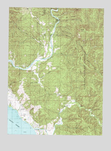
Mount Emily, OR USGS Topographic Map
Click on map above to begin viewing in our Map Viewer.

This topographic map contains these locations and features:
Feature Name Type Latitude Longitude GNIS ID View Map
Alfred A Loeb State ParkParkN42.1128°W124.1894°1137121View Map
Alfred A Loeb State Park Boat LaunchLocaleN42.1109°W124.1857°2668450View Map
Boar BackboneRidgeN42.1151°W124.1704°1138348View Map
Camel RockIslandN42.0018°W124.2301°1139183View Map
Carey CreekStreamN42.0643°W124.2359°1139369View Map
Chetco (historical)LocaleN42.0068°W124.2040°1154705View Map
Chetco Post Office (historical)Post OfficeN42.0068°W124.2040°1165045View Map
Chetco Valley Historical MuseumBuildingN42.0280°W124.2305°2661461View Map
Cooley CreekStreamN42.0096°W124.2206°1154703View Map
Crissey Field State ParkParkN42.0018°W124.2109°1877611View Map
Deer CreekStreamN42.0251°W124.1420°1140819View Map
Dry CreekStreamN42.1029°W124.1909°1141270View Map
Elk CreekStreamN42.1232°W124.1959°1141757View Map
Elk Mountain TrailTrailN42.0543°W124.1468°1141793View Map
Emily CreekStreamN42.1143°W124.1876°1141871View Map
Gardner RidgeRidgeN42.1079°W124.2101°1142577View Map
Hamilton CreekStreamN42.0515°W124.2120°1143243View Map
Jack CreekStreamN42.0637°W124.2220°1144158View Map
Johnson CreekStreamN42.0234°W124.2387°1154702View Map
Jordan CreekStreamN42.0559°W124.2120°1144401View Map
Little Emily CreekStreamN42.1126°W124.1851°1145163View Map
McVay CreekStreamN42.0179°W124.2345°1154701View Map
McVay RockPillarN42.0183°W124.2302°1116493View Map
McVay Rock State ParkParkN42.0199°W124.2359°1851880View Map
Mill CreekStreamN42.0809°W124.1931°1146220View Map
Moore CreekStreamN42.0068°W124.2179°1154704View Map
Moser CreekStreamN42.0107°W124.1804°1146482View Map
Mount EmilySummitN42.1024°W124.1532°1141873View Map
Nell CreekStreamN42.0973°W124.1948°1146766View Map
North Fork Chetco RiverStreamN42.0734°W124.2112°1146925View Map
Ostenbery BarBarN42.0679°W124.2206°1154700View Map
Peavine RidgeRidgeN42.0154°W124.1531°1147544View Map
Pioneer CemeteryCemeteryN42.0424°W124.2463°1116492View Map
Ram CreekStreamN42.0998°W124.1929°1154699View Map
Short RidgeRidgeN42.0837°W124.1612°1149439View Map
Social Security Bar Boat LaunchLocaleN42.0646°W124.2270°2668395View Map
Tamba RanchLocaleN42.0937°W124.1931°1150884View Map
Tide RockPillarN42.0726°W124.2493°1134647View Map
Upper Chetco Charter SchoolSchoolN42.0814°W124.2006°1151667View Map
Upper Chetco Rural Fire Protection DistrictBuildingN42.0866°W124.2049°2576664View Map
Van Pelt CemeteryCemeteryN42.0480°W124.2490°1116491View Map
Wildcat CreekStreamN42.0109°W124.1318°1154707View Map
Willow CreekStreamN42.0782°W124.1490°1152406View Map
Winchuck Post Office (historical)Post OfficeN42.0062°W124.2118°1164789View Map
Winchuck RiverStreamN42.0051°W124.2154°1152482View Map
Winchuck Rural Fire Protection DistrictBuildingN42.0343°W124.1658°2576891View Map
Winchuck State ParkParkN42.0062°W124.2131°1154706View Map

Note: Coordinates in the location and feature list above are referenced to NAD83 datum.


Copyright (C) 2008-2024 Ryan Niemi / Sunset Dynamics ... All Rights Reserved