TopoQuest Logo
Do you find TopoQuest useful?
Help keep TopoQuest running and adding new maps/features by donating!
Bitcoin:  19c7KJd3qBynnjoSw5npx9KScwjBe4ifkT
Litecoin:  LXs6TkuXGGXo1vDsWCkWVdjQX94eUKd6ui
Home View Maps Find Maps Find Places Resources & Links


Mount Boardman, California Topographic Map

USGS Map Title: Mount Boardman, CA
USGS Map MRC: 37121D4
DRG (GeoTIFF) Download: o37121d4.tif


Neighboring USGS Topographic Map Quads:


  Cedar Mountain, CA  
37121E5
 

  Lone Tree Creek, CA  
37121E4
 

  Solyo, CA  
37121E3
 

  Eylar Mountain, CA  
37121D5
 

  Mount Boardman, CA  
37121D4
 

  Copper Mountain, CA  
37121D3
 

  Isabel Valley, CA  
37121C5
 

  Mount Stakes, CA  
37121C4
 

  Wilcox Ridge, CA  
37121C3


Map MRC Location:

N38°
W122°
N38°
W121°
H8 H7 H6 H5 H4 H3 H2 H1
G8 G7 G6 G5 G4 G3 G2 G1
F8 F7 F6 F5 F4 F3 F2 F1
E8 E7 E6 E5 E4 E3 E2 E1
D8 D7 D6 D5 D4 D3 D2 D1
C8 C7 C6 C5 C4 C3 C2 C1
B8 B7 B6 B5 B4 B3 B2 B1
A8 A7 A6 A5 A4 A3 A2 A1
N37°
W122°
N37°
W121°

Mount Boardman, CA USGS 1:24K Topographic Map Preview:
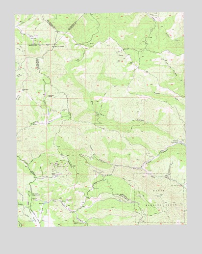
Mount Boardman, CA USGS Topographic Map
Click on map above to begin viewing in our Map Viewer.

This topographic map contains these locations and features:
Feature Name Type Latitude Longitude GNIS ID View Map
Adobe CanyonValleyN37.4091°W121.4088°217986View Map
Adobe CreekStreamN37.4088°W121.4086°217988View Map
Big Rock DamDamN37.4430°W121.4663°219243View Map
Deer Park CanyonValleyN37.4238°W121.3805°222201View Map
Department of Forestry and Fire Protection Station 25 SweetwaterBuildingN37.3938°W121.4912°2624698View Map
Fenton CanyonValleyN37.4352°W121.4786°223445View Map
Hamilton RanchLocaleN37.3758°W121.4711°1702990View Map
Harney Elementary School (historical)SchoolN37.3938°W121.4913°224949View Map
Herman RanchLocaleN37.4155°W121.3960°1703002View Map
Hideout CanyonValleyN37.4105°W121.4286°225259View Map
Jones RanchLocaleN37.4049°W121.4433°1703003View Map
Kronkite RanchLocaleN37.4172°W121.4447°1703004View Map
Little Fawn CanyonValleyN37.4033°W121.3899°227256View Map
Livermore Dude RanchLocaleN37.4860°W121.4858°1702986View Map
Mount BoardmanSummitN37.4813°W121.4713°1658089View Map
Mount MochoSummitN37.4555°W121.4944°228887View Map
Passionate SpringSpringN37.4515°W121.4772°230392View Map
Peach Tree CreekStreamN37.4049°W121.4305°230432View Map
Phoenix MineMineN37.3974°W121.4444°230610View Map
Red MountainSummitN37.4152°W121.4669°1659483View Map
Rodgers CanyonValleyN37.3883°W121.4969°231808View Map
San Antonio Ranger StationLocaleN37.3935°W121.4908°232369View Map
Schmidt RanchLocaleN37.4791°W121.4174°1703009View Map
Stanislaus County RanchLocaleN37.4233°W121.3799°235367View Map
Sulphur Springs CreekStreamN37.3766°W121.4872°235734View Map
Sweetwater CreekStreamN37.3835°W121.4972°235897View Map
Tripp RanchLocaleN37.4130°W121.4024°1703010View Map
Western MineMineN37.3908°W121.4194°1703011View Map
Western MinesMineN37.4094°W121.4702°237543View Map
Williams RanchLocaleN37.4110°W121.3880°1703012View Map
Winegar Ranch (historical)LocaleN37.4938°W121.3922°1703013View Map

Note: Coordinates in the location and feature list above are referenced to NAD83 datum.


Copyright (C) 2008-2024 Ryan Niemi / Sunset Dynamics ... All Rights Reserved