TopoQuest Logo
Do you find TopoQuest useful?
Help keep TopoQuest running and adding new maps/features by donating!
Bitcoin:  19c7KJd3qBynnjoSw5npx9KScwjBe4ifkT
Litecoin:  LXs6TkuXGGXo1vDsWCkWVdjQX94eUKd6ui
Home View Maps Find Maps Find Places Resources & Links


Morrisonville, New York Topographic Map

USGS Map Title: Morrisonville, NY
USGS Map MRC: 44073F5
DRG (GeoTIFF) Download: o44073f5.tif


Neighboring USGS Topographic Map Quads:


  Jericho, NY  
44073G6
 

  West Chazy, NY  
44073G5
 

  Beekmantown, NY  
44073G4
 

  Dannemora, NY  
44073F6
 

  Morrisonville, NY  
44073F5
 

  Plattsburgh, NY  
44073F4
 

  Peasleeville, NY  
44073E6
 

  Peru, NY  
44073E5
 

  Keeseville, NY  
44073E4


Map MRC Location:

N45°
W74°
N45°
W73°
H8 H7 H6 H5 H4 H3 H2 H1
G8 G7 G6 G5 G4 G3 G2 G1
F8 F7 F6 F5 F4 F3 F2 F1
E8 E7 E6 E5 E4 E3 E2 E1
D8 D7 D6 D5 D4 D3 D2 D1
C8 C7 C6 C5 C4 C3 C2 C1
B8 B7 B6 B5 B4 B3 B2 B1
A8 A7 A6 A5 A4 A3 A2 A1
N44°
W74°
N44°
W73°

Morrisonville, NY USGS 1:24K Topographic Map Preview:
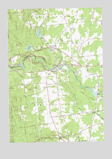
Morrisonville, NY USGS Topographic Map
Click on map above to begin viewing in our Map Viewer.

This topographic map contains these locations and features:
Feature Name Type Latitude Longitude GNIS ID View Map
Adcott PitMineN44.6939°W73.5964°2633259View Map
Baker CemeteryCemeteryN44.7090°W73.5539°942825View Map
Banker Road Industrial ParkLocaleN44.7052°W73.5417°2598627View Map
Beartown BrookStreamN44.7328°W73.5804°943337View Map
Beckwith School (historical)SchoolN44.6628°W73.5725°2360272View Map
Bread of Life Baptist ChurchChurchN44.6464°W73.5124°2598286View Map
Castine FarmsLocaleN44.7453°W73.5489°2703132View Map
Clinton County Airport (historical)AirportN44.6922°W73.5227°978232View Map
Clinton County LandfillLocaleN44.6940°W73.5967°2598570View Map
Clinton State ForestForestN44.6475°W73.6232°970015View Map
Country Dreams FarmLocaleN44.7456°W73.5292°2542466View Map
District School Number 11 (historical)SchoolN44.7381°W73.5006°2360277View Map
District School Number 15 (historical)SchoolN44.7358°W73.5467°2360278View Map
District School Number 2 (historical)SchoolN44.6531°W73.5119°2360273View Map
District School Number 3 (historical)SchoolN44.6678°W73.5592°2360274View Map
District School Number 3 (historical)SchoolN44.6756°W73.5103°2360275View Map
District School Number 7 (historical)SchoolN44.7097°W73.5306°2360276View Map
Everett OrchardsLocaleN44.7122°W73.5381°2516833View Map
Four Seasons Mobile Home ParkPopulated PlaceN44.7106°W73.5583°2598585View Map
Irish Settlement CemeteryCemeteryN44.6521°W73.5159°953771View Map
Kent FallsFallsN44.7037°W73.6018°954535View Map
Kent Falls Hydro-Electric PlantBuildingN44.7053°W73.5961°2360344View Map
Kingdom Hall of Jehovahs WitnessesChurchN44.7083°W73.5640°2597565View Map
Magdala Solitude CemeteryCemeteryN44.7031°W73.5626°963269View Map
Mead BrookStreamN44.6973°W73.5501°956856View Map
Mead ReservoirReservoirN44.7268°W73.5831°956867View Map
MorrisonvillePopulated PlaceN44.6931°W73.5621°957705View Map
Morrisonville ArmoryMilitaryN44.6948°W73.5357°2598618View Map
Morrisonville Census Designated PlaceCensusN44.6922°W73.5505°2389507View Map
Morrisonville Community ChurchChurchN44.6947°W73.5624°2597569View Map
Morrisonville Elementary SchoolSchoolN44.6913°W73.5718°2597545View Map
Morrisonville Post OfficePost OfficeN44.6942°W73.5628°2598576View Map
Morrisonville Schuyler Falls Volunteer Ambulance ServiceBuildingN44.6994°W73.5490°2720130View Map
Mountain View AirparkAirportN44.6689°W73.5457°977912View Map
Northway AirportAirportN44.6703°W73.5622°978163View Map
Patterson BrookStreamN44.7117°W73.5690°959988View Map
Patterson ReservoirReservoirN44.7137°W73.5970°959995View Map
Plattsburgh Drive-In (historical)LocaleN44.6967°W73.5028°2558368View Map
Plattsburgh West Census Designated PlaceCensusN44.6837°W73.5038°2389683View Map
Pytlak OrchardsLocaleN44.7056°W73.5378°2516854View Map
Rand Hill School (historical)SchoolN44.7497°W73.6083°2360279View Map
Riley BrookStreamN44.6506°W73.5157°962529View Map
Saint Alexanders SchoolSchoolN44.6970°W73.5354°963270View Map
Saint Joseph ChurchChurchN44.6806°W73.5067°2597578View Map
Sandburn BrookStreamN44.7125°W73.6010°964409View Map
Saranac River BridgeBridgeN44.6958°W73.5605°2598601View Map
Schuyler FallsPopulated PlaceN44.6287°W73.5579°964633View Map
Schuyler Falls Post OfficePost OfficeN44.6314°W73.5592°2598580View Map
Schuyler Falls Town HallBuildingN44.6905°W73.5612°2598624View Map
Scribner PondReservoirN44.7106°W73.5651°964708View Map
Town of PlattsburghCivilN44.7039°W73.5123°979377View Map
Town of Schuyler FallsCivilN44.6578°W73.5843°979474View Map
Turnpike Wesleyan ChurchChurchN44.7333°W73.5432°2597652View Map
Wesleyan ChurchChurchN44.7306°W73.5404°969073View Map
West BrookStreamN44.7289°W73.5865°969146View Map
West PlattsburghPopulated PlaceN44.7137°W73.5682°970842View Map
West Plattsburgh Union CemeteryCemeteryN44.7001°W73.5596°968173View Map
Woods MillsPopulated PlaceN44.6925°W73.6143°971709View Map

Note: Coordinates in the location and feature list above are referenced to NAD83 datum.


Copyright (C) 2008-2024 Ryan Niemi / Sunset Dynamics ... All Rights Reserved