TopoQuest Logo
Do you find TopoQuest useful?
Help keep TopoQuest running and adding new maps/features by donating!
Bitcoin:  19c7KJd3qBynnjoSw5npx9KScwjBe4ifkT
Litecoin:  LXs6TkuXGGXo1vDsWCkWVdjQX94eUKd6ui
Home View Maps Find Maps Find Places Resources & Links


Monon, Indiana Topographic Map

USGS Map Title: Monon, IN
USGS Map MRC: 40086G8
DRG (GeoTIFF) Download: o40086g8.tif


Neighboring USGS Topographic Map Quads:


  McCoysburg, IN  
40087H1
 

  Francesville, IN  
40086H8
 

  Monon NE, IN  
40086H7
 

  Wolcott, IN  
40087G1
 

  Monon, IN  
40086G8
 

  Monticello North, IN  
40086G7
 

  Templeton NE, IN  
40087F1
 

  Brookston NW, IN  
40086F8
 

  Monticello South, IN  
40086F7


Map MRC Location:

N41°
W87°
N41°
W86°
H8 H7 H6 H5 H4 H3 H2 H1
G8 G7 G6 G5 G4 G3 G2 G1
F8 F7 F6 F5 F4 F3 F2 F1
E8 E7 E6 E5 E4 E3 E2 E1
D8 D7 D6 D5 D4 D3 D2 D1
C8 C7 C6 C5 C4 C3 C2 C1
B8 B7 B6 B5 B4 B3 B2 B1
A8 A7 A6 A5 A4 A3 A2 A1
N40°
W87°
N40°
W86°

Monon, IN USGS 1:24K Topographic Map Preview:
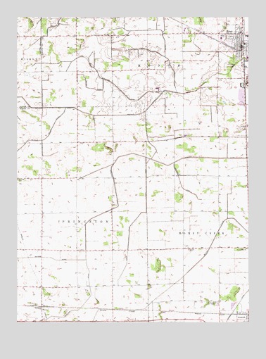
Monon, IN USGS Topographic Map
Click on map above to begin viewing in our Map Viewer.

This topographic map contains these locations and features:
Feature Name Type Latitude Longitude GNIS ID View Map
Blanchard DitchCanalN40.8509°W86.9556°431174View Map
Bossung DitchCanalN40.7534°W86.8939°431363View Map
Box DitchCanalN40.8606°W86.9247°431417View Map
Hoagland DitchCanalN40.8189°W86.9367°436254View Map
Kesler DitchCanalN40.8581°W86.9192°437268View Map
Klopfenstein Airport (historical)AirportN40.7673°W86.9208°449320View Map
McKillip DitchCanalN40.8350°W86.9431°438895View Map
Minch DitchCanalN40.7928°W86.9353°439260View Map
MononPopulated PlaceN40.8678°W86.8789°439333View Map
Monon CemeteryCemeteryN40.8671°W86.8874°439334View Map
Monon Fire DepartmentBuildingN40.8608°W86.8782°2625578View Map
Monon Police DepartmentBuildingN40.8637°W86.8794°2758221View Map
Monon QuarryMineN40.8422°W86.8800°2566582View Map
North White High SchoolSchoolN40.8670°W86.8756°447505View Map
Obrien DitchCanalN40.8742°W86.9770°440495View Map
Palestine CemeteryCemeteryN40.8086°W86.9999°440840View Map
Robinson DitchCanalN40.8059°W86.9114°442180View Map
SeafieldPopulated PlaceN40.7564°W86.9867°443180View Map
Swisher CemeteryCemeteryN40.7799°W86.9074°444500View Map
Town of MononCivilN40.8641°W86.8787°2396770View Map
Township of MononCivilN40.8706°W86.8776°453632View Map
Walker DitchCanalN40.8462°W86.9611°445378View Map
White County Pullet FarmLocaleN40.8617°W86.9700°2566583View Map
Winters DitchCanalN40.7762°W86.9981°446197View Map

Note: Coordinates in the location and feature list above are referenced to NAD83 datum.


Copyright (C) 2008-2024 Ryan Niemi / Sunset Dynamics ... All Rights Reserved