TopoQuest Logo
Do you find TopoQuest useful?
Help keep TopoQuest running and adding new maps/features by donating!
Bitcoin:  19c7KJd3qBynnjoSw5npx9KScwjBe4ifkT
Litecoin:  LXs6TkuXGGXo1vDsWCkWVdjQX94eUKd6ui
Home View Maps Find Maps Find Places Resources & Links


Becker, New Mexico Topographic Map

USGS Map Title: Becker, NM
USGS Map MRC: 34106D5
DRG (GeoTIFF) Download: o34106d5.tif


Neighboring USGS Topographic Map Quads:


  Casa Colorada, NM  
34106E6
 

  Tome SE, NM  
34106E5
 

  Manzano Peak, NM  
34106E4
 

  Black Butte, NM  
34106D6
 

  Becker, NM  
34106D5
 

  Scholle, NM  
34106D4
 

  Becker SW, NM  
34106C6
 

  Cerro Montoso, NM  
34106C5
 

  Rayo Hills, NM  
34106C4


Map MRC Location:

N35°
W107°
N35°
W106°
H8 H7 H6 H5 H4 H3 H2 H1
G8 G7 G6 G5 G4 G3 G2 G1
F8 F7 F6 F5 F4 F3 F2 F1
E8 E7 E6 E5 E4 E3 E2 E1
D8 D7 D6 D5 D4 D3 D2 D1
C8 C7 C6 C5 C4 C3 C2 C1
B8 B7 B6 B5 B4 B3 B2 B1
A8 A7 A6 A5 A4 A3 A2 A1
N34°
W107°
N34°
W106°

Becker, NM USGS 1:24K Topographic Map Preview:
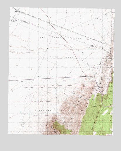
Becker, NM USGS Topographic Map
Click on map above to begin viewing in our Map Viewer.

This topographic map contains these locations and features:
Feature Name Type Latitude Longitude GNIS ID View Map
10019 Water WellWellN34.4953°W106.6164°926135View Map
Abo CanyonValleyN34.4614°W106.5215°902939View Map
BeckerPopulated PlaceN34.4962°W106.6156°898520View Map
Becker Coal ElevatorLocaleN34.4978°W106.5864°929181View Map
Blue SpringSpringN34.4234°W106.5181°886524View Map
Blue SpringsLocaleN34.4312°W106.5181°920048View Map
Blue Springs DrawValleyN34.4609°W106.5300°886525View Map
Blue Springs QuarryMineN34.4223°W106.5225°917422View Map
Burris Ranch Number 1 AirportAirportN34.4829°W106.6164°936910View Map
Goat DrawValleyN34.4590°W106.5411°889450View Map
Goat RanchLocaleN34.4034°W106.5217°889456View Map
Pino Water WellWellN34.3853°W106.5600°925843View Map
Pinon CanyonValleyN34.4206°W106.5931°893306View Map
SaisLocaleN34.4653°W106.5128°898595View Map
West and Pyle RanchLocaleN34.4867°W106.6214°896327View Map
Whiteface MountainSummitN34.3798°W106.5686°896552View Map

Note: Coordinates in the location and feature list above are referenced to NAD83 datum.


Copyright (C) 2008-2024 Ryan Niemi / Sunset Dynamics ... All Rights Reserved