TopoQuest Logo
Do you find TopoQuest useful?
Help keep TopoQuest running and adding new maps/features by donating!
Bitcoin:  19c7KJd3qBynnjoSw5npx9KScwjBe4ifkT
Litecoin:  LXs6TkuXGGXo1vDsWCkWVdjQX94eUKd6ui
Home View Maps Find Maps Find Places Resources & Links


Moccasin, California Topographic Map

USGS Map Title: Moccasin, CA
USGS Map MRC: 37120G3
DRG (GeoTIFF) Download: o37120g3.tif


Neighboring USGS Topographic Map Quads:


  Sonora, CA  
37120H4
 

  Standard, CA  
37120H3
 

  Tuolumne, CA  
37120H2
 

  Chinese Camp, CA  
37120G4
 

  Moccasin, CA  
37120G3
 

  Groveland, CA  
37120G2
 

  La Grange, CA  
37120F4
 

  Penon Blanco Peak, CA  
37120F3
 

  Coulterville, CA  
37120F2


Map MRC Location:

N38°
W121°
N38°
W120°
H8 H7 H6 H5 H4 H3 H2 H1
G8 G7 G6 G5 G4 G3 G2 G1
F8 F7 F6 F5 F4 F3 F2 F1
E8 E7 E6 E5 E4 E3 E2 E1
D8 D7 D6 D5 D4 D3 D2 D1
C8 C7 C6 C5 C4 C3 C2 C1
B8 B7 B6 B5 B4 B3 B2 B1
A8 A7 A6 A5 A4 A3 A2 A1
N37°
W121°
N37°
W120°

Moccasin, CA USGS 1:24K Topographic Map Preview:
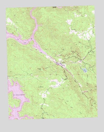
Moccasin, CA USGS Topographic Map
Click on map above to begin viewing in our Map Viewer.

This topographic map contains these locations and features:
Feature Name Type Latitude Longitude GNIS ID View Map
Big Jackass CreekStreamN37.7788°W120.2721°256948View Map
Big Oak FlatPopulated PlaceN37.8235°W120.2582°1658056View Map
Big Oak Flat Post OfficePost OfficeN37.8275°W120.2518°1785636View Map
Big Oak Flat SchoolSchoolN37.8227°W120.2560°1785637View Map
Clio MineMineN37.8463°W120.3680°221230View Map
Cobbs CreekStreamN37.7830°W120.2535°258498View Map
Deer CreekStreamN37.8735°W120.2966°222167View Map
Domingo PeakSummitN37.7860°W120.3307°222482View Map
First CreekStreamN37.7508°W120.3294°223519View Map
Grizzly GulchValleyN37.8116°W120.3032°224634View Map
Groveland Community Services District Fire Department Station 2BuildingN37.8278°W120.2531°2624391View Map
Groveland DivisionCivilN37.7848°W120.3118°1935124View Map
Haigh QuarryMineN37.7702°W120.2571°1670840View Map
Harriman MineMineN37.8383°W120.3496°224955View Map
Kanaka CreekStreamN37.8444°W120.3574°226417View Map
Kelley GradeSlopeN37.7997°W120.2946°226458View Map
Marshs FlatFlatN37.7888°W120.3063°228156View Map
McAlpine MineMineN37.7660°W120.2535°228272View Map
MoccasinPopulated PlaceN37.8108°W120.2999°1659150View Map
Moccasin CreekStreamN37.8396°W120.3391°228884View Map
Moccasin Creek Power HouseBuildingN37.8099°W120.2999°1785639View Map
Moccasin PeakSummitN37.8052°W120.3280°228885View Map
Moccasin Post OfficePost OfficeN37.8118°W120.3014°2769546View Map
Moccasin ReservoirReservoirN37.8104°W120.3032°228886View Map
Mountain Lutheran Worship ChurchChurchN37.8260°W120.2549°1785640View Map
Old Priest GradeSlopeN37.8177°W120.2780°229981View Map
Our Lady of Mount Carmel Catholic ChurchChurchN37.8260°W120.2549°1785641View Map
Peņon Blanco RidgeRidgeN37.7708°W120.2999°253888View Map
PriestPopulated PlaceN37.8141°W120.2727°252770View Map
Priest 9-006 DamDamN37.8008°W120.2658°1663349View Map
Priest GradeSlopeN37.8238°W120.2780°231054View Map
Priest ReservoirReservoirN37.8030°W120.2672°231055View Map
Rattlesnake CreekStreamN37.7822°W120.2588°231253View Map
Red Jacke MineMineN37.8169°W120.2507°265283View Map
Second CreekStreamN37.7574°W120.3263°234668View Map
Tip Top PeakSummitN37.8294°W120.2627°236391View Map
Tuolumne County Fire Department Station 62 MoccasinBuildingN37.8113°W120.3019°2624099View Map

Note: Coordinates in the location and feature list above are referenced to NAD83 datum.


Copyright (C) 2008-2024 Ryan Niemi / Sunset Dynamics ... All Rights Reserved