TopoQuest Logo
Do you find TopoQuest useful?
Help keep TopoQuest running and adding new maps/features by donating!
Bitcoin:  19c7KJd3qBynnjoSw5npx9KScwjBe4ifkT
Litecoin:  LXs6TkuXGGXo1vDsWCkWVdjQX94eUKd6ui
Home View Maps Find Maps Find Places Resources & Links


Millville, Minnesota Topographic Map

USGS Map Title: Millville, MN
USGS Map MRC: 44092B3
DRG (GeoTIFF) Download: o44092b3.tif


Neighboring USGS Topographic Map Quads:


  Zumbro Falls, MN  
44092C4
 

  West Albany, MN  
44092C3
 

  Theilman, MN  
44092C2
 

  Zumbro Lake, MN  
44092B4
 

  Millville, MN  
44092B3
 

  Plainview, MN  
44092B2
 

  Rochester, MN  
44092A4
 

  Chester, MN  
44092A3
 

  Plainview SW, MN  
44092A2


Map MRC Location:

N45°
W93°
N45°
W92°
H8 H7 H6 H5 H4 H3 H2 H1
G8 G7 G6 G5 G4 G3 G2 G1
F8 F7 F6 F5 F4 F3 F2 F1
E8 E7 E6 E5 E4 E3 E2 E1
D8 D7 D6 D5 D4 D3 D2 D1
C8 C7 C6 C5 C4 C3 C2 C1
B8 B7 B6 B5 B4 B3 B2 B1
A8 A7 A6 A5 A4 A3 A2 A1
N44°
W93°
N44°
W92°

Millville, MN USGS 1:24K Topographic Map Preview:
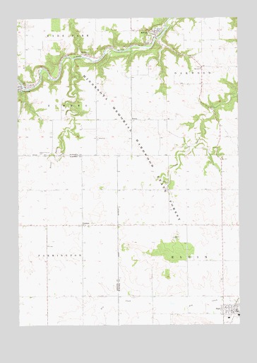
Millville, MN USGS Topographic Map
Click on map above to begin viewing in our Map Viewer.

This topographic map contains these locations and features:
Feature Name Type Latitude Longitude GNIS ID View Map
BremenPopulated PlaceN44.2086°W92.3107°654613View Map
Bremen ChurchChurchN44.2008°W92.3299°640457View Map
Bremen Post Office (historical)Post OfficeN44.2086°W92.3106°2064607View Map
City of ElginCivilN44.1300°W92.2544°2394642View Map
City of HammondCivilN44.2220°W92.3738°2394281View Map
City of MillvilleCivilN44.2445°W92.2960°2395331View Map
De Frang Pooling Agreement DamDamN44.2433°W92.3118°1776605View Map
ElginPopulated PlaceN44.1302°W92.2516°643242View Map
Elgin (historical)LocaleN44.1314°W92.2533°2064697View Map
Elgin AmbulanceBuildingN44.1307°W92.2509°2721249View Map
Elgin Fire DepartmentBuildingN44.1307°W92.2507°2064692View Map
Elgin High SchoolSchoolN44.1289°W92.2503°2064695View Map
Elgin Police DepartmentBuildingN44.1309°W92.2539°2064693View Map
Elgin Post OfficePost OfficeN44.1308°W92.2503°2064691View Map
Elgin-Millville Elementary SchoolSchoolN44.1278°W92.2558°2064694View Map
Grace United Church of ChristChurchN44.2447°W92.2969°2064652View Map
HammondPopulated PlaceN44.2222°W92.3735°644609View Map
Hammond Post Office (historical)Post OfficeN44.2222°W92.3733°2064599View Map
Hilltop Fellowship ChurchChurchN44.2447°W92.2956°2064651View Map
JarrettPopulated PlaceN44.2361°W92.3391°645581View Map
Jarretts Post Office (historical)Post OfficeN44.2361°W92.3389°2064595View Map
MillvillePopulated PlaceN44.2447°W92.2957°647891View Map
Millville (historical)LocaleN44.2447°W92.2956°2064646View Map
Millville CemeteryCemeteryN44.2453°W92.2978°2064653View Map
Millville Fire DepartmentBuildingN44.2447°W92.2956°2064650View Map
Millville Post OfficePost OfficeN44.2447°W92.2956°2064647View Map
Oakwood ChurchChurchN44.2297°W92.2710°648888View Map
Pleasant Prairie CemeteryCemeteryN44.1941°W92.3629°649565View Map
PotsdamPopulated PlaceN44.1655°W92.3391°649691View Map
Potsdam Lutheran CemeteryCemeteryN44.1653°W92.3350°2064105View Map
Potsdam Post Office (historical)Post OfficeN44.1655°W92.3391°2052225View Map
Saint Patrick's Catholic ChurchChurchN44.2447°W92.2956°2064648View Map
Silver Spring CreekStreamN44.2333°W92.3435°652068View Map
Spring Creek Motorcross ParkParkN44.2447°W92.2956°2064649View Map
Swedish Lutheran CemeteryCemeteryN44.2439°W92.2967°2064654View Map
Township of ElginCivilN44.1514°W92.2595°664064View Map
Trinity Lutheran ChurchChurchN44.1319°W92.2578°2064696View Map
Zion CemeteryCemeteryN44.1364°W92.3486°2064104View Map

Note: Coordinates in the location and feature list above are referenced to NAD83 datum.


Copyright (C) 2008-2024 Ryan Niemi / Sunset Dynamics ... All Rights Reserved