TopoQuest Logo
Do you find TopoQuest useful?
Help keep TopoQuest running and adding new maps/features by donating!
Bitcoin:  19c7KJd3qBynnjoSw5npx9KScwjBe4ifkT
Litecoin:  LXs6TkuXGGXo1vDsWCkWVdjQX94eUKd6ui
Home View Maps Find Maps Find Places Resources & Links


Mildred Peak, Arizona Topographic Map

USGS Map Title: Mildred Peak, AZ
USGS Map MRC: 31111F5
DRG (GeoTIFF) Download: o31111f5.tif


Neighboring USGS Topographic Map Quads:


  Chiuli Shaik, AZ  
31111G6
 

  Baboquivari Peak, AZ  
31111G5
 

  Fresno Wash, AZ  
31111G4
 

  Aguirre Peak, AZ  
31111F6
 

  Mildred Peak, AZ  
31111F5
 

  Las Guijas, AZ  
31111F4
 

  Caponera Peak, AZ  
31111E6
 

  Presumido Peak, AZ  
31111E5
 

  Wilbur Canyon, AZ  
31111E4


Map MRC Location:

N32°
W112°
N32°
W111°
H8 H7 H6 H5 H4 H3 H2 H1
G8 G7 G6 G5 G4 G3 G2 G1
F8 F7 F6 F5 F4 F3 F2 F1
E8 E7 E6 E5 E4 E3 E2 E1
D8 D7 D6 D5 D4 D3 D2 D1
C8 C7 C6 C5 C4 C3 C2 C1
B8 B7 B6 B5 B4 B3 B2 B1
A8 A7 A6 A5 A4 A3 A2 A1
N31°
W112°
N31°
W111°

Mildred Peak, AZ USGS 1:24K Topographic Map Preview:
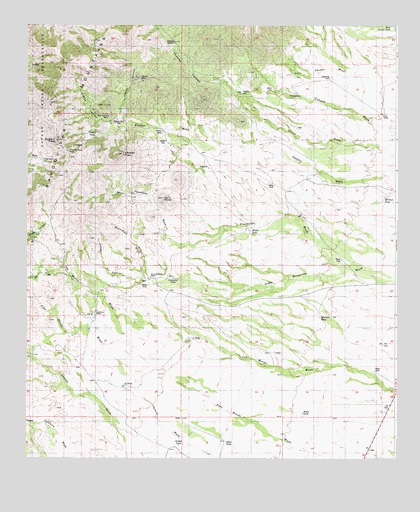
Mildred Peak, AZ USGS Topographic Map
Click on map above to begin viewing in our Map Viewer.

This topographic map contains these locations and features:
Feature Name Type Latitude Longitude GNIS ID View Map
Arroyo del PuenteValleyN31.6768°W111.5854°813View Map
Black TankReservoirN31.7315°W111.5429°1625View Map
Cemetery TankReservoirN31.6771°W111.5756°2683View Map
Cerro PrietoSummitN31.7004°W111.5793°2722View Map
Charlie Bent WellWellN31.7229°W111.5948°27515View Map
Chutum Vaya PassGapN31.7137°W111.6115°2917View Map
Clemente WindmillLocaleN31.7454°W111.5757°3009View Map
Corodope SpringSpringN31.7001°W111.5840°24053View Map
Elgin SchoolSchoolN31.6623°W111.5245°36624View Map
Escondido SpringSpringN31.6948°W111.6007°15355View Map
Escondido WashStreamN31.6768°W111.5854°4480View Map
Fourteen TankReservoirN31.6458°W111.5919°4798View Map
Gold Bullion MineMineN31.7240°W111.5982°5094View Map
Indian TankReservoirN31.7188°W111.6048°6239View Map
Jackknife TankReservoirN31.7348°W111.5229°6310View Map
Jupiter CanyonValleyN31.7240°W111.5929°6557View Map
Jupiter MineMineN31.7340°W111.5865°6558View Map
Las Moras RanchLocaleN31.6673°W111.6021°6884View Map
Leyvas CanyonValleyN31.6915°W111.6168°6991View Map
Middle TankReservoirN31.6909°W111.5500°8004View Map
Mildred PeakSummitN31.7131°W111.5932°8043View Map
Milpa TankReservoirN31.6383°W111.5318°8082View Map
Mitchell TankReservoirN31.6661°W111.5259°8136View Map
Mormon TankReservoirN31.7008°W111.5041°8301View Map
Osobavi PeakSummitN31.7170°W111.6157°9025View Map
Placeritos WashStreamN31.6790°W111.5157°9561View Map
Santa Margarita RanchLocaleN31.6770°W111.5837°10941View Map
Seven X TankReservoirN31.6599°W111.5704°11107View Map
Shaffer CampLocaleN31.7195°W111.5796°11140View Map
Shute TankReservoirN31.6304°W111.5565°11265View Map
Thomas CanyonValleyN31.7340°W111.5615°12393View Map
Thomas WellWellN31.7309°W111.5532°12395View Map
Twin TanksReservoirN31.7245°W111.5051°12965View Map
Weaver CanyonValleyN31.7231°W111.5940°13413View Map
West Brown TankReservoirN31.7498°W111.5023°13481View Map

Note: Coordinates in the location and feature list above are referenced to NAD83 datum.


Copyright (C) 2008-2024 Ryan Niemi / Sunset Dynamics ... All Rights Reserved