TopoQuest Logo
Do you find TopoQuest useful?
Help keep TopoQuest running and adding new maps/features by donating!
Bitcoin:  19c7KJd3qBynnjoSw5npx9KScwjBe4ifkT
Litecoin:  LXs6TkuXGGXo1vDsWCkWVdjQX94eUKd6ui
Home View Maps Find Maps Find Places Resources & Links


Beaucoup, Illinois Topographic Map

USGS Map Title: Beaucoup, IL
USGS Map MRC: 38089C3
DRG (GeoTIFF) Download: o38089c3.tif


Neighboring USGS Topographic Map Quads:


  Addieville, IL  
38089D4
 

  Hoyleton, IL  
38089D3
 

  Irvington, IL  
38089D2
 

  Nashville, IL  
38089C4
 

  Beaucoup, IL  
38089C3
 

  Ashley, IL  
38089C2
 

  Winkle, IL  
38089B4
 

  Todds Mill, IL  
38089B3
 

  Tamaroa, IL  
38089B2


Map MRC Location:

N39°
W90°
N39°
W89°
H8 H7 H6 H5 H4 H3 H2 H1
G8 G7 G6 G5 G4 G3 G2 G1
F8 F7 F6 F5 F4 F3 F2 F1
E8 E7 E6 E5 E4 E3 E2 E1
D8 D7 D6 D5 D4 D3 D2 D1
C8 C7 C6 C5 C4 C3 C2 C1
B8 B7 B6 B5 B4 B3 B2 B1
A8 A7 A6 A5 A4 A3 A2 A1
N38°
W90°
N38°
W89°

Beaucoup, IL USGS 1:24K Topographic Map Preview:
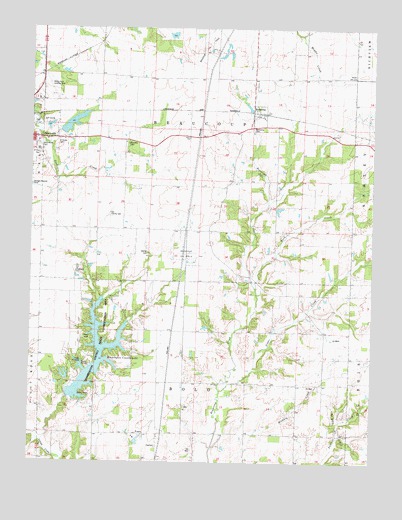
Beaucoup, IL USGS Topographic Map
Click on map above to begin viewing in our Map Viewer.

This topographic map contains these locations and features:
Feature Name Type Latitude Longitude GNIS ID View Map
Back CreekStreamN38.3003°W89.2926°403786View Map
BeaucoupPopulated PlaceN38.3498°W89.2920°404044View Map
Beaucoup CemeteryCemeteryN38.3462°W89.2948°404045View Map
Beaucoup Oil FieldOilfieldN38.3101°W89.3184°424613View Map
Beaucoup Oil FieldOilfieldN38.3684°W89.3106°424614View Map
Becks Farm Landing Strip (historical)AirportN38.3576°W89.3681°1823752View Map
Bethel CemeteryCemeteryN38.3103°W89.3320°404268View Map
Bethel School (historical)SchoolN38.3167°W89.3320°1823753View Map
Bolo School (historical)SchoolN38.2542°W89.3284°1823754View Map
Bolo TownhallBuildingN38.2542°W89.3287°1823755View Map
Greenwood CemeteryCemeteryN38.3409°W89.3726°409454View Map
Hickory Creek School (historical)SchoolN38.2728°W89.2767°1823770View Map
Huegelys LakeReservoirN38.3731°W89.3237°1692003View Map
Huegelys Lake DamDamN38.3717°W89.3251°1692002View Map
Kennedy CemeteryCemeteryN38.3423°W89.3395°411400View Map
Lake View Picnic AreaLocaleN38.2714°W89.3604°1823780View Map
Lazy L Picnic AreaLocaleN38.2826°W89.3534°1823781View Map
Little Bear Camping AreaLocaleN38.2784°W89.3579°1823782View Map
Lookout Point Picnic AreaLocaleN38.2698°W89.3562°1823785View Map
Nashville City ReservoirReservoirN38.3476°W89.3599°1691080View Map
Nashville City Reservoir DamDamN38.3467°W89.3634°1691079View Map
Nashville ReservoirReservoirN38.3469°W89.3684°1691437View Map
Nashville Reservoir DamDamN38.3467°W89.3701°1691436View Map
Nashville Water Treatment PlantLocaleN38.3422°W89.3589°2741005View Map
Nuptial School (historical)SchoolN38.3167°W89.3662°1823791View Map
Oak Hill School (historical)SchoolN38.2806°W89.3190°1823792View Map
Old County CemeteryCemeteryN38.3214°W89.3459°415011View Map
Ponderosa Picnic AreaLocaleN38.2762°W89.3570°1823800View Map
PosenPopulated PlaceN38.2584°W89.3356°423082View Map
Posen Woods Nature PreserveParkN38.2787°W89.3351°1998807View Map
Prairie Hill School (historical)SchoolN38.3614°W89.3456°1823801View Map
Saint Anns Catholic CemeteryCemeteryN38.3425°W89.3651°417161View Map
Saint Paul CemeteryCemeteryN38.3398°W89.3731°1823804View Map
Sugar CreekStreamN38.2706°W89.3048°419272View Map
The Pines Picnic AreaLocaleN38.2676°W89.3565°1823808View Map
Township of BeaucoupCivilN38.3466°W89.3142°428646View Map
Township of BoloCivilN38.2582°W89.3148°428692View Map
Washington County LakeReservoirN38.2777°W89.3503°420556View Map
Washington County Lake DamDamN38.2687°W89.3606°1691081View Map
Washington County State Conservation AreaParkN38.2839°W89.3479°420557View Map
WQHC-FM (Nashville)TowerN38.3439°W89.3498°428256View Map

Note: Coordinates in the location and feature list above are referenced to NAD83 datum.


Copyright (C) 2008-2024 Ryan Niemi / Sunset Dynamics ... All Rights Reserved