TopoQuest Logo
Do you find TopoQuest useful?
Help keep TopoQuest running and adding new maps/features by donating!
Bitcoin:  19c7KJd3qBynnjoSw5npx9KScwjBe4ifkT
Litecoin:  LXs6TkuXGGXo1vDsWCkWVdjQX94eUKd6ui
Home View Maps Find Maps Find Places Resources & Links


Mechanicsburg, Indiana Topographic Map

USGS Map Title: Mechanicsburg, IN
USGS Map MRC: 40086B4
DRG (GeoTIFF) Download: o40086b4.tif


Neighboring USGS Topographic Map Quads:


  Frankfort, IN  
40086C5
 

  Michigantown, IN  
40086C4
 

  Hillisburg, IN  
40086C3
 

  Thorntown, IN  
40086B5
 

  Mechanicsburg, IN  
40086B4
 

  Kirklin, IN  
40086B3
 

  Hazelrigg, IN  
40086A5
 

  Lebanon, IN  
40086A4
 

  Rosston, IN  
40086A3


Map MRC Location:

N41°
W87°
N41°
W86°
H8 H7 H6 H5 H4 H3 H2 H1
G8 G7 G6 G5 G4 G3 G2 G1
F8 F7 F6 F5 F4 F3 F2 F1
E8 E7 E6 E5 E4 E3 E2 E1
D8 D7 D6 D5 D4 D3 D2 D1
C8 C7 C6 C5 C4 C3 C2 C1
B8 B7 B6 B5 B4 B3 B2 B1
A8 A7 A6 A5 A4 A3 A2 A1
N40°
W87°
N40°
W86°

Mechanicsburg, IN USGS 1:24K Topographic Map Preview:
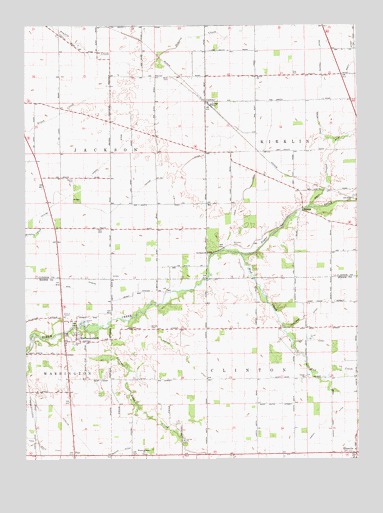
Mechanicsburg, IN USGS Topographic Map
Click on map above to begin viewing in our Map Viewer.

This topographic map contains these locations and features:
Feature Name Type Latitude Longitude GNIS ID View Map
Allen CemeteryCemeteryN40.2350°W86.4456°430086View Map
Barnes DitchCanalN40.1545°W86.4400°430505View Map
Bethel ChurchChurchN40.2353°W86.4133°430935View Map
Browns Wonder CreekStreamN40.1617°W86.4844°431645View Map
Buntin CemeteryCemeteryN40.2057°W86.4809°431818View Map
CyclonePopulated PlaceN40.2284°W86.4325°433268View Map
Davis DitchCanalN40.2006°W86.4181°433354View Map
Davis DitchCanalN40.2256°W86.3894°433355View Map
Dew CemeteryCemeteryN40.2358°W86.3987°433517View Map
ElizavillePopulated PlaceN40.1267°W86.3758°434073View Map
Garrett CemeteryCemeteryN40.1633°W86.4526°434970View Map
Harshman DitchCanalN40.1664°W86.3933°435819View Map
Hopewell South ChurchChurchN40.1264°W86.4561°436469View Map
McIntire CemeteryCemeteryN40.1865°W86.4211°438883View Map
MechanicsburgPopulated PlaceN40.1598°W86.4811°438956View Map
Mud CreekStreamN40.1839°W86.4189°439811View Map
Osborn DitchCanalN40.1356°W86.3872°440713View Map
Ruddell DitchCanalN40.2464°W86.3889°442380View Map
Salem ChurchChurchN40.1481°W86.3944°442917View Map
Scotland ChurchChurchN40.1845°W86.4319°443136View Map
Scott DitchCanalN40.2398°W86.3761°443148View Map
Scott Wincoop DitchCanalN40.2128°W86.3853°443155View Map
Sims Rogers DitchCanalN40.1750°W86.4872°443543View Map
Taylor DitchCanalN40.2006°W86.4597°444594View Map
Titus DitchCanalN40.1592°W86.3925°444788View Map
Township of ClintonCivilN40.1375°W86.4122°453228View Map
Woods DitchCanalN40.2114°W86.4681°446311View Map

Note: Coordinates in the location and feature list above are referenced to NAD83 datum.


Copyright (C) 2008-2024 Ryan Niemi / Sunset Dynamics ... All Rights Reserved