TopoQuest Logo
Do you find TopoQuest useful?
Help keep TopoQuest running and adding new maps/features by donating!
Bitcoin:  19c7KJd3qBynnjoSw5npx9KScwjBe4ifkT
Litecoin:  LXs6TkuXGGXo1vDsWCkWVdjQX94eUKd6ui
Home View Maps Find Maps Find Places Resources & Links


McClellan Mountain, Oregon Topographic Map

USGS Map Title: McClellan Mountain, OR
USGS Map MRC: 44119C2
DRG (GeoTIFF) Download: o44119c2.tif


Neighboring USGS Topographic Map Quads:


  Shop Gulch, OR  
44119D3
 

  Wolfinger Butte, OR  
44119D2
 

  Mount Vernon, OR  
44119D1
 

  Big Weasel Springs, OR  
44119C3
 

  McClellan Mountain, OR  
44119C2
 

  Fall Mountain, OR  
44119C1
 

  Flagtail Mountain, OR  
44119B3
 

  Logdell, OR  
44119B2
 

  Scotty Creek, OR  
44119B1


Map MRC Location:

N45°
W120°
N45°
W119°
H8 H7 H6 H5 H4 H3 H2 H1
G8 G7 G6 G5 G4 G3 G2 G1
F8 F7 F6 F5 F4 F3 F2 F1
E8 E7 E6 E5 E4 E3 E2 E1
D8 D7 D6 D5 D4 D3 D2 D1
C8 C7 C6 C5 C4 C3 C2 C1
B8 B7 B6 B5 B4 B3 B2 B1
A8 A7 A6 A5 A4 A3 A2 A1
N44°
W120°
N44°
W119°

McClellan Mountain, OR USGS 1:24K Topographic Map Preview:
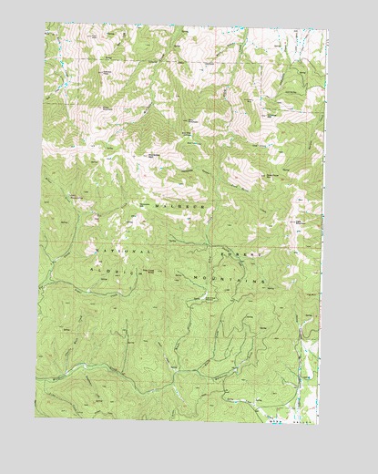
McClellan Mountain, OR USGS Topographic Map
Click on map above to begin viewing in our Map Viewer.

This topographic map contains these locations and features:
Feature Name Type Latitude Longitude GNIS ID View Map
Alkali CreekStreamN44.2649°W119.1880°1137130View Map
Basin CreekStreamN44.2654°W119.1791°1137558View Map
Bear FlatFlatN44.3377°W119.1844°1158120View Map
Bear Flat SpringsSpringN44.3402°W119.1841°1137710View Map
Buck GulchValleyN44.3699°W119.1622°1138788View Map
Charlie Mack CreekStreamN44.2635°W119.2358°1139576View Map
Cinnabar MineMineN44.3518°W119.1578°1139734View Map
Cinnabar MountainSummitN44.3471°W119.1513°1139735View Map
Cold SpringSpringN44.3547°W119.1435°1139937View Map
Dead Horse CreekStreamN44.3271°W119.1713°1154278View Map
Dead Horse MountainSummitN44.3285°W119.1508°1140695View Map
First PeakSummitN44.3707°W119.2291°1142141View Map
Grapefruit CreekStreamN44.2660°W119.2272°1142949View Map
High TrailTrailN44.3577°W119.1841°1143585View Map
Hoppy SpringSpringN44.3197°W119.2370°1143728View Map
Ingle MountainSummitN44.3138°W119.1380°1144093View Map
Ingle RockPillarN44.2913°W119.1319°1144094View Map
Lime CreekStreamN44.2613°W119.2436°1145021View Map
McClellan MountainSummitN44.3335°W119.2030°1145936View Map
Miner CreekStreamN44.3138°W119.2325°1146310View Map
Moon MountainSummitN44.3485°W119.2236°1146423View Map
Packsaddle CanyonValleyN44.3268°W119.1716°1147336View Map
Packsaddle GapGapN44.3182°W119.2066°1147339View Map
Rail CreekStreamN44.3554°W119.2400°1148151View Map
Riley Creek ButteSummitN44.2971°W119.1972°1148452View Map
Riley Creek MeadowFlatN44.2895°W119.1767°1148453View Map
Riley MountainSummitN44.3452°W119.1855°1148454View Map
Second PeakSummitN44.3596°W119.2236°1149208View Map
Spring GulchValleyN44.3665°W119.1636°1152803View Map
Sugar CreekStreamN44.2927°W119.2466°1150530View Map
The HoleBasinN44.3374°W119.1541°1151015View Map
Third CreekStreamN44.3710°W119.2444°1151061View Map
Umatilla CreekStreamN44.3052°W119.1736°1151636View Map
White CreekStreamN44.2654°W119.1863°1152227View Map

Note: Coordinates in the location and feature list above are referenced to NAD83 datum.


Copyright (C) 2008-2024 Ryan Niemi / Sunset Dynamics ... All Rights Reserved