TopoQuest Logo
Do you find TopoQuest useful?
Help keep TopoQuest running and adding new maps/features by donating!
Bitcoin:  19c7KJd3qBynnjoSw5npx9KScwjBe4ifkT
Litecoin:  LXs6TkuXGGXo1vDsWCkWVdjQX94eUKd6ui
Home View Maps Find Maps Find Places Resources & Links


Marthaville, Louisiana Topographic Map

USGS Map Title: Marthaville, LA
USGS Map MRC: 31093F4
DRG (GeoTIFF) Download: o31093f4.tif


Neighboring USGS Topographic Map Quads:


  Pleasant Hill, LA  
31093G5
 

  Hollis Creek, LA  
31093G4
 

  Allen, LA  
31093G3
 

  Belmont, LA  
31093F5
 

  Marthaville, LA  
31093F4
 

  Robeline, LA  
31093F3
 

  Loring, LA  
31093E5
 

  Many, LA  
31093E4
 

  Vowells Mill, LA  
31093E3


Map MRC Location:

N32°
W94°
N32°
W93°
H8 H7 H6 H5 H4 H3 H2 H1
G8 G7 G6 G5 G4 G3 G2 G1
F8 F7 F6 F5 F4 F3 F2 F1
E8 E7 E6 E5 E4 E3 E2 E1
D8 D7 D6 D5 D4 D3 D2 D1
C8 C7 C6 C5 C4 C3 C2 C1
B8 B7 B6 B5 B4 B3 B2 B1
A8 A7 A6 A5 A4 A3 A2 A1
N31°
W94°
N31°
W93°

Marthaville, LA USGS 1:24K Topographic Map Preview:
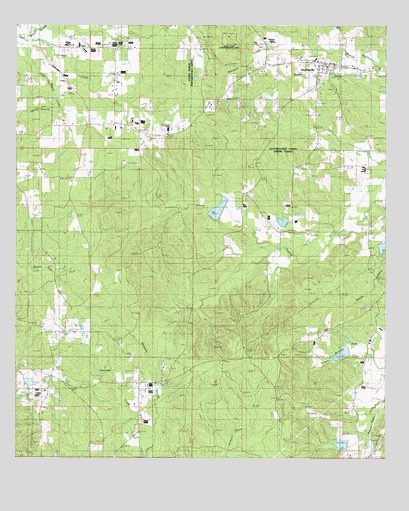
Marthaville, LA USGS Topographic Map
Click on map above to begin viewing in our Map Viewer.

This topographic map contains these locations and features:
Feature Name Type Latitude Longitude GNIS ID View Map
Armstrong School (historical)SchoolN31.6652°W93.4988°549488View Map
Bayou Dupont Number 11 DamDamN31.6285°W93.3885°556764View Map
Bayou Dupont Number 12 DamDamN31.6552°W93.3885°556763View Map
Bayou Dupont Number Four DamDamN31.6935°W93.4085°556735View Map
Bayou Dupont Number Two DamDamN31.6985°W93.4285°556736View Map
Bayou of the Three PrairiesStreamN31.6857°W93.4121°558912View Map
Boleyn ChurchChurchN31.7485°W93.4416°533308View Map
Cedar Grove ChurchChurchN31.6679°W93.3816°533840View Map
Christ ChurchChurchN31.6618°W93.4835°541648View Map
Klondike Oil FieldOilfieldN31.6738°W93.4857°546128View Map
Klondike School (historical)SchoolN31.6257°W93.4666°546129View Map
Lewis ChurchChurchN31.7357°W93.4677°536417View Map
Little Flock ChurchChurchN31.6957°W93.4071°536547View Map
Lone Star ChurchChurchN31.6827°W93.4874°536671View Map
MarthavillePopulated PlaceN31.7388°W93.3966°543447View Map
Marthaville Elementary and Junior High SchoolSchoolN31.7399°W93.3995°549028View Map
Marthaville Post OfficePost OfficeN31.7391°W93.3921°1630945View Map
Mount Freedom ChurchChurchN31.6257°W93.4666°537317View Map
Mount Zion ChurchChurchN31.6493°W93.4891°537441View Map
Natchitoches Parish Fire Protection District 7 Station 2BuildingN31.7386°W93.3926°2672984View Map
Pisgah ChurchChurchN31.7188°W93.4568°538220View Map
Rebel State Historic SiteParkN31.7460°W93.4280°540615View Map
Rock Spring ChurchChurchN31.7007°W93.4224°538661View Map
Rocky Springs School (historical)SchoolN31.6904°W93.4252°546166View Map
Spring BranchStreamN31.7271°W93.4874°539567View Map
Thomas CreekStreamN31.7460°W93.4971°539879View Map
Whitlock CreekStreamN31.7371°W93.4007°540385View Map

Note: Coordinates in the location and feature list above are referenced to NAD83 datum.


Copyright (C) 2008-2024 Ryan Niemi / Sunset Dynamics ... All Rights Reserved