TopoQuest Logo
Do you find TopoQuest useful?
Help keep TopoQuest running and adding new maps/features by donating!
Bitcoin:  19c7KJd3qBynnjoSw5npx9KScwjBe4ifkT
Litecoin:  LXs6TkuXGGXo1vDsWCkWVdjQX94eUKd6ui
Home View Maps Find Maps Find Places Resources & Links


Lucerne, California Topographic Map

USGS Map Title: Lucerne, CA
USGS Map MRC: 39122A7
DRG (GeoTIFF) Download: o39122a7.tif


Neighboring USGS Topographic Map Quads:


  Upper Lake, CA  
39122B8
 

  Bartlett Mountain, CA  
39122B7
 

  Bartlett Springs, CA  
39122B6
 

  Lakeport, CA  
39122A8
 

  Lucerne, CA  
39122A7
 

  Clearlake Oaks, CA  
39122A6
 

  Highland Springs, CA  
38122H8
 

  Kelseyville, CA  
38122H7
 

  Clearlake Highlands, CA  
38122H6


Map MRC Location:

N40°
W123°
N40°
W122°
H8 H7 H6 H5 H4 H3 H2 H1
G8 G7 G6 G5 G4 G3 G2 G1
F8 F7 F6 F5 F4 F3 F2 F1
E8 E7 E6 E5 E4 E3 E2 E1
D8 D7 D6 D5 D4 D3 D2 D1
C8 C7 C6 C5 C4 C3 C2 C1
B8 B7 B6 B5 B4 B3 B2 B1
A8 A7 A6 A5 A4 A3 A2 A1
N39°
W123°
N39°
W122°

Lucerne, CA USGS 1:24K Topographic Map Preview:
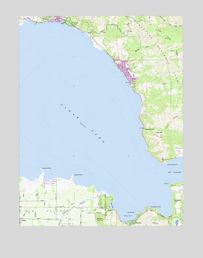
Lucerne, CA USGS Topographic Map
Click on map above to begin viewing in our Map Viewer.

This topographic map contains these locations and features:
Feature Name Type Latitude Longitude GNIS ID View Map
Big Soda SpringSpringN39.0079°W122.7884°257011View Map
Buckingham Golf CourseLocaleN39.0013°W122.7539°1766083View Map
Buckingham ParkPopulated PlaceN39.0155°W122.7580°1658159View Map
Clear LakeReservoirN39.0407°W122.8006°1664234View Map
Clear LakeLakeN39.0616°W122.8272°258441View Map
Clear Lake State ParkParkN39.0093°W122.8117°258443View Map
Clear Lake State Park Visitor CenterBuildingN39.0177°W122.8158°1766091View Map
Cole CreekStreamN39.0177°W122.8153°258583View Map
Cole Creek CampgroundLocaleN39.0143°W122.8139°1766093View Map
Dali-DonaSummitN39.0035°W122.8147°259021View Map
Dorn BayBayN39.0118°W122.8069°259491View Map
Dorn Nature TrailTrailN39.0163°W122.8094°1766095View Map
Ferndale Resort Seaplane BaseAirportN39.0027°W122.7978°1653568View Map
Henderson PointCapeN39.0110°W122.7767°261266View Map
High Valley RidgeRidgeN39.1102°W122.7636°261340View Map
Horseshoe BendBendN39.0049°W122.7642°261522View Map
Indian Nature TrailTrailN39.0110°W122.8128°1766105View Map
Keeling ParkParkN39.1216°W122.8553°1766106View Map
Kelsey CreekStreamN39.0205°W122.8161°262116View Map
Kelsey Creek CampgroundLocaleN39.0182°W122.8080°1766107View Map
Kelsey Creek School (historical)SchoolN39.0038°W122.8475°1666658View Map
Kelseyville Fire StationBuildingN39.0088°W122.7767°2622150View Map
Kono Tayee PointCapeN39.0368°W122.7647°262237View Map
KXBX-FM (Lakeport)TowerN39.0482°W122.7675°1662916View Map
Lake CountyCivilN39.0996°W122.7532°277281View Map
Lake County Sheriff's Office Lucerne SubstationBuildingN39.0913°W122.7961°2751089View Map
Lake View CampgroundLocaleN39.1027°W122.7580°277155View Map
Lakeside ParkParkN39.0257°W122.8503°262300View Map
Laurel BeachBeachN39.1218°W122.8528°262350View Map
Little Borax LakeLakeN39.0020°W122.7559°262549View Map
Long Tule PointCapeN39.0338°W122.8592°262882View Map
Lower Bayview CampgroundLocaleN39.0157°W122.8053°1766123View Map
LucernePopulated PlaceN39.0902°W122.7964°277551View Map
Lucerne Census Designated PlaceCensusN39.0697°W122.7760°2408150View Map
Lucerne Christian Conference CenterLocaleN39.0893°W122.7889°1766131View Map
Lucerne Elementary SchoolSchoolN39.0840°W122.7897°1766132View Map
Lucerne Post OfficePost OfficeN39.0937°W122.7991°1766133View Map
McGaugh SloughStreamN39.0268°W122.8639°263349View Map
Morrison CreekStreamN39.0957°W122.8042°263845View Map
NicePopulated PlaceN39.1232°W122.8483°1659227View Map
Nice Post OfficePost OfficeN39.1208°W122.8367°1766139View Map
Northshore Fire Protection District Station 80 Lucerne HeadquartersBuildingN39.0914°W122.7956°2621865View Map
Northshore Fire Protection District Station 85 NiceBuildingN39.1232°W122.8425°2621797View Map
Old Kelsey CreekStreamN39.0193°W122.8044°1766141View Map
Paradise ValleyBasinN39.0455°W122.7550°264513View Map
Pepperwood GrovePopulated PlaceN39.0579°W122.7814°1659371View Map
Pierce CanyonValleyN39.0485°W122.7578°264709View Map
Pine MountainSummitN39.0530°W122.7694°264768View Map
Queen of the Rosary Catholic ChurchChurchN39.0904°W122.7919°1766143View Map
Quercus PointCapeN39.0302°W122.8355°265109View Map
Quercus RanchLocaleN39.0130°W122.8361°1666662View Map
Shag RockIslandN39.0252°W122.7622°266029View Map
Shirley SloughGutN39.0252°W122.8569°277156View Map
Soda BayPopulated PlaceN39.0010°W122.7892°1659810View Map
Soda BayBayN39.0055°W122.7928°267358View Map
Soda Bay Census Designated PlaceCensusN39.0024°W122.7795°2583147View Map
Sonrise Assembly Charismatic ChurchChurchN39.0977°W122.7964°1766152View Map
The NarrowsChannelN39.0302°W122.7575°268200View Map
Upper Bayview CampgroundLocaleN39.0124°W122.8100°1766154View Map

Note: Coordinates in the location and feature list above are referenced to NAD83 datum.


Copyright (C) 2008-2024 Ryan Niemi / Sunset Dynamics ... All Rights Reserved