TopoQuest Logo
Do you find TopoQuest useful?
Help keep TopoQuest running and adding new maps/features by donating!
Bitcoin:  19c7KJd3qBynnjoSw5npx9KScwjBe4ifkT
Litecoin:  LXs6TkuXGGXo1vDsWCkWVdjQX94eUKd6ui
Home View Maps Find Maps Find Places Resources & Links


Laona, Wisconsin Topographic Map

USGS Map Title: Laona, WI
USGS Map MRC: 45088E6
DRG (GeoTIFF) Download: o45088e6.tif


Neighboring USGS Topographic Map Quads:


  Crandon NE, WI  
45088F7
 

  Newald, WI  
45088F6
 

  Lake Gordon, WI  
45088F5
 

  Lake Lucerne, WI  
45088E7
 

  Laona, WI  
45088E6
 

  Blackwell, WI  
45088E5
 

  Roberts Lake, WI  
45088D7
 

  Wabeno, WI  
45088D6
 

  Otter Lake, WI  
45088D5


Map MRC Location:

N46°
W89°
N46°
W88°
H8 H7 H6 H5 H4 H3 H2 H1
G8 G7 G6 G5 G4 G3 G2 G1
F8 F7 F6 F5 F4 F3 F2 F1
E8 E7 E6 E5 E4 E3 E2 E1
D8 D7 D6 D5 D4 D3 D2 D1
C8 C7 C6 C5 C4 C3 C2 C1
B8 B7 B6 B5 B4 B3 B2 B1
A8 A7 A6 A5 A4 A3 A2 A1
N45°
W89°
N45°
W88°

Laona, WI USGS 1:24K Topographic Map Preview:
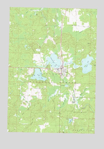
Laona, WI USGS Topographic Map
Click on map above to begin viewing in our Map Viewer.

This topographic map contains these locations and features:
Feature Name Type Latitude Longitude GNIS ID View Map
Birch LakeLakeN45.5691°W88.6380°1578792View Map
Blackwell JunctionPopulated PlaceN45.5316°W88.6543°1578809View Map
Bobs CreekStreamN45.6219°W88.7109°1578822View Map
Bobs LakeLakeN45.6178°W88.7139°1578823View Map
Camp Twenty CreekStreamN45.5372°W88.6557°1578940View Map
Connor Forest Industries 1897C211 DamDamN45.5666°W88.6784°1792763View Map
Flanners CreekStreamN45.6230°W88.7040°1579257View Map
Heritage Acres AirportAirportN45.5750°W88.7084°1582051View Map
Honey CreekStreamN45.5622°W88.7323°1579475View Map
Kazmier LakeLakeN45.5126°W88.6598°1579568View Map
Kokots CreekStreamN45.5333°W88.6523°1579603View Map
LaonaPopulated PlaceN45.5647°W88.6740°1579628View Map
Laona CemeteryCemeteryN45.5758°W88.6773°1579629View Map
Laona Census Designated PlaceCensusN45.5597°W88.6697°2586522View Map
Laona District Ranger StationBuildingN45.5602°W88.6787°1580864View Map
Laona Fire DepartmentBuildingN45.5637°W88.6745°2696885View Map
Laona High SchoolSchoolN45.5610°W88.6686°2713403View Map
Laona Lookout TowerTowerN45.5902°W88.6379°1581258View Map
Laona Police DepartmentBuildingN45.5591°W88.6737°2759969View Map
Laona Rescue SquadBuildingN45.5639°W88.6745°2698440View Map
Little Birch LakeLakeN45.5710°W88.6598°1579668View Map
Robinson Elementary SchoolSchoolN45.5620°W88.6688°2713404View Map
Scattered Rice LakeLakeN45.5686°W88.6853°1580357View Map
Scattered Rice Lake 38ReservoirN45.5666°W88.6784°1792764View Map
Silver LakeLakeN45.5571°W88.7072°1580410View Map
Silver Lake Golf CourseLocaleN45.5625°W88.7001°1837807View Map
Spring PondLakeN45.5260°W88.6977°1580866View Map
Swan CreekStreamN45.5044°W88.6268°1580565View Map
Swanson CreekStreamN45.5489°W88.6662°1580566View Map
Town of LaonaCivilN45.5633°W88.6997°1583528View Map
Town of Laona Beach and Public Picnic AreaLocaleN45.5594°W88.7015°1580865View Map

Note: Coordinates in the location and feature list above are referenced to NAD83 datum.


Copyright (C) 2008-2024 Ryan Niemi / Sunset Dynamics ... All Rights Reserved