TopoQuest Logo
Do you find TopoQuest useful?
Help keep TopoQuest running and adding new maps/features by donating!
Bitcoin:  19c7KJd3qBynnjoSw5npx9KScwjBe4ifkT
Litecoin:  LXs6TkuXGGXo1vDsWCkWVdjQX94eUKd6ui
Home View Maps Find Maps Find Places Resources & Links


Lady Bird Johnson Park, Texas Topographic Map

USGS Map Title: Lady Bird Johnson Park, TX
USGS Map MRC: 30098B8
DRG (GeoTIFF) Download: o30098b8.tif


Neighboring USGS Topographic Map Quads:


  Roundhead, TX  
30099C1
 

  Fredericksburg West, TX  
30098C8
 

  Fredericksburg East, TX  
30098C7
 

  Morris Ranch, TX  
30099B1
 

  Lady Bird Johnson Park, TX  
30098B8
 

  Cain City, TX  
30098B7
 

  Legion, TX  
30099A1
 

  Cypress Creek, TX  
30098A8
 

  Rafter Hollow, TX  
30098A7


Map MRC Location:

N31°
W99°
N31°
W98°
H8 H7 H6 H5 H4 H3 H2 H1
G8 G7 G6 G5 G4 G3 G2 G1
F8 F7 F6 F5 F4 F3 F2 F1
E8 E7 E6 E5 E4 E3 E2 E1
D8 D7 D6 D5 D4 D3 D2 D1
C8 C7 C6 C5 C4 C3 C2 C1
B8 B7 B6 B5 B4 B3 B2 B1
A8 A7 A6 A5 A4 A3 A2 A1
N30°
W99°
N30°
W98°

Lady Bird Johnson Park, TX USGS 1:24K Topographic Map Preview:
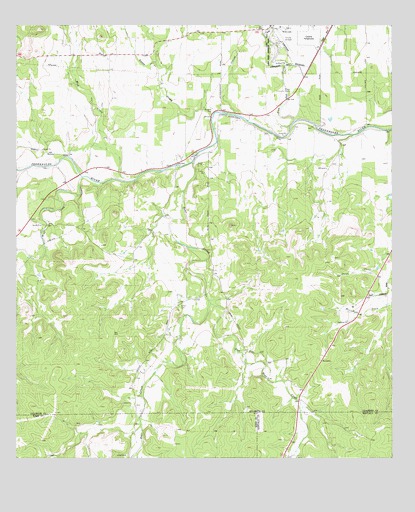
Lady Bird Johnson Park, TX USGS Topographic Map
Click on map above to begin viewing in our Map Viewer.

This topographic map contains these locations and features:
Feature Name Type Latitude Longitude GNIS ID View Map
Bear CreekStreamN30.2105°W98.9412°1377766View Map
Cameron Ranch AirportAirportN30.1871°W98.9584°2675974View Map
Eckert CemeteryCemeteryN30.1688°W98.9456°1377767View Map
Gillespie County AirportAirportN30.2448°W98.9087°1386687View Map
Lady Bird Johnson Municipal ParkParkN30.2410°W98.9162°2029072View Map
Lady Bird Johnson Park DamDamN30.2385°W98.9120°1859275View Map
Lady Bird Johnson Park ReservoirReservoirN30.2385°W98.9120°1859276View Map
Lady Bird Johnson Park TrailTrailN30.2388°W98.9117°2033479View Map
Left Bear CreekStreamN30.1697°W98.9353°1377776View Map
Live Oak CreekStreamN30.2227°W98.9070°1377768View Map
Meusebach CreekStreamN30.1702°W98.8750°1377777View Map
Mud CreekStreamN30.2060°W98.9600°1377769View Map
Nasse CreekStreamN30.2233°W98.9353°1377765View Map
Oak Crest ParkParkN30.2430°W98.9156°1377770View Map
Stink CreekStreamN30.2474°W98.9178°1377772View Map
Wolf CreekStreamN30.2060°W98.9784°1377773View Map
Wrede Community HouseLocaleN30.2308°W98.9089°1377774View Map

Note: Coordinates in the location and feature list above are referenced to NAD83 datum.


Copyright (C) 2008-2024 Ryan Niemi / Sunset Dynamics ... All Rights Reserved