TopoQuest Logo
Do you find TopoQuest useful?
Help keep TopoQuest running and adding new maps/features by donating!
Bitcoin:  19c7KJd3qBynnjoSw5npx9KScwjBe4ifkT
Litecoin:  LXs6TkuXGGXo1vDsWCkWVdjQX94eUKd6ui
Home View Maps Find Maps Find Places Resources & Links


Kennett South, Missouri Topographic Map

USGS Map Title: Kennett South, MO
USGS Map MRC: 36090B1
DRG (GeoTIFF) Download: o36090b1.tif


Neighboring USGS Topographic Map Quads:


  Greenway, AR  
36090C2
 

  Kennett North, MO  
36090C1
 

  Bragg City, MO  
36089C8
 

  Senath, MO  
36090B2
 

  Kennett South, MO  
36090B1
 

  Deering, MO  
36089B8
 

  Arbyrd, MO  
36090A2
 

  Hornersville, MO  
36090A1
 

  Denton, MO  
36089A8


Map MRC Location:

N37°
W91°
N37°
W90°
H8 H7 H6 H5 H4 H3 H2 H1
G8 G7 G6 G5 G4 G3 G2 G1
F8 F7 F6 F5 F4 F3 F2 F1
E8 E7 E6 E5 E4 E3 E2 E1
D8 D7 D6 D5 D4 D3 D2 D1
C8 C7 C6 C5 C4 C3 C2 C1
B8 B7 B6 B5 B4 B3 B2 B1
A8 A7 A6 A5 A4 A3 A2 A1
N36°
W91°
N36°
W90°

Kennett South, MO USGS 1:24K Topographic Map Preview:
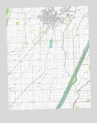
Kennett South, MO USGS Topographic Map
Click on map above to begin viewing in our Map Viewer.

This topographic map contains these locations and features:
Feature Name Type Latitude Longitude GNIS ID View Map
Baker Landing Strip (historical)AirportN36.1526°W90.0781°743104View Map
Bark Camp ChurchChurchN36.2478°W90.0870°713641View Map
Bark Camp SchoolSchoolN36.2431°W90.0965°713642View Map
Bootheel Landing Strip (historical)AirportN36.1581°W90.0770°743105View Map
Bowie CornerPopulated PlaceN36.1326°W90.0048°714576View Map
CaruthPopulated PlaceN36.1342°W90.0868°715459View Map
City of KennettCivilN36.2403°W90.0481°2395508View Map
Coker Lodge (historical)LocaleN36.1634°W90.0373°730072View Map
Cooks FarmLocaleN36.1865°W90.1145°716228View Map
Deer LandPopulated PlaceN36.1615°W90.0043°716807View Map
DillmanPopulated PlaceN36.1848°W90.1048°716901View Map
Ditch Number 19CanalN36.2148°W90.0381°755069View Map
Ditch Number 259CanalN36.1301°W90.0454°755089View Map
Ditch Number 27CanalN36.1412°W90.0626°755090View Map
Ditch Number 3CanalN36.2490°W90.0982°755096View Map
Ditch Number 36CanalN36.1987°W90.0245°755105View Map
Ditch Number 4CanalN36.2134°W90.1170°755109View Map
Ditch Number 66CanalN36.1878°W90.0076°755137View Map
Ditch Number 79CanalN36.1581°W90.0154°755154View Map
Ditch Number 81CanalN36.1828°W90.0159°755159View Map
Dunklin County Cut-offCanalN36.2439°W90.1072°717190View Map
Dunklin County Sheriff's OfficeBuildingN36.2491°W90.0444°2752225View Map
Hawkins LodgeLocaleN36.2281°W90.1232°719240View Map
Hemphill ChurchChurchN36.2162°W90.0148°719365View Map
Hemphill School (historical)SchoolN36.2145°W90.0201°746694View Map
Hickory Lodge (historical)LocaleN36.1309°W90.0348°719486View Map
Horse IslandIslandN36.1960°W90.1001°719854View Map
Johnson ChapelChurchN36.1687°W90.1220°720365View Map
Johnson IslandIslandN36.1975°W90.0493°720374View Map
Johnson Island ChurchChurchN36.1887°W90.0515°720376View Map
Johnson Island School (historical)SchoolN36.1878°W90.0515°746696View Map
KBOA-AM (Kennett)TowerN36.2248°W90.0754°759179View Map
KennettPopulated PlaceN36.2362°W90.0556°731596View Map
Kennett Lodge (historical)LocaleN36.2356°W90.0887°746688View Map
Kennett Memorial AirportAirportN36.2311°W90.0352°758760View Map
Kennett Police DepartmentBuildingN36.2381°W90.0552°2752331View Map
Kennett Post OfficePost OfficeN36.2374°W90.0571°2779528View Map
Kennett Volunteer Fire Department Station 1BuildingN36.2363°W90.0598°2621129View Map
Kennett Volunteer Fire Department Station 2BuildingN36.2362°W90.0359°2621660View Map
Kennett Volunteer Fire Department Station 3BuildingN36.2368°W90.0725°2621519View Map
KTMO-FM (Kennett)TowerN36.2248°W90.0754°759104View Map
Lateral Number 1CanalN36.1859°W90.0287°755260View Map
Lateral Number 2CanalN36.2115°W90.0309°755270View Map
Lateral Number 3CanalN36.2223°W90.0109°755276View Map
Lateral Number 4CanalN36.2412°W90.0112°755279View Map
Liberty CemeteryCemeteryN36.1406°W90.0770°720956View Map
Liberty Church (historical)ChurchN36.1409°W90.0790°746693View Map
Main Ditch Number 10CanalN36.2228°W90.0962°755298View Map
Marsh CemeteryCemeteryN36.2184°W90.0709°721899View Map
Oak Ridge CemeteryCemeteryN36.2490°W90.0572°723634View Map
OctaPopulated PlaceN36.1712°W90.1232°723693View Map
Providence ChurchChurchN36.2151°W90.1107°730183View Map
Ragland DitchCanalN36.1562°W90.1134°725063View Map
Ragland SloughStreamN36.1378°W90.1137°731637View Map
Rogers CemeteryCemeteryN36.1626°W90.0720°725532View Map
Sand RidgeRidgeN36.2070°W90.0690°726016View Map
ScobevillePopulated PlaceN36.1853°W90.0745°730208View Map
Shady Grove ChurchChurchN36.1723°W90.0765°726239View Map
Shady Grove SchoolSchoolN36.1723°W90.0765°2120835View Map
Snipe SloughStreamN36.2231°W90.0740°726666View Map
Swan HoleLakeN36.2141°W90.0957°739539View Map
Tatom Chapel (historical)ChurchN36.1859°W90.0957°746691View Map
Tatom Chapel School (historical)SchoolN36.1859°W90.0968°730276View Map
Thomas School (historical)SchoolN36.2076°W90.0740°746695View Map
Township of IndependenceCivilN36.2363°W90.0384°766640View Map
Twin Rivers Regional Medical CenterHospitalN36.2354°W90.0412°2655022View Map
Twin Rivers Regional Medical Center HeliportAirportN36.2359°W90.0409°758761View Map
Two Mile Church (historical)ChurchN36.2137°W90.1109°746690View Map
Two Mile SchoolSchoolN36.2148°W90.1243°746689View Map
Tywhappity SchoolSchoolN36.1570°W90.0565°727947View Map
Varney River CanalCanalN36.1967°W90.1134°728148View Map
VincitPopulated PlaceN36.1659°W90.0693°741340View Map
WilliamsCemeteryN36.1901°W90.0684°728877View Map

Note: Coordinates in the location and feature list above are referenced to NAD83 datum.


Copyright (C) 2008-2024 Ryan Niemi / Sunset Dynamics ... All Rights Reserved