TopoQuest Logo
Do you find TopoQuest useful?
Help keep TopoQuest running and adding new maps/features by donating!
Bitcoin:  19c7KJd3qBynnjoSw5npx9KScwjBe4ifkT
Litecoin:  LXs6TkuXGGXo1vDsWCkWVdjQX94eUKd6ui
Home View Maps Find Maps Find Places Resources & Links


Kenelty Mountain, Montana Topographic Map

USGS Map Title: Kenelty Mountain, MT
USGS Map MRC: 48115A3
DRG (GeoTIFF) Download: o48115a3.tif


Neighboring USGS Topographic Map Quads:


  Horse Mountain, MT  
48115B4
 

  Fisher Mountain, MT  
48115B3
 

  Calx Mountain, MT  
48115B2
 

  Barren Peak, MT  
48115A4
 

  Kenelty Mountain, MT  
48115A3
 

  Loon Lake, MT  
48115A2
 

  Silver Butte Pass, MT  
47115H4
 

  Miller Lake, MT  
47115H3
 

  Mantrap Fork, MT  
47115H2


Map MRC Location:

N49°
W116°
N49°
W115°
H8 H7 H6 H5 H4 H3 H2 H1
G8 G7 G6 G5 G4 G3 G2 G1
F8 F7 F6 F5 F4 F3 F2 F1
E8 E7 E6 E5 E4 E3 E2 E1
D8 D7 D6 D5 D4 D3 D2 D1
C8 C7 C6 C5 C4 C3 C2 C1
B8 B7 B6 B5 B4 B3 B2 B1
A8 A7 A6 A5 A4 A3 A2 A1
N48°
W116°
N48°
W115°

Kenelty Mountain, MT USGS 1:24K Topographic Map Preview:
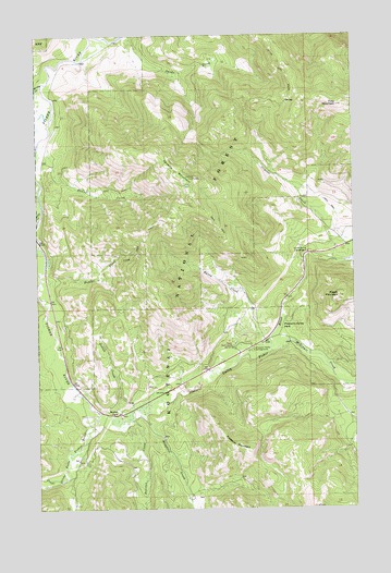
Kenelty Mountain, MT USGS Topographic Map
Click on map above to begin viewing in our Map Viewer.

This topographic map contains these locations and features:
Feature Name Type Latitude Longitude GNIS ID View Map
Crystal CreekStreamN48.0652°W115.2593°781951View Map
Fisher River Valley Fire and Rescue Battalion 2BuildingN48.0356°W115.3109°2546750View Map
Fosseum MountainSummitN48.0152°W115.2935°783624View Map
Fritz MountainSummitN48.1063°W115.2566°783759View Map
Houghton CreekStreamN48.0266°W115.3377°785091View Map
Hunter CreekStreamN48.0599°W115.3713°785168View Map
Kenelty MountainSummitN48.0872°W115.3132°785673View Map
Lyons Spring CampgroundLocaleN48.0677°W115.2688°786749View Map
Manicke (historical)Populated PlaceN48.0416°W115.2982°1782430View Map
Manicke Post Office (historical)Post OfficeN48.0416°W115.2982°1782319View Map
McGinnis CreekStreamN48.0416°W115.2838°787055View Map
Miller CreekStreamN48.0788°W115.3738°787409View Map
Pleasant Valley CampgroundLocaleN48.0419°W115.2913°788991View Map
Pleasant Valley Fisher RiverStreamN48.0258°W115.3524°788994View Map
Pleasant Valley ParkFlatN48.0461°W115.2785°788996View Map
Raritan CreekStreamN48.0241°W115.3399°789387View Map
Raven CreekStreamN48.0416°W115.2838°789412View Map
Raven Ranger StationLocaleN48.0427°W115.2991°789414View Map
Raven Work CenterLocaleN48.0341°W115.2982°1782405View Map
Schrieber CreekStreamN48.1008°W115.3724°790134View Map
Sedlak CreekStreamN48.0249°W115.3404°790191View Map
Sedlak ParkFlatN48.0258°W115.3449°790192View Map
Silver Butte Fisher RiverStreamN48.0258°W115.3527°790503View Map
Spring CreekStreamN48.1119°W115.3732°791269View Map
Wapiti MountainSummitN48.0558°W115.2571°792802View Map

Note: Coordinates in the location and feature list above are referenced to NAD83 datum.


Copyright (C) 2008-2024 Ryan Niemi / Sunset Dynamics ... All Rights Reserved