TopoQuest Logo
Do you find TopoQuest useful?
Help keep TopoQuest running and adding new maps/features by donating!
Bitcoin:  19c7KJd3qBynnjoSw5npx9KScwjBe4ifkT
Litecoin:  LXs6TkuXGGXo1vDsWCkWVdjQX94eUKd6ui
Home View Maps Find Maps Find Places Resources & Links


Kelly Mountain, Idaho Topographic Map

USGS Map Title: Kelly Mountain, ID
USGS Map MRC: 45116D1
DRG (GeoTIFF) Download: o45116d1.tif


Neighboring USGS Topographic Map Quads:


  John Day Mountain, ID  
45116E2
 

  Florence, ID  
45116E1
 

  Hanover Mountain, ID  
45115E8
 

  Riggins Hot Springs, ID  
45116D2
 

  Kelly Mountain, ID  
45116D1
 

  Carey Dome, ID  
45115D8
 

  Patrick Butte, ID  
45116C2
 

  Hershey Point, ID  
45116C1
 

  Burgdorf, ID  
45115C8


Map MRC Location:

N46°
W117°
N46°
W116°
H8 H7 H6 H5 H4 H3 H2 H1
G8 G7 G6 G5 G4 G3 G2 G1
F8 F7 F6 F5 F4 F3 F2 F1
E8 E7 E6 E5 E4 E3 E2 E1
D8 D7 D6 D5 D4 D3 D2 D1
C8 C7 C6 C5 C4 C3 C2 C1
B8 B7 B6 B5 B4 B3 B2 B1
A8 A7 A6 A5 A4 A3 A2 A1
N45°
W117°
N45°
W116°

Kelly Mountain, ID USGS 1:24K Topographic Map Preview:
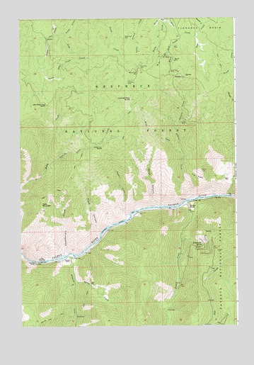
Kelly Mountain, ID USGS Topographic Map
Click on map above to begin viewing in our Map Viewer.

This topographic map contains these locations and features:
Feature Name Type Latitude Longitude GNIS ID View Map
Banner MineMineN45.4827°W116.0351°376933View Map
Black Bear MineMineN45.4924°W116.0640°377719View Map
Broken Leg TrailTrailN45.3785°W116.1051°378246View Map
Burn CreekStreamN45.4999°W116.1046°378524View Map
Chamberlain GulchValleyN45.4041°W116.1004°379163View Map
Chessler CreekStreamN45.4546°W116.0349°379244View Map
Coffee Can SaddleGapN45.4474°W116.0774°379490View Map
Cow FlatsFlatN45.4355°W116.0229°379967View Map
Elkhorn CreekStreamN45.4038°W116.0951°381413View Map
Flock CanyonValleyN45.4107°W116.0801°381868View Map
French CreekStreamN45.4249°W116.0307°382063View Map
French CreekPopulated PlaceN45.4232°W116.0274°396516View Map
French Creek Post Office (historical)Post OfficeN45.4232°W116.0274°2027025View Map
Gasper CreekStreamN45.4205°W116.0621°382213View Map
Gold Bug MineMineN45.4782°W116.0382°382351View Map
Gold CreekStreamN45.4938°W116.1043°382358View Map
Greek CreekStreamN45.4932°W116.0985°382618View Map
Healy CreekStreamN45.4991°W116.0399°383023View Map
Hi Yu CreekStreamN45.4860°W116.0385°383131View Map
Hi Yu MineMineN45.4843°W116.0401°383132View Map
Howard RanchLocaleN45.4021°W116.0968°383475View Map
Kelly MountainSummitN45.4263°W116.1124°396734View Map
Little Slate Creek SaddleGapN45.4649°W116.1096°384954View Map
Lone Pine MineMineN45.4807°W116.0551°386005View Map
Looking Glass ButteSummitN45.4671°W116.0607°386101View Map
Looking Glass CreekStreamN45.4413°W116.1079°386102View Map
Manning BridgeBridgeN45.4016°W116.1168°386433View Map
Mother Lode MineMineN45.4780°W116.0568°387275View Map
Poorman MineMineN45.4746°W116.0615°374496View Map
Rattlesnake SpringSpringN45.4075°W116.0202°389165View Map
Robbins CreekStreamN45.4266°W116.0265°389434View Map
Scott PlaceLocaleN45.4346°W116.0071°397138View Map
SeaburgPopulated PlaceN45.4760°W116.0310°390064View Map
Smith CanyonValleyN45.4235°W116.0460°390657View Map
Spring CreekStreamN45.3924°W116.0935°391177View Map
Summit CreekStreamN45.4974°W116.0176°391621View Map
The CreviceLocaleN45.4021°W116.1110°391959View Map
US MineMineN45.4885°W116.0357°392592View Map
West Fork Robbins CreekStreamN45.4424°W116.0315°393181View Map
White Sand CreekStreamN45.4932°W116.0226°393369View Map
Yakima MineMineN45.4577°W116.0290°393731View Map

Note: Coordinates in the location and feature list above are referenced to NAD83 datum.


Copyright (C) 2008-2024 Ryan Niemi / Sunset Dynamics ... All Rights Reserved