TopoQuest Logo
Do you find TopoQuest useful?
Help keep TopoQuest running and adding new maps/features by donating!
Bitcoin:  19c7KJd3qBynnjoSw5npx9KScwjBe4ifkT
Litecoin:  LXs6TkuXGGXo1vDsWCkWVdjQX94eUKd6ui
Home View Maps Find Maps Find Places Resources & Links


Bandera, Washington Topographic Map

USGS Map Title: Bandera, WA
USGS Map MRC: 47121D5
DRG (GeoTIFF) Download: o47121d5.tif


Neighboring USGS Topographic Map Quads:


  Mount Si, WA  
47121E6
 

  Lake Philippa, WA  
47121E5
 

  Snoqualmie Lake, WA  
47121E4
 

  Chester Morse Lake, WA  
47121D6
 

  Bandera, WA  
47121D5
 

  Snoqualmie Pass, WA  
47121D4
 

  Cougar Mountain, WA  
47121C6
 

  Findley Lake, WA  
47121C5
 

  Lost Lake, WA  
47121C4


Map MRC Location:

N48°
W122°
N48°
W121°
H8 H7 H6 H5 H4 H3 H2 H1
G8 G7 G6 G5 G4 G3 G2 G1
F8 F7 F6 F5 F4 F3 F2 F1
E8 E7 E6 E5 E4 E3 E2 E1
D8 D7 D6 D5 D4 D3 D2 D1
C8 C7 C6 C5 C4 C3 C2 C1
B8 B7 B6 B5 B4 B3 B2 B1
A8 A7 A6 A5 A4 A3 A2 A1
N47°
W122°
N47°
W121°

Bandera, WA USGS 1:24K Topographic Map Preview:
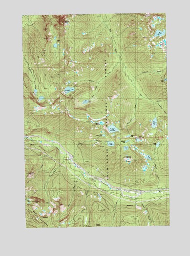
Bandera, WA USGS Topographic Map
Click on map above to begin viewing in our Map Viewer.

This topographic map contains these locations and features:
Feature Name Type Latitude Longitude GNIS ID View Map
Alice CreekStreamN47.4187°W121.5909°1515802View Map
Alice LakesLakeN47.3904°W121.6237°1515804View Map
BanderaPopulated PlaceN47.3868°W121.5337°1516115View Map
Bandera MountainSummitN47.4151°W121.5382°1516116View Map
Bandera State AirportAirportN47.3957°W121.5368°1533673View Map
Blazer LakeLakeN47.4279°W121.5358°1516648View Map
Camp JoyLocaleN47.3934°W121.5337°1517291View Map
Carter CreekStreamN47.3937°W121.5412°1517431View Map
GarciaPopulated PlaceN47.4237°W121.6223°1519890View Map
Gifford LakesLakeN47.4828°W121.5978°1519951View Map
Granite LakesLakeN47.4532°W121.6151°1520224View Map
Hansen CreekStreamN47.3912°W121.5307°1520516View Map
Harris CreekStreamN47.4040°W121.5715°1520566View Map
Hatchet LakeLakeN47.4959°W121.5050°1520600View Map
Ira Spring TrailTrailN47.4234°W121.5659°2742050View Map
Island LakeLakeN47.4208°W121.5379°1521264View Map
Island LakesLakeN47.4249°W121.5369°1530506View Map
Kaleetan CreekStreamN47.4607°W121.5320°1521551View Map
Kulla Kulla CreekStreamN47.4512°W121.5254°1521782View Map
Lake CarolineLakeN47.4878°W121.5069°1517413View Map
Lake Kulla KullaLakeN47.4323°W121.5496°1521783View Map
Little Kulla LakeLakeN47.4287°W121.5486°1530504View Map
Little Mason LakeLakeN47.4286°W121.5574°1522261View Map
Little Pratt LakeLakeN47.4320°W121.5012°1530505View Map
Mason CreekStreamN47.4168°W121.5873°1522792View Map
Mason LakeLakeN47.4237°W121.5512°1522794View Map
McClellan ButteSummitN47.4068°W121.6223°1522865View Map
Mount DefianceSummitN47.4348°W121.5648°1518660View Map
Mount Defiance TrailTrailN47.4301°W121.5551°1523423View Map
Mount KentSummitN47.3901°W121.6176°1521623View Map
Mount RooseveltSummitN47.4807°W121.5037°1525203View Map
Mount Roosevelt LakeLakeN47.4907°W121.5230°1530507View Map
North Bend Ranger DistrictForestN47.4582°W121.5018°1530060View Map
Olallie LakeLakeN47.4226°W121.5104°1523990View Map
Pratt LakeLakeN47.4353°W121.5131°1524623View Map
Pratt Lake TrailTrailN47.4337°W121.5095°1524624View Map
Pratt MountainSummitN47.4265°W121.5259°1524625View Map
Preacher MountainSummitN47.4987°W121.5190°1524627View Map
Rainbow LakeLakeN47.4249°W121.5369°1524822View Map
Rock CreekStreamN47.4093°W121.5784°1525116View Map
Russian ButteSummitN47.4954°W121.5898°1525296View Map
Snoqualmie National Forest Division (historical)CensusN47.4354°W121.5132°1939630View Map
Spider CreekStreamN47.4593°W121.5609°1526358View Map
Spider LakeLakeN47.4483°W121.5729°1526362View Map
Talapus CreekStreamN47.3937°W121.5143°1526907View Map
Talapus LakeLakeN47.4152°W121.5186°1526908View Map
Thompson CreekStreamN47.4712°W121.5418°1527104View Map
Thompson LakeLakeN47.4556°W121.5863°1527110View Map
Tuscohatchie CreekStreamN47.4471°W121.5129°1527489View Map
Windy LakeLakeN47.4603°W121.5027°1528227View Map
Wood CreekStreamN47.4232°W121.6070°1528290View Map

Note: Coordinates in the location and feature list above are referenced to NAD83 datum.


Copyright (C) 2008-2024 Ryan Niemi / Sunset Dynamics ... All Rights Reserved