TopoQuest Logo
Do you find TopoQuest useful?
Help keep TopoQuest running and adding new maps/features by donating!
Bitcoin:  19c7KJd3qBynnjoSw5npx9KScwjBe4ifkT
Litecoin:  LXs6TkuXGGXo1vDsWCkWVdjQX94eUKd6ui
Home View Maps Find Maps Find Places Resources & Links


Kane Canyon, Utah Topographic Map

USGS Map Title: Kane Canyon, UT
USGS Map MRC: 38112B5
DRG (GeoTIFF) Download: o38112b5.tif


Neighboring USGS Topographic Map Quads:


  Beaver, UT  
38112C6
 

  Black Ridge, UT  
38112C5
 

  Shelly Baldy Peak, UT  
38112C4
 

  Greenville Bench, UT  
38112B6
 

  Kane Canyon, UT  
38112B5
 

  Circleville Mountain, UT  
38112B4
 

  Buckhorn Flat, UT  
38112A6
 

  Burnt Peak, UT  
38112A5
 

  Fremont Pass, UT  
38112A4


Map MRC Location:

N39°
W113°
N39°
W112°
H8 H7 H6 H5 H4 H3 H2 H1
G8 G7 G6 G5 G4 G3 G2 G1
F8 F7 F6 F5 F4 F3 F2 F1
E8 E7 E6 E5 E4 E3 E2 E1
D8 D7 D6 D5 D4 D3 D2 D1
C8 C7 C6 C5 C4 C3 C2 C1
B8 B7 B6 B5 B4 B3 B2 B1
A8 A7 A6 A5 A4 A3 A2 A1
N38°
W113°
N38°
W112°

Kane Canyon, UT USGS 1:24K Topographic Map Preview:
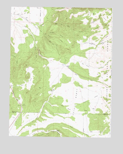
Kane Canyon, UT USGS Topographic Map
Click on map above to begin viewing in our Map Viewer.

This topographic map contains these locations and features:
Feature Name Type Latitude Longitude GNIS ID View Map
Beaver RidgeRidgeN38.1536°W112.6113°1438539View Map
Big Twist CreekStreamN38.1950°W112.5577°1438754View Map
Birch CreekStreamN38.2236°W112.5991°1438793View Map
Blue ValleyValleyN38.1736°W112.6158°1438964View Map
Boulder CanyonValleyN38.2164°W112.5947°1439018View Map
Chalk CreekStreamN38.1791°W112.5208°1451209View Map
Chalk HollowValleyN38.1797°W112.5199°1439638View Map
Copes DugwayTrailN38.2486°W112.5074°1439940View Map
Coxs RanchLocaleN38.1944°W112.5580°1427027View Map
Coyote BenchBenchN38.1658°W112.5460°1427031View Map
Coyote CreekStreamN38.1297°W112.5766°1440111View Map
Fremont CanyonValleyN38.1291°W112.5766°1441233View Map
Horse FlatFlatN38.2441°W112.5277°1441872View Map
Kane CanyonValleyN38.2414°W112.6247°1442269View Map
Kane SpringSpringN38.2347°W112.5705°1442275View Map
Lees SpringSpringN38.1700°W112.5726°1442484View Map
Mud LakeLakeN38.2443°W112.5248°1443671View Map
North Fork Kane CanyonValleyN38.2286°W112.5316°1443910View Map
Patterson HollowValleyN38.2152°W112.5160°1444244View Map
Porkies PastureFlatN38.2400°W112.5085°1444591View Map
Pot GutValleyN38.2233°W112.5822°1444602View Map
Rocky CanyonValleyN38.1547°W112.5577°1445113View Map
Rocky CreekStreamN38.1652°W112.5738°1451344View Map
Sand Cliff SpringSpringN38.1307°W112.5668°1445301View Map
Scrabble CanyonValleyN38.2325°W112.5919°1445393View Map
South Fork Kane CanyonValleyN38.2283°W112.5316°1445852View Map
The NarrowsValleyN38.2116°W112.5930°1446480View Map
Wet HollowValleyN38.2336°W112.5624°1447197View Map
Wide Mouth WashValleyN38.1591°W112.5788°1447323View Map

Note: Coordinates in the location and feature list above are referenced to NAD83 datum.


Copyright (C) 2008-2024 Ryan Niemi / Sunset Dynamics ... All Rights Reserved