TopoQuest Logo
Do you find TopoQuest useful?
Help keep TopoQuest running and adding new maps/features by donating!
Bitcoin:  19c7KJd3qBynnjoSw5npx9KScwjBe4ifkT
Litecoin:  LXs6TkuXGGXo1vDsWCkWVdjQX94eUKd6ui
Home View Maps Find Maps Find Places Resources & Links


Kadunce River, Minnesota Topographic Map

USGS Map Title: Kadunce River, MN
USGS Map MRC: 47090G2
DRG (GeoTIFF) Download: o47090g2.tif


Neighboring USGS Topographic Map Quads:


  Pine Mountain, MN  
47090H3
 

  Northern Light Lake, MN  
47090H2
 

  Tom Lake, MN  
47090H1
 

  Grand Marais, MN  
47090G3
 

  Kadunce River, MN  
47090G2
 

  Marr Island, MN  
47090G1


Map MRC Location:

N48°
W91°
N48°
W90°
H8 H7 H6 H5 H4 H3 H2 H1
G8 G7 G6 G5 G4 G3 G2 G1
F8 F7 F6 F5 F4 F3 F2 F1
E8 E7 E6 E5 E4 E3 E2 E1
D8 D7 D6 D5 D4 D3 D2 D1
C8 C7 C6 C5 C4 C3 C2 C1
B8 B7 B6 B5 B4 B3 B2 B1
A8 A7 A6 A5 A4 A3 A2 A1
N47°
W91°
N47°
W90°

Kadunce River, MN USGS 1:24K Topographic Map Preview:
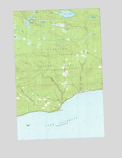
Kadunce River, MN USGS Topographic Map
Click on map above to begin viewing in our Map Viewer.

This topographic map contains these locations and features:
Feature Name Type Latitude Longitude GNIS ID View Map
Benson LakeLakeN47.8499°W90.2487°655337View Map
Bogus LakeLakeN47.8669°W90.1379°655470View Map
Boys LakeLakeN47.8728°W90.2194°655506View Map
Cliff CreekStreamN47.7829°W90.1837°655754View Map
Colvill Area Volunteer Fire DepartmentBuildingN47.7961°W90.1368°2666673View Map
Colvill HomesteadLocaleN47.7771°W90.2251°659216View Map
Cook County LandfillLocaleN47.8282°W90.2290°659213View Map
CovillPopulated PlaceN47.7952°W90.1607°659211View Map
Durfee CreekStreamN47.7766°W90.2254°656072View Map
Five Mile RockIslandN47.7641°W90.2362°656469View Map
Kadunce RiverStreamN47.7935°W90.1548°656844View Map
Kadunce River State ParkParkN47.7938°W90.1543°656845View Map
Kadunce Wayside Recreation SiteParkN47.7943°W90.1551°659212View Map
Kimball CreekStreamN47.7846°W90.1818°656888View Map
Kimball LakeLakeN47.8621°W90.2305°656889View Map
Kimball Lake CampgroundLocaleN47.8624°W90.2262°659214View Map
Kodonce River Wayside ParkParkN47.7933°W90.1589°2094030View Map
Marsh LakeLakeN47.8718°W90.1888°657329View Map
Mink LakeLakeN47.8676°W90.2242°657406View Map
Red CliffCliffN47.7777°W90.1876°658000View Map
Scabbard LakeLakeN47.8647°W90.2091°658173View Map
Section Fifteen LakeLakeN47.8541°W90.1771°658213View Map
Trout LakeLakeN47.8703°W90.1727°658756View Map

Note: Coordinates in the location and feature list above are referenced to NAD83 datum.


Copyright (C) 2008-2024 Ryan Niemi / Sunset Dynamics ... All Rights Reserved