TopoQuest Logo
Do you find TopoQuest useful?
Help keep TopoQuest running and adding new maps/features by donating!
Bitcoin:  19c7KJd3qBynnjoSw5npx9KScwjBe4ifkT
Litecoin:  LXs6TkuXGGXo1vDsWCkWVdjQX94eUKd6ui
Home View Maps Find Maps Find Places Resources & Links


Kaaterskill Clove, New York Topographic Map

USGS Map Title: Kaaterskill Clove, NY
USGS Map MRC: 42074B1
DRG (GeoTIFF) Download: o42074b1.tif


Neighboring USGS Topographic Map Quads:


  Hensonville, NY  
42074C2
 

  Freehold, NY  
42074C1
 

  Leeds, NY  
42073C8
 

  Hunter, NY  
42074B2
 

  Kaaterskill Clove, NY  
42074B1
 

  Cementon, NY  
42073B8
 

  Bearsville, NY  
42074A2
 

  Woodstock, NY  
42074A1
 

  Saugerties, NY  
42073A8


Map MRC Location:

N43°
W75°
N43°
W74°
H8 H7 H6 H5 H4 H3 H2 H1
G8 G7 G6 G5 G4 G3 G2 G1
F8 F7 F6 F5 F4 F3 F2 F1
E8 E7 E6 E5 E4 E3 E2 E1
D8 D7 D6 D5 D4 D3 D2 D1
C8 C7 C6 C5 C4 C3 C2 C1
B8 B7 B6 B5 B4 B3 B2 B1
A8 A7 A6 A5 A4 A3 A2 A1
N42°
W75°
N42°
W74°

Kaaterskill Clove, NY USGS 1:24K Topographic Map Preview:
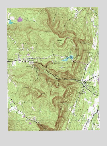
Kaaterskill Clove, NY USGS Topographic Map
Click on map above to begin viewing in our Map Viewer.

This topographic map contains these locations and features:
Feature Name Type Latitude Longitude GNIS ID View Map
All Angels Episcopal ChurchChurchN42.1976°W74.0963°2615515View Map
Artists RockCliffN42.2015°W74.0307°942601View Map
Buttermilk FallsFallsN42.1754°W74.0718°945363View Map
Catskill Public Library Palenville BranchBuildingN42.1746°W74.0218°2617242View Map
Colgate LakeReservoirN42.2355°W74.1197°947126View Map
Devils KitchenBasinN42.1337°W74.0812°948368View Map
Goodwin CemeteryCemeteryN42.1687°W74.0220°951344View Map
Haines FallsPopulated PlaceN42.1959°W74.0971°952000View Map
Haines Falls CemeteryCemeteryN42.1991°W74.0973°2547547View Map
Haines Falls Free LibraryBuildingN42.1972°W74.0960°2617296View Map
Haines Falls Post OfficePost OfficeN42.1951°W74.0952°2617951View Map
Haines Falls Volunteer Fire CompanyBuildingN42.1958°W74.1056°2718499View Map
High PeakSummitN42.1620°W74.0801°952749View Map
Hillyer RavineValleyN42.1769°W74.0566°952871View Map
Hunter Ambulance ServiceBuildingN42.1962°W74.1203°2718309View Map
Immaculate Conception ChurchChurchN42.1985°W74.0961°2616514View Map
Kaaterskill CloveValleyN42.1737°W74.0264°954364View Map
Kaaterskill FallsFallsN42.1934°W74.0632°954366View Map
Ledgewood ParkPopulated PlaceN42.2023°W74.0137°955160View Map
ManorvillePopulated PlaceN42.1423°W74.0360°956381View Map
Marys GlenValleyN42.2014°W74.0405°956626View Map
Mountain HouseLocaleN42.1951°W74.0349°957941View Map
North LakeReservoirN42.1993°W74.0410°958840View Map
North MountainSummitN42.2176°W74.0487°958859View Map
PalenvillePopulated PlaceN42.1745°W74.0201°959772View Map
Palenville Census Designated PlaceCensusN42.1773°W74.0229°2389635View Map
Palenville Fire DepartmentBuildingN42.1737°W74.0193°2718415View Map
Palenville Fire DistrictBuildingN42.1694°W74.0167°2718597View Map
Palenville Post OfficePost OfficeN42.1755°W74.0245°2618054View Map
Palenville Village CemeteryCemeteryN42.1729°W74.0156°2547548View Map
Platte ClovePopulated PlaceN42.1345°W74.0888°960685View Map
Platte Clove ChurchChurchN42.1429°W74.1035°960686View Map
Rip Van Winkle HollowValleyN42.2123°W74.0082°962539View Map
Roaring KillStreamN42.1551°W74.1232°962641View Map
Roundtop MountainSummitN42.1684°W74.0946°963044View Map
Sacred Heart ChurchChurchN42.1741°W74.0183°2616859View Map
Santa Cruz RavineValleyN42.1848°W74.0729°964463View Map
Saxton Katsbaan Volunteer Fire Company Saxton StationBuildingN42.1478°W74.0019°2735458View Map
Saxton Sandstone QuarryMineN42.1478°W74.0003°2674906View Map
School Number 2 (historical)SchoolN42.1498°W74.0315°975160View Map
Shoub CemeteryCemeteryN42.1324°W74.0170°965180View Map
South LakeReservoirN42.1962°W74.0507°965800View Map
South MountainSummitN42.1893°W74.0518°965818View Map
Spruce CreekStreamN42.1854°W74.0737°966119View Map
Stoppel PointSummitN42.2251°W74.0651°966600View Map
Twilight ParkPopulated PlaceN42.1893°W74.0871°968030View Map
Wildcat RavineValleyN42.1773°W74.0579°971254View Map

Note: Coordinates in the location and feature list above are referenced to NAD83 datum.


Copyright (C) 2008-2024 Ryan Niemi / Sunset Dynamics ... All Rights Reserved