TopoQuest Logo
Do you find TopoQuest useful?
Help keep TopoQuest running and adding new maps/features by donating!
Bitcoin:  19c7KJd3qBynnjoSw5npx9KScwjBe4ifkT
Litecoin:  LXs6TkuXGGXo1vDsWCkWVdjQX94eUKd6ui
Home View Maps Find Maps Find Places Resources & Links


Humboldt, Nebraska Topographic Map

USGS Map Title: Humboldt, NE
USGS Map MRC: 40095B8
DRG (GeoTIFF) Download: o40095b8.tif


Neighboring USGS Topographic Map Quads:


  Tecumseh SE, NE  
40096C1
 

  Howe SW, NE  
40095C8
 

  Howe, NE  
40095C7
 

  Table Rock, NE  
40096B1
 

  Humboldt, NE  
40095B8
 

  Dawson, NE  
40095B7
 

  Du Bois, NE  
40096A1
 

  Humboldt SW, NE  
40095A8
 

  Humboldt SE, NE  
40095A7


Map MRC Location:

N41°
W96°
N41°
W95°
H8 H7 H6 H5 H4 H3 H2 H1
G8 G7 G6 G5 G4 G3 G2 G1
F8 F7 F6 F5 F4 F3 F2 F1
E8 E7 E6 E5 E4 E3 E2 E1
D8 D7 D6 D5 D4 D3 D2 D1
C8 C7 C6 C5 C4 C3 C2 C1
B8 B7 B6 B5 B4 B3 B2 B1
A8 A7 A6 A5 A4 A3 A2 A1
N40°
W96°
N40°
W95°

Humboldt, NE USGS 1:24K Topographic Map Preview:
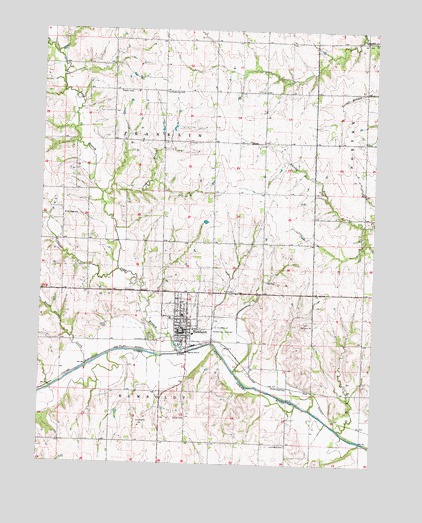
Humboldt, NE USGS Topographic Map
Click on map above to begin viewing in our Map Viewer.

This topographic map contains these locations and features:
Feature Name Type Latitude Longitude GNIS ID View Map
Bruun Memorial LibraryBuildingN40.1639°W95.9450°1883629View Map
Christian ChurchChurchN40.1644°W95.9475°1883638View Map
City of HumboldtCivilN40.1658°W95.9443°2394445View Map
Colonial Acres Nursing HomeHospitalN40.1722°W95.9397°1883635View Map
Community Memorial HospitalHospitalN40.1736°W95.9397°1883634View Map
Crooked BranchStreamN40.2028°W95.9778°828468View Map
Faith Lutheran ChurchChurchN40.1697°W95.9467°1883639View Map
First Presbyterian ChurchChurchN40.1581°W95.9450°1883641View Map
Franklin Election PrecinctCivilN40.2179°W95.9541°1928881View Map
HumboldtLocaleN40.1583°W95.9453°1883626View Map
HumboldtPopulated PlaceN40.1639°W95.9450°830195View Map
Humboldt Bible ChurchChurchN40.1581°W95.9489°1883642View Map
Humboldt CemeteryCemeteryN40.1611°W95.9581°830196View Map
Humboldt City WellWellN40.2322°W95.9544°830197View Map
Humboldt Election PrecinctCivilN40.1298°W95.9543°1928973View Map
Humboldt Family PracticeHospitalN40.1639°W95.9450°1883636View Map
Humboldt Grain and Flour Company ElevatorLocaleN40.1639°W95.9450°1883628View Map
Humboldt Hospital HeliportAirportN40.1667°W95.9336°837604View Map
Humboldt Lake ParkParkN40.1594°W95.9475°1883644View Map
Humboldt Lake Park CampgroundLocaleN40.1594°W95.9475°1883645View Map
Humboldt Police DepartmentBuildingN40.1629°W95.9475°1883631View Map
Humboldt Post OfficePost OfficeN40.1637°W95.9479°1883632View Map
Humboldt Public SchoolsSchoolN40.1678°W95.9464°1883633View Map
Humboldt RescueBuildingN40.1630°W95.9461°2553705View Map
Humboldt Volunteer Fire DepartmentBuildingN40.1630°W95.9461°1883630View Map
Kirkham CreekStreamN40.1811°W95.9711°830525View Map
Kirkmans Cove LakeReservoirN40.1886°W95.9933°1883646View Map
Kirkmans Cove Recreation AreaParkN40.1833°W95.9892°1883648View Map
Kirkmans Cove Recreation Area CampgroundLocaleN40.1833°W95.9892°1883650View Map
Kirkmans Lakeview Gold CourseLocaleN40.1833°W95.9892°1883647View Map
Lions Club FountainParkN40.1639°W95.9450°1883596View Map
Long BranchStreamN40.1567°W95.9481°830856View Map
Long Branch Post Office (historical)Post OfficeN40.2097°W95.9878°1883523View Map
Lynchburg CemeteryCemeteryN40.1306°W95.9072°830975View Map
Monond Post Office (historical)Post OfficeN40.1383°W95.8794°1883521View Map
Parkside Dental ClinicHospitalN40.1639°W95.9450°1883637View Map
Pine Ridge SchoolSchoolN40.1967°W95.9917°832113View Map
Round Grove CreekStreamN40.1533°W95.9822°832738View Map
Saint James Lutheran ChurchChurchN40.1639°W95.9450°1883643View Map
Town Square ParkParkN40.1633°W95.9469°1883595View Map
Township of FranklinCivilN40.2167°W95.9531°1883494View Map
Township of HumboldtCivilN40.1306°W95.9531°1883495View Map
United Methodist ChurchChurchN40.1636°W95.9444°1883640View Map
Wilhelm Grain Incorporated ElevatorLocaleN40.1639°W95.9450°1883627View Map
Yearling DamDamN40.1946°W95.9392°1767846View Map
Yearling ReservoirReservoirN40.1948°W95.9385°1767847View Map

Note: Coordinates in the location and feature list above are referenced to NAD83 datum.


Copyright (C) 2008-2024 Ryan Niemi / Sunset Dynamics ... All Rights Reserved