TopoQuest Logo
Do you find TopoQuest useful?
Help keep TopoQuest running and adding new maps/features by donating!
Bitcoin:  19c7KJd3qBynnjoSw5npx9KScwjBe4ifkT
Litecoin:  LXs6TkuXGGXo1vDsWCkWVdjQX94eUKd6ui
Home View Maps Find Maps Find Places Resources & Links


Bailey Lake, Mississippi Topographic Map

USGS Map Title: Bailey Lake, MS
USGS Map MRC: 33089D7
DRG (GeoTIFF) Download: o33089d7.tif


Neighboring USGS Topographic Map Quads:


  North Carrollton, MS  
33089E8
 

  McCarley, MS  
33089E7
 

  Eskridge, MS  
33089E6
 

  Coila, MS  
33089D8
 

  Bailey Lake, MS  
33089D7
 

  Winona, MS  
33089D6
 

  Murdock Lake, MS  
33089C8
 

  Peachahala Creek, MS  
33089C7
 

  Vaiden, MS  
33089C6


Map MRC Location:

N34°
W90°
N34°
W89°
H8 H7 H6 H5 H4 H3 H2 H1
G8 G7 G6 G5 G4 G3 G2 G1
F8 F7 F6 F5 F4 F3 F2 F1
E8 E7 E6 E5 E4 E3 E2 E1
D8 D7 D6 D5 D4 D3 D2 D1
C8 C7 C6 C5 C4 C3 C2 C1
B8 B7 B6 B5 B4 B3 B2 B1
A8 A7 A6 A5 A4 A3 A2 A1
N33°
W90°
N33°
W89°

Bailey Lake, MS USGS 1:24K Topographic Map Preview:
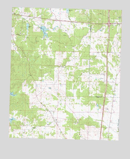
Bailey Lake, MS USGS Topographic Map
Click on map above to begin viewing in our Map Viewer.

This topographic map contains these locations and features:
Feature Name Type Latitude Longitude GNIS ID View Map
Acorner ChurchChurchN33.3868°W89.7640°666140View Map
Bailey LakeReservoirN33.4783°W89.8379°666463View Map
Big Sand Creek Watershed Y-32-9b DamDamN33.4851°W89.8551°682139View Map
Big Sand Watershed Y-32-9a DamDamN33.4818°W89.8417°682136View Map
Bluff Springs CemeteryCemeteryN33.4451°W89.8304°1959792View Map
Bluff Springs Methodist ChurchChurchN33.4443°W89.8167°667345View Map
Booths LakeReservoirN33.4166°W89.8731°667445View Map
Bryantville (historical)LocaleN33.3932°W89.8240°706992View Map
Ebenezer ChurchChurchN33.4737°W89.8670°669659View Map
Friendship ChurchChurchN33.4932°W89.7523°670250View Map
G H Curtis Lake DamDamN33.4801°W89.7717°682132View Map
Hazel Green ChurchChurchN33.4379°W89.7684°671045View Map
Interchange 185CrossingN33.4865°W89.7645°691447View Map
Marvin CemeteryCemeteryN33.4682°W89.8470°673204View Map
Meadows LakeReservoirN33.4813°W89.8570°673453View Map
Middleton (historical)LocaleN33.4862°W89.7509°683319View Map
Nebo CemeteryCemeteryN33.4746°W89.8156°674532View Map
Nebo ChurchChurchN33.4585°W89.8034°674536View Map
New Salem CemeteryCemeteryN33.3851°W89.8451°674829View Map
New Salem ChurchChurchN33.3910°W89.8212°674845View Map
Pelucia Watershed Y-33a-5 DamDamN33.3918°W89.8717°682052View Map
Powells CreekStreamN33.3837°W89.7504°684919View Map
Saint Johns ChapelChurchN33.3885°W89.8292°677076View Map
Summerfield CemeteryCemeteryN33.4021°W89.8323°1959775View Map
Summerfield ChurchChurchN33.4018°W89.8315°678398View Map
Supervisor District 4CivilN33.4110°W89.8663°711796View Map
Waters LakeReservoirN33.3922°W89.8721°679371View Map

Note: Coordinates in the location and feature list above are referenced to NAD83 datum.


Copyright (C) 2008-2024 Ryan Niemi / Sunset Dynamics ... All Rights Reserved