TopoQuest Logo
Do you find TopoQuest useful?
Help keep TopoQuest running and adding new maps/features by donating!
Bitcoin:  19c7KJd3qBynnjoSw5npx9KScwjBe4ifkT
Litecoin:  LXs6TkuXGGXo1vDsWCkWVdjQX94eUKd6ui
Home View Maps Find Maps Find Places Resources & Links


Horatio Rock, Wyoming Topographic Map

USGS Map Title: Horatio Rock, WY
USGS Map MRC: 41106A3
DRG (GeoTIFF) Download: o41106a3.tif


Neighboring USGS Topographic Map Quads:


  Overlook Hill, WY  
41106B4
 

  Keystone, WY  
41106B3
 

  Albany, WY  
41106B2
 

  Elkhorn Point, WY  
41106A4
 

  Horatio Rock, WY  
41106A3
 

  Foxpark, WY  
41106A2
 

  Independence Mountain, CO  
40106H4
 

  Northgate, CO  
40106H3
 

  Kings Canyon, CO  
40106H2


Map MRC Location:

N42°
W107°
N42°
W106°
H8 H7 H6 H5 H4 H3 H2 H1
G8 G7 G6 G5 G4 G3 G2 G1
F8 F7 F6 F5 F4 F3 F2 F1
E8 E7 E6 E5 E4 E3 E2 E1
D8 D7 D6 D5 D4 D3 D2 D1
C8 C7 C6 C5 C4 C3 C2 C1
B8 B7 B6 B5 B4 B3 B2 B1
A8 A7 A6 A5 A4 A3 A2 A1
N41°
W107°
N41°
W106°

Horatio Rock, WY USGS 1:24K Topographic Map Preview:
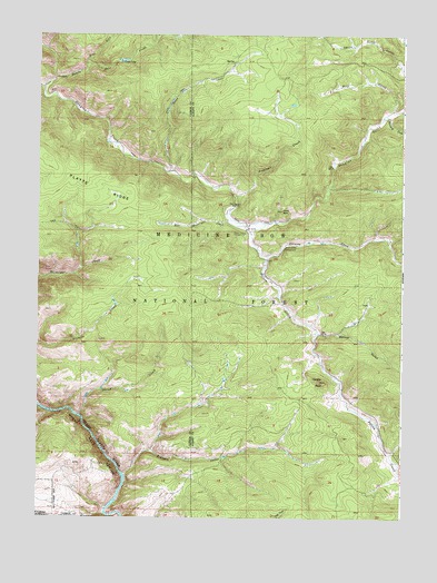
Horatio Rock, WY USGS Topographic Map
Click on map above to begin viewing in our Map Viewer.

This topographic map contains these locations and features:
Feature Name Type Latitude Longitude GNIS ID View Map
Anderson CreekStreamN41.0833°W106.3081°1597748View Map
Bert CreekStreamN41.1053°W106.2539°1598122View Map
Castle RockSummitN41.0794°W106.2917°1598664View Map
Devils Gate CreekStreamN41.1141°W106.3700°1599231View Map
East Walbright CreekStreamN41.0766°W106.3103°1599528View Map
Elkhorn CreekStreamN41.0116°W106.3445°1599597View Map
Fairview Claim-Tenderfoot Mountain MineMineN41.1244°W106.3134°1726174View Map
Hans CreekStreamN41.0894°W106.3309°1600196View Map
Horatio RockSummitN41.0353°W106.2775°1600386View Map
Illinois CreekStreamN41.0678°W106.2970°1600484View Map
Illinois Creek CampgroundLocaleN41.0700°W106.2909°1600485View Map
Lost ParkLocaleN41.0616°W106.3414°1601148View Map
Magnolia LodeMineN41.0522°W106.3119°1726172View Map
Many Values ProspectMineN41.0475°W106.2861°1726173View Map
Mowberg CreekStreamN41.1030°W106.2572°1601593View Map
Pelton CreekStreamN41.0741°W106.3031°1602089View Map
Pelton Creek CampgroundLocaleN41.0736°W106.3047°1602090View Map
Pelton Creek MineMineN41.0486°W106.2811°1726171View Map
Pelton ParkFlatN41.0290°W106.2702°1597175View Map
Platte RidgeRidgeN41.0897°W106.3689°1602212View Map
Porter CreekStreamN41.0266°W106.3600°1602275View Map
Ropers CabinLocaleN41.1139°W106.2517°1704451View Map
Spruce GulchValleyN41.0478°W106.2781°1603291View Map
West Fork Devils Gate CreekStreamN41.1158°W106.3592°1604052View Map

Note: Coordinates in the location and feature list above are referenced to NAD83 datum.


Copyright (C) 2008-2024 Ryan Niemi / Sunset Dynamics ... All Rights Reserved