TopoQuest Logo
Do you find TopoQuest useful?
Help keep TopoQuest running and adding new maps/features by donating!
Bitcoin:  19c7KJd3qBynnjoSw5npx9KScwjBe4ifkT
Litecoin:  LXs6TkuXGGXo1vDsWCkWVdjQX94eUKd6ui
Home View Maps Find Maps Find Places Resources & Links


Hopedale, Illinois Topographic Map

USGS Map Title: Hopedale, IL
USGS Map MRC: 40089D4
DRG (GeoTIFF) Download: o40089d4.tif


Neighboring USGS Topographic Map Quads:


  Marquette Heights, IL  
40089E5
 

  Morton, IL  
40089E4
 

  Mackinaw, IL  
40089E3
 

  Delavan North, IL  
40089D5
 

  Hopedale, IL  
40089D4
 

  Minier, IL  
40089D3
 

  Delavan South, IL  
40089C5
 

  Emden, IL  
40089C4
 

  Armington, IL  
40089C3


Map MRC Location:

N41°
W90°
N41°
W89°
H8 H7 H6 H5 H4 H3 H2 H1
G8 G7 G6 G5 G4 G3 G2 G1
F8 F7 F6 F5 F4 F3 F2 F1
E8 E7 E6 E5 E4 E3 E2 E1
D8 D7 D6 D5 D4 D3 D2 D1
C8 C7 C6 C5 C4 C3 C2 C1
B8 B7 B6 B5 B4 B3 B2 B1
A8 A7 A6 A5 A4 A3 A2 A1
N40°
W90°
N40°
W89°

Hopedale, IL USGS 1:24K Topographic Map Preview:
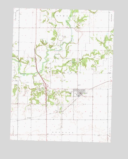
Hopedale, IL USGS Topographic Map
Click on map above to begin viewing in our Map Viewer.

This topographic map contains these locations and features:
Feature Name Type Latitude Longitude GNIS ID View Map
Beaver CemeteryCemeteryN40.4050°W89.4750°404049View Map
Boynton Church (historical)ChurchN40.3956°W89.4170°1747442View Map
Briggs CemeteryCemeteryN40.4400°W89.3781°404864View Map
BrownwoodPopulated PlaceN40.3962°W89.4748°422507View Map
Danforth CemeteryCemeteryN40.4273°W89.4959°406940View Map
Freeman CemeteryCemeteryN40.3821°W89.3918°408727View Map
Griesemer CemeteryCemeteryN40.4287°W89.4178°409500View Map
HopedalePopulated PlaceN40.4209°W89.4145°410509View Map
Hopedale ChurchChurchN40.3998°W89.3990°410510View Map
Hopedale Elementary SchoolSchoolN40.4200°W89.4187°1821594View Map
Hopedale Fire Protection DistrictBuildingN40.4216°W89.4156°2640632View Map
Hopedale Medical ComplexHospitalN40.4183°W89.4168°2662345View Map
Hopedale Post OfficePost OfficeN40.4196°W89.4130°2788817View Map
Indian CreekStreamN40.4375°W89.4815°410837View Map
Interchange 19CrossingN40.4275°W89.4573°1811134View Map
Klemm Memorial WoodsWoodsN40.4500°W89.4237°411564View Map
Little Mackinaw RiverStreamN40.4423°W89.4618°412369View Map
Maiden Lane School (historical)SchoolN40.4964°W89.4768°1747482View Map
McClure CemeteryCemeteryN40.4703°W89.3878°1964574View Map
Mennonite CemeteryCemeteryN40.4239°W89.4348°413401View Map
Orendorff CemeteryCemeteryN40.4036°W89.4411°415168View Map
Prairie CreekStreamN40.4614°W89.4579°416127View Map
Sargent SloughStreamN40.4612°W89.3826°418022View Map
Shiloh CemeteryCemeteryN40.4442°W89.3990°418403View Map
Sparrow CemeteryCemeteryN40.4330°W89.4358°418879View Map
Township of HopedaleCivilN40.4391°W89.4361°429148View Map
Village of HopedaleCivilN40.4221°W89.4209°2398541View Map
Wilson CemeteryCemeteryN40.4701°W89.3880°1821612View Map

Note: Coordinates in the location and feature list above are referenced to NAD83 datum.


Copyright (C) 2008-2024 Ryan Niemi / Sunset Dynamics ... All Rights Reserved