TopoQuest Logo
Do you find TopoQuest useful?
Help keep TopoQuest running and adding new maps/features by donating!
Bitcoin:  19c7KJd3qBynnjoSw5npx9KScwjBe4ifkT
Litecoin:  LXs6TkuXGGXo1vDsWCkWVdjQX94eUKd6ui
Home View Maps Find Maps Find Places Resources & Links


Hoosick Falls, New York Topographic Map

USGS Map Title: Hoosick Falls, NY
USGS Map MRC: 42073H3
DRG (GeoTIFF) Download: o42073h3.tif


Neighboring USGS Topographic Map Quads:


  Cambridge, NY  
43073A4
 

  Shushan, NY  
43073A3
 

  Arlington, VT  
43073A2
 

  Eagle Bridge, NY  
42073H4
 

  Hoosick Falls, NY  
42073H3
 

  Bennington, VT  
42073H2
 

  Grafton, NY  
42073G4
 

  North Pownal, VT  
42073G3
 

  Pownal, VT  
42073G2


Map MRC Location:

N43°
W74°
N43°
W73°
H8 H7 H6 H5 H4 H3 H2 H1
G8 G7 G6 G5 G4 G3 G2 G1
F8 F7 F6 F5 F4 F3 F2 F1
E8 E7 E6 E5 E4 E3 E2 E1
D8 D7 D6 D5 D4 D3 D2 D1
C8 C7 C6 C5 C4 C3 C2 C1
B8 B7 B6 B5 B4 B3 B2 B1
A8 A7 A6 A5 A4 A3 A2 A1
N42°
W74°
N42°
W73°

Hoosick Falls, NY USGS 1:24K Topographic Map Preview:
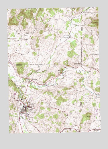
Hoosick Falls, NY USGS Topographic Map
Click on map above to begin viewing in our Map Viewer.

This topographic map contains these locations and features:
Feature Name Type Latitude Longitude GNIS ID View Map
Bennington Battlefield ParkParkN42.9387°W73.3048°943694View Map
Bennington State Airport (historical)AirportN42.8926°W73.2509°1920192View Map
Bouplon CornerPopulated PlaceN42.9948°W73.2665°1460397View Map
Browns BrookStreamN42.8751°W73.3037°944938View Map
Burden Ore Bed - Sherwood CemeteryCemeteryN42.9012°W73.2743°1920207View Map
Cheney LibraryBuildingN42.9016°W73.3490°2617245View Map
Cold Spring BrookStreamN42.9345°W73.2643°1460744View Map
Cornerstone Fellowship ChurchChurchN42.9195°W73.3491°2615820View Map
Danforth Adult Care CenterBuildingN42.9097°W73.3478°2614622View Map
East HoosickPopulated PlaceN42.9031°W73.2859°972418View Map
Elm Spring FarmLocaleN42.9719°W73.2992°2559390View Map
First Baptist Church of Hoosick FallsChurchN42.8992°W73.3500°2513415View Map
First United Presbyterian ChurchChurchN42.8972°W73.3500°2513541View Map
Happenchance FarmLocaleN42.9636°W73.3450°2559412View Map
Hathaways Drive-InLocaleN42.9286°W73.3375°2557357View Map
Henry Covered BridgeBridgeN42.9123°W73.2548°1920281View Map
Hoosick Area Senior Service CenterBuildingN42.8998°W73.3522°2615311View Map
Hoosick FallsPopulated PlaceN42.9012°W73.3515°953177View Map
Hoosick Falls Armory (historical)MilitaryN42.8997°W73.3522°2617562View Map
Hoosick Falls Community ChurchChurchN42.9017°W73.3519°2513417View Map
Hoosick Falls Country ClubLocaleN42.8959°W73.3446°974411View Map
Hoosick Falls Health CenterBuildingN42.9099°W73.3467°2614680View Map
Hoosick Falls Wastewater Treatment PlantLocaleN42.9120°W73.3585°2617730View Map
Hoosick JunctionPopulated PlaceN42.9229°W73.3596°972624View Map
Hoosick Rescue SquadBuildingN42.8978°W73.3534°2720173View Map
Immaculate Conception Roman Catholic ChurchChurchN42.8993°W73.3509°2616518View Map
Kingsley CemeteryCemeteryN42.8834°W73.2632°1458108View Map
Little White CreekStreamN42.9292°W73.3504°955730View Map
Maple Grove CemeteryCemeteryN42.8911°W73.3476°956412View Map
Meerwarth AirportAirportN42.9482°W73.3383°2443169View Map
North HoosickPopulated PlaceN42.9281°W73.3429°958822View Map
North Hoosick Fire DepartmentBuildingN42.9244°W73.3467°2718633View Map
North Hoosick United Methodist ChurchChurchN42.9261°W73.3461°2513556View Map
Perrys OrchardLocaleN42.9711°W73.3433°2516853View Map
Pleasant Valley SchoolSchoolN42.8770°W73.2579°1459004View Map
Post CornersLocaleN42.9704°W73.3559°961011View Map
Quaker CemeteryCemeteryN42.9702°W73.3012°962038View Map
Riverside SchoolSchoolN42.9098°W73.2534°1459206View Map
Rosewood CemeteryCemeteryN42.9827°W73.2816°962927View Map
Saint Mark's Episcopal ChurchChurchN42.9000°W73.3503°2513418View Map
Saint Mary's Academy Elementary SchoolSchoolN42.9041°W73.3473°2668900View Map
Saint Marys CemeteryCemeteryN42.8865°W73.3490°963901View Map
School Number 13 (historical)SchoolN42.9884°W73.2868°975062View Map
School Number 14SchoolN42.8890°W73.3626°975089View Map
School Number 16SchoolN42.9367°W73.2971°975125View Map
School Number 2 (historical)SchoolN42.9562°W73.3196°975196View Map
School Number 5 (historical)SchoolN42.9690°W73.3529°975429View Map
Shaftsbury HollowValleyN42.9915°W73.2755°964914View Map
Shaftsbury HollowValleyN42.9917°W73.2737°1461387View Map
Shaftsbury Hollow CemeteryCemeteryN42.9924°W73.2633°1920436View Map
SodomPopulated PlaceN42.9362°W73.2657°1459558View Map
Town of HoosickCivilN42.8903°W73.3561°979072View Map
Village of Hoosick FallsCivilN42.9009°W73.3500°2390904View Map
WalloomsacPopulated PlaceN42.9242°W73.3237°968707View Map
Walloomsac RiverStreamN42.9276°W73.3651°968708View Map
Whipstock HillSummitN42.8915°W73.2659°1460211View Map
White CreekPopulated PlaceN42.9701°W73.2912°971088View Map
White Creek StationLocaleN42.9423°W73.2743°1460219View Map
White Creek StationLocaleN42.9423°W73.2748°971097View Map
Woods BrookStreamN42.9031°W73.3546°971700View Map

Note: Coordinates in the location and feature list above are referenced to NAD83 datum.


Copyright (C) 2008-2024 Ryan Niemi / Sunset Dynamics ... All Rights Reserved