TopoQuest Logo
Do you find TopoQuest useful?
Help keep TopoQuest running and adding new maps/features by donating!
Bitcoin:  19c7KJd3qBynnjoSw5npx9KScwjBe4ifkT
Litecoin:  LXs6TkuXGGXo1vDsWCkWVdjQX94eUKd6ui
Home View Maps Find Maps Find Places Resources & Links


Hollyhill, Kentucky Topographic Map

USGS Map Title: Hollyhill, KY
USGS Map MRC: 36084F3
DRG (GeoTIFF) Download: o36084f3.tif


Neighboring USGS Topographic Map Quads:


  Wiborg, KY  
36084G4
 

  Cumberland Falls, KY  
36084G3
 

  Wofford, KY  
36084G2
 

  Whitley City, KY  
36084F4
 

  Hollyhill, KY  
36084F3
 

  Williamsburg, KY  
36084F2
 

  Winfield, TN  
36084E4
 

  Ketchen, TN  
36084E3
 

  Jellico West, TN  
36084E2


Map MRC Location:

N37°
W85°
N37°
W84°
H8 H7 H6 H5 H4 H3 H2 H1
G8 G7 G6 G5 G4 G3 G2 G1
F8 F7 F6 F5 F4 F3 F2 F1
E8 E7 E6 E5 E4 E3 E2 E1
D8 D7 D6 D5 D4 D3 D2 D1
C8 C7 C6 C5 C4 C3 C2 C1
B8 B7 B6 B5 B4 B3 B2 B1
A8 A7 A6 A5 A4 A3 A2 A1
N36°
W85°
N36°
W84°

Hollyhill, KY USGS 1:24K Topographic Map Preview:
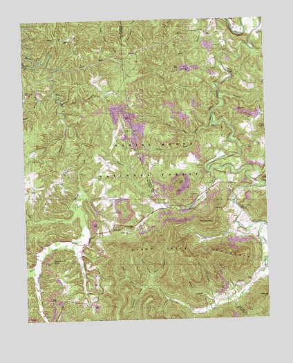
Hollyhill, KY USGS Topographic Map
Click on map above to begin viewing in our Map Viewer.

This topographic map contains these locations and features:
Feature Name Type Latitude Longitude GNIS ID View Map
Ball SchoolSchoolN36.6804°W84.3738°510376View Map
Bear Wallow SchoolSchoolN36.7456°W84.3472°510477View Map
Becks CreekStreamN36.7451°W84.2527°510492View Map
Bethel ChurchChurchN36.6870°W84.3538°510568View Map
Big BranchStreamN36.7062°W84.3527°510599View Map
Bridge ChurchChurchN36.6712°W84.2627°510912View Map
Bridge SchoolSchoolN36.6740°W84.2680°510917View Map
Brierfield BranchStreamN36.6390°W84.3141°510922View Map
Bucks BranchStreamN36.6634°W84.2644°511033View Map
Caddell BranchStreamN36.7151°W84.3549°511123View Map
Chitwood HollowValleyN36.6339°W84.2793°511355View Map
Clear CreekStreamN36.6729°W84.3472°511393View Map
Coal BranchStreamN36.6331°W84.3019°511433View Map
Duck RunStreamN36.7306°W84.3552°511939View Map
DuckrunPopulated PlaceN36.7359°W84.3166°511940View Map
Fairview SchoolSchoolN36.7020°W84.2569°512113View Map
Granny Holt KnobSummitN36.6492°W84.3602°512366View Map
Hayes CreekStreamN36.6484°W84.3691°512606View Map
Holly Hill Fire StationBuildingN36.6631°W84.3299°2637029View Map
HollyhillPopulated PlaceN36.6631°W84.3302°512755View Map
Hominy CreekStreamN36.7170°W84.2722°512761View Map
Indian CreekStreamN36.7067°W84.2777°512897View Map
Jacks CreekStreamN36.7229°W84.2752°512957View Map
Jellico Creek ChurchChurchN36.6854°W84.2702°512989View Map
Jellico Creek Elementary SchoolSchoolN36.6820°W84.2641°516624View Map
Kidd SchoolSchoolN36.7031°W84.3380°513134View Map
Laurel CemeteryCemeteryN36.7195°W84.3727°513234View Map
Laurel CreekStreamN36.7317°W84.3708°513239View Map
Liza MountainSummitN36.6656°W84.2783°513551View Map
Lovitt HollowValleyN36.6425°W84.3109°513660View Map
Meadors HollowValleyN36.6352°W84.2665°513885View Map
Ned Ridge (historical)RidgeN36.7122°W84.3271°2558381View Map
New Liberty ChurchChurchN36.7417°W84.3533°514244View Map
North Fork Indian CreekStreamN36.7029°W84.2855°514289View Map
Osborn CreekStreamN36.6559°W84.3508°514377View Map
Paint CreekStreamN36.6801°W84.2502°514418View Map
Parks BranchStreamN36.6823°W84.2549°514439View Map
Peak MountainSummitN36.6820°W84.2960°514472View Map
Perkins CreekStreamN36.6462°W84.3744°514492View Map
Pleasant Hill ChurchChurchN36.7298°W84.2891°514644View Map
Pleasant RunStreamN36.6879°W84.2774°514649View Map
Pleasant Run Methodist ChurchChurchN36.6623°W84.3222°514652View Map
Pleasant Run SchoolSchoolN36.6654°W84.3288°514655View Map
Riggs BranchStreamN36.6390°W84.3141°514924View Map
Rocky Point SchoolSchoolN36.7317°W84.2819°515081View Map
Rube HollowValleyN36.6428°W84.3106°515143View Map
Ryans CreekStreamN36.6459°W84.2513°515156View Map
Ryans Creek ChurchChurchN36.6398°W84.2663°515157View Map
Ryans Creek MountainSummitN36.6551°W84.3058°515158View Map
Ryans Creek SchoolSchoolN36.6362°W84.2730°515159View Map
Seago HollowValleyN36.6322°W84.2777°515307View Map
South Fork Indian CreekStreamN36.7029°W84.2858°515544View Map
Taylor BranchStreamN36.7192°W84.3602°515879View Map

Note: Coordinates in the location and feature list above are referenced to NAD83 datum.


Copyright (C) 2008-2024 Ryan Niemi / Sunset Dynamics ... All Rights Reserved