TopoQuest Logo
Do you find TopoQuest useful?
Help keep TopoQuest running and adding new maps/features by donating!
Bitcoin:  19c7KJd3qBynnjoSw5npx9KScwjBe4ifkT
Litecoin:  LXs6TkuXGGXo1vDsWCkWVdjQX94eUKd6ui
Home View Maps Find Maps Find Places Resources & Links


Hollis Creek, Louisiana Topographic Map

USGS Map Title: Hollis Creek, LA
USGS Map MRC: 31093G4
DRG (GeoTIFF) Download: o31093g4.tif


Neighboring USGS Topographic Map Quads:


  Pelican, LA  
31093H5
 

  Evelyn, LA  
31093H4
 

  Hanna, LA  
31093H3
 

  Pleasant Hill, LA  
31093G5
 

  Hollis Creek, LA  
31093G4
 

  Allen, LA  
31093G3
 

  Belmont, LA  
31093F5
 

  Marthaville, LA  
31093F4
 

  Robeline, LA  
31093F3


Map MRC Location:

N32°
W94°
N32°
W93°
H8 H7 H6 H5 H4 H3 H2 H1
G8 G7 G6 G5 G4 G3 G2 G1
F8 F7 F6 F5 F4 F3 F2 F1
E8 E7 E6 E5 E4 E3 E2 E1
D8 D7 D6 D5 D4 D3 D2 D1
C8 C7 C6 C5 C4 C3 C2 C1
B8 B7 B6 B5 B4 B3 B2 B1
A8 A7 A6 A5 A4 A3 A2 A1
N31°
W94°
N31°
W93°

Hollis Creek, LA USGS 1:24K Topographic Map Preview:
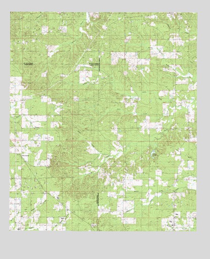
Hollis Creek, LA USGS Topographic Map
Click on map above to begin viewing in our Map Viewer.

This topographic map contains these locations and features:
Feature Name Type Latitude Longitude GNIS ID View Map
Bethel ChurchChurchN31.8521°W93.4407°532976View Map
Beulah ChurchChurchN31.8021°W93.3832°533001View Map
Blue Ridge ChurchChurchN31.8227°W93.4666°533241View Map
Clark School (historical)SchoolN31.8232°W93.4666°546092View Map
Dobs CrossingPopulated PlaceN31.7929°W93.4930°541087View Map
Dykes CreekStreamN31.7916°W93.4313°534675View Map
Haskin CreekStreamN31.7743°W93.3877°535555View Map
Hollis CreekStreamN31.8199°W93.3846°554732View Map
Jennings ChapelChurchN31.7846°W93.4213°536023View Map
Lockes PondsReservoirN31.7985°W93.4025°555116View Map
Lovick SchoolSchoolN31.8060°W93.3793°536757View Map
McCartney CemeteryCemeteryN31.7857°W93.3968°536965View Map
McCaskill ChurchChurchN31.7882°W93.4466°536968View Map
Mineral (historical)Populated PlaceN31.8696°W93.4571°545647View Map
Natchitoches Parish Fire Protection District 7 Station 4BuildingN31.7823°W93.4222°2672982View Map
New Hope ChurchChurchN31.7632°W93.4624°537577View Map
Palmetto School (historical)SchoolN31.7635°W93.4627°546152View Map
Pine Grove School (historical)SchoolN31.8310°W93.3899°548896View Map
Rosa ChapelChurchN31.8596°W93.3771°538704View Map
San Miquel Creek Oil FieldOilfieldN31.7752°W93.4932°546179View Map
Stacy CreekStreamN31.8213°W93.3888°539610View Map
Union Grove ChurchChurchN31.8471°W93.4255°540104View Map
Union Grove School (historical)SchoolN31.8474°W93.4257°548931View Map
Williams Church (historical)ChurchN31.8418°W93.4566°546202View Map
Zion Rest ChurchChurchN31.8652°W93.4674°540604View Map

Note: Coordinates in the location and feature list above are referenced to NAD83 datum.


Copyright (C) 2008-2024 Ryan Niemi / Sunset Dynamics ... All Rights Reserved